Estimated Value: $599,571 - $658,000
3
Beds
3
Baths
1,828
Sq Ft
$342/Sq Ft
Est. Value
About This Home
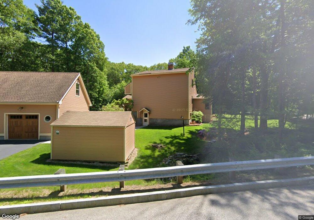
This home is located at 57 Stark Rd, Derry, NH 03038 and is currently estimated at $625,393, approximately $342 per square foot. 57 Stark Rd is a home located in Rockingham County with nearby schools including Derry Village School, West Running Brook Middle School, and Pinkerton Academy.
Create a Home Valuation Report for This Property
The Home Valuation Report is an in-depth analysis detailing your home's value as well as a comparison with similar homes in the area
Home Values in the Area
Average Home Value in this Area
Tax History
| Year | Tax Paid | Tax Assessment Tax Assessment Total Assessment is a certain percentage of the fair market value that is determined by local assessors to be the total taxable value of land and additions on the property. | Land | Improvement |
|---|---|---|---|---|
| 2025 | $10,995 | $579,000 | $190,100 | $388,900 |
| 2024 | $10,822 | $579,000 | $190,100 | $388,900 |
| 2023 | $10,704 | $517,600 | $170,100 | $347,500 |
| 2022 | $11,020 | $578,800 | $170,100 | $408,700 |
| 2021 | $9,859 | $398,200 | $130,000 | $268,200 |
| 2020 | $10,512 | $398,200 | $130,000 | $268,200 |
| 2019 | $9,529 | $364,800 | $100,400 | $264,400 |
| 2018 | $9,656 | $364,800 | $100,400 | $264,400 |
| 2017 | $7,726 | $311,500 | $95,400 | $216,100 |
| 2016 | $7,796 | $288,100 | $95,400 | $192,700 |
| 2015 | $7,936 | $271,500 | $95,400 | $176,100 |
| 2014 | $7,988 | $271,500 | $95,400 | $176,100 |
| 2013 | $8,039 | $255,300 | $87,400 | $167,900 |
Source: Public Records
Map
Nearby Homes
- 5 Craven Terrace
- 5 Stone Fence Dr
- 13 Kilrea Rd Unit L
- 21 Berry Rd
- 4 Westview Dr
- 139 Rockingham Rd Unit 21
- 144 Rockingham Rd
- 242 Rockingham Rd
- 89 Lane Rd
- 52 Windham Depot Rd
- 16 Towne Dr
- 8 Blueberry Rd Unit U: R
- 13 Sunnyside Ln Unit L
- 12R Brian Ave Unit R
- 4 Norman Dr Unit L
- 4C Pine Isle Dr Unit B
- 30 Kendall Pond Rd Unit 77
- 30 Kendall Pond Rd Unit 87
- 7 Lilac Ridge Rd
- 15 Bonnie Ln Unit R
Your Personal Tour Guide
Ask me questions while you tour the home.