Estimated Value: $145,646 - $178,000
3
Beds
1
Bath
1,470
Sq Ft
$110/Sq Ft
Est. Value
About This Home
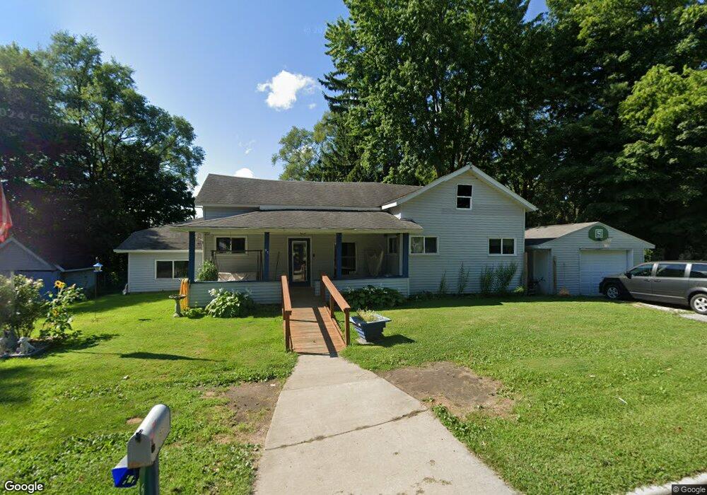
This home is located at 57 W Gilford Rd, Caro, MI 48723 and is currently estimated at $162,412, approximately $110 per square foot. 57 W Gilford Rd is a home with nearby schools including McComb Elementary School, Schall Elementary School, and Caro Middle School.
Ownership History
Date
Name
Owned For
Owner Type
Purchase Details
Closed on
Nov 12, 2010
Sold by
Hile David T and Hile Bambi A
Bought by
Hile David T and Hile Bambi A
Current Estimated Value
Purchase Details
Closed on
Apr 15, 2005
Sold by
Babcock Judy R and Babcock Franklin Delano
Bought by
Hile David T
Home Financials for this Owner
Home Financials are based on the most recent Mortgage that was taken out on this home.
Original Mortgage
$59,000
Outstanding Balance
$30,998
Interest Rate
6.06%
Mortgage Type
New Conventional
Estimated Equity
$131,414
Create a Home Valuation Report for This Property
The Home Valuation Report is an in-depth analysis detailing your home's value as well as a comparison with similar homes in the area
Home Values in the Area
Average Home Value in this Area
Purchase History
| Date | Buyer | Sale Price | Title Company |
|---|---|---|---|
| Hile David T | -- | Independent Title Services I | |
| Hile David T | $59,000 | None Available |
Source: Public Records
Mortgage History
| Date | Status | Borrower | Loan Amount |
|---|---|---|---|
| Open | Hile David T | $59,000 |
Source: Public Records
Tax History Compared to Growth
Tax History
| Year | Tax Paid | Tax Assessment Tax Assessment Total Assessment is a certain percentage of the fair market value that is determined by local assessors to be the total taxable value of land and additions on the property. | Land | Improvement |
|---|---|---|---|---|
| 2025 | $1,365 | $56,500 | $0 | $0 |
| 2024 | $1,365 | $53,600 | $0 | $0 |
| 2023 | $1,301 | $48,600 | $0 | $0 |
| 2022 | $1,240 | $42,000 | $0 | $0 |
| 2021 | $1,201 | $36,400 | $0 | $0 |
| 2020 | $1,184 | $33,500 | $0 | $0 |
| 2019 | $1,161 | $31,100 | $0 | $0 |
| 2018 | $1,138 | $28,400 | $0 | $0 |
| 2017 | $1,114 | $26,600 | $0 | $0 |
| 2016 | $1,070 | $25,700 | $0 | $0 |
| 2015 | $6 | $24,800 | $0 | $0 |
| 2014 | $6 | $25,100 | $0 | $0 |
| 2013 | $7 | $26,800 | $0 | $0 |
Source: Public Records
Map
Nearby Homes
- 91 W Gilford Rd
- 127 W Bush St
- 1081 Cleaver Rd
- 621 Meek St
- 1164 Mary Jane Ct
- 112 Alexander St
- 120 W Adams St
- 0000 E Dayton Rd
- 1303 Sugar Tree Ct Unit 141
- 323 Green St
- 17 N Hooper St
- 1565 Parkway Dr
- 1333 E Caro Rd
- 140 2nd St
- 1429 E Caro Rd
- 0 Weeden Rd
- 1600 E Dayton Rd
- 742 Westchester Dr
- 1685 E Dayton Rd
- 1548 E Caro Rd
- 71 W Gilford Rd
- 62 W Gilford Rd
- 75 W Gilford Rd
- 54 W Gilford Rd
- 46 W Gilford Rd
- 68 W Gilford Rd Unit Bldg-Unit
- 68 W Gilford Rd
- 74 W Gilford Rd
- 79 W Gilford Rd
- 83 W Gilford Rd
- 82 W Gilford Rd
- 733 N State St
- 30 W Gilford Rd
- 729 N State St
- 1002 Turner Dr
- 719 N State St
- N State St
- 762 N State St
- 134 Quinn Ave
- 202 Quinn Ave