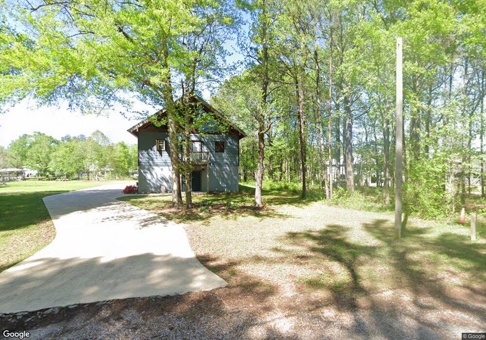
570 Humphries Cove Rd West Point, MS 39773
Estimated Value: $241,000 - $355,000
2
Beds
--
Bath
--
Sq Ft
0.4
Acres
About This Home
This home is located at 570 Humphries Cove Rd, West Point, MS 39773 and is currently estimated at $304,497. 570 Humphries Cove Rd is a home located in Clay County with nearby schools including East Side Elementary School, West Clay Elementary School, and Church Hill Elementary School.
Ownership History
Date
Name
Owned For
Owner Type
Purchase Details
Closed on
Mar 11, 2022
Sold by
Simmons Robert John
Bought by
Remiasz Jonathan
Current Estimated Value
Purchase Details
Closed on
Dec 21, 2018
Sold by
Bearden James D and Bearden Maria E
Bought by
Simmons Robert John
Home Financials for this Owner
Home Financials are based on the most recent Mortgage that was taken out on this home.
Original Mortgage
$174,960
Interest Rate
4.8%
Create a Home Valuation Report for This Property
The Home Valuation Report is an in-depth analysis detailing your home's value as well as a comparison with similar homes in the area
Home Values in the Area
Average Home Value in this Area
Purchase History
| Date | Buyer | Sale Price | Title Company |
|---|---|---|---|
| Remiasz Jonathan | -- | -- | |
| Simmons Robert John | -- | -- |
Source: Public Records
Mortgage History
| Date | Status | Borrower | Loan Amount |
|---|---|---|---|
| Previous Owner | Simmons Robert John | $174,960 |
Source: Public Records
Tax History Compared to Growth
Tax History
| Year | Tax Paid | Tax Assessment Tax Assessment Total Assessment is a certain percentage of the fair market value that is determined by local assessors to be the total taxable value of land and additions on the property. | Land | Improvement |
|---|---|---|---|---|
| 2024 | $1,484 | $26,383 | $3,000 | $23,383 |
| 2023 | $1,793 | $15,800 | $3,000 | $12,800 |
| 2022 | $724 | $15,800 | $3,000 | $12,800 |
| 2021 | $723 | $15,800 | $3,000 | $12,800 |
| 2020 | $723 | $15,800 | $3,000 | $12,800 |
| 2019 | $675 | $15,683 | $3,000 | $12,683 |
| 2018 | $1,186 | $23,525 | $4,500 | $19,025 |
| 2017 | $1,186 | $23,525 | $4,500 | $19,025 |
| 2016 | $1,145 | $23,525 | $4,500 | $19,025 |
| 2015 | $1,137 | $22,581 | $4,500 | $18,081 |
| 2014 | $1,039 | $22,581 | $4,500 | $18,081 |
| 2013 | $1,039 | $22,581 | $4,500 | $18,081 |
Source: Public Records
Map
Nearby Homes
- 0 Riverchase Dr
- 120 Nelda Dr
- 164 Deer Run Rd
- 0 Officers Lake Rd
- 1873 Sandy Land Rd
- 145 Brownlee Dr
- 1372 Mike Parra Rd
- 230 Acorn Aly
- 45 Greenleaf Ln
- 0 Mississippi 373
- 0 Downs Rd
- 1 W Jess Lyons Rd
- 4 W Jess Lyons Rd
- 3 W Jess Lyons Rd
- 6 W Jess Lyons Rd
- 5 W Jess Lyons Rd
- 1 Sleepy Hollow Dr
- 134 S Perkins Rd
- 226 Green Hollow Cir
- 170 Saber Trail
- 590 Humphries Cove Rd
- 2095 Humphries Cove
- 2920 Harrell Dr
- 3399 Harrell Dr
- 4716 White Station Rd
- 4518 White Station Rd
- 4861 White Station Rd
- 4385 White Station Rd
- 4566 White Station Rd
- 4559 White Station Rd
- 4829 White Station Rd
- 4181 White Station Rd
- 4099 White Station Rd
- 3853 White Station Rd
- 622 Humphries Cove Rd
- 2051 Humphries Cove
- 2218 Fairway Ct
- 2220 Fairway Ct
- 2216 Fairway Ct
- 2570 Humphries Cove