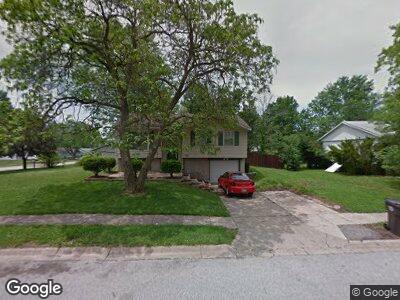
5700 Sir Galahad Ln Godfrey, IL 62035
Estimated Value: $138,000 - $169,000
3
Beds
2
Baths
851
Sq Ft
$174/Sq Ft
Est. Value
About This Home
This home is located at 5700 Sir Galahad Ln, Godfrey, IL 62035 and is currently estimated at $147,709, approximately $173 per square foot. 5700 Sir Galahad Ln is a home located in Madison County with nearby schools including Alton High School, North Elementary School, and Alton Middle School.
Ownership History
Date
Name
Owned For
Owner Type
Purchase Details
Closed on
Jul 29, 2021
Sold by
Stark Matilda
Bought by
Stark Family Enterprises Llc
Current Estimated Value
Purchase Details
Closed on
Feb 21, 2003
Sold by
Citifinancial Mortgage Co Inc
Bought by
Stark Larry
Home Financials for this Owner
Home Financials are based on the most recent Mortgage that was taken out on this home.
Original Mortgage
$50,400
Interest Rate
6%
Mortgage Type
Purchase Money Mortgage
Purchase Details
Closed on
Dec 19, 2002
Sold by
Reithman Frank G
Bought by
Citifinancial Mortgage Co
Create a Home Valuation Report for This Property
The Home Valuation Report is an in-depth analysis detailing your home's value as well as a comparison with similar homes in the area
Home Values in the Area
Average Home Value in this Area
Purchase History
| Date | Buyer | Sale Price | Title Company |
|---|---|---|---|
| Stark Family Enterprises Llc | -- | None Available | |
| Stark Larry | -- | Fatic | |
| Citifinancial Mortgage Co | -- | Fatic |
Source: Public Records
Mortgage History
| Date | Status | Borrower | Loan Amount |
|---|---|---|---|
| Previous Owner | Stark Larry | $50,400 |
Source: Public Records
Tax History Compared to Growth
Tax History
| Year | Tax Paid | Tax Assessment Tax Assessment Total Assessment is a certain percentage of the fair market value that is determined by local assessors to be the total taxable value of land and additions on the property. | Land | Improvement |
|---|---|---|---|---|
| 2023 | $2,519 | $36,110 | $7,130 | $28,980 |
| 2022 | $2,519 | $33,020 | $6,520 | $26,500 |
| 2021 | $2,312 | $31,050 | $6,130 | $24,920 |
| 2020 | $2,271 | $30,380 | $6,000 | $24,380 |
| 2019 | $2,326 | $29,580 | $5,840 | $23,740 |
| 2018 | $2,292 | $28,320 | $5,590 | $22,730 |
| 2017 | $2,193 | $28,320 | $5,590 | $22,730 |
| 2016 | $2,130 | $28,320 | $5,590 | $22,730 |
| 2015 | $1,916 | $27,420 | $5,410 | $22,010 |
| 2014 | $1,916 | $27,420 | $5,410 | $22,010 |
| 2013 | $1,916 | $27,420 | $5,410 | $22,010 |
Source: Public Records
Map
Nearby Homes
- 5507 Ladue Dr
- 805 Taylor Ave
- 5323 Lynwood Ct
- 5310 Godfrey Rd Unit 2
- 721 Taylor Ave
- 715 Taylor Ave
- 0 Sycamore Hill Dr
- 6413 Winter Ct
- 5221 Sundrop Ct
- 4900 Eiffel Dr
- 5711 Barbara Place
- 5714 Humbert Rd
- 205 Pine Ridge Dr
- 5012 Staten Dr
- 4809 Paris Dr
- 3207 Morkel Dr
- 1904 Tomahawk Ln
- 107 N Alby Ct
- 1603 Mont Vista Ave
- 1005 Koenig Dr
- 5700 Sir Galahad Ln
- 1302 Sir Lancelot Ln
- 5701 Sir Galahad Ln
- 5704 Sir Galahad Ln
- 5701 Sir Kay Ct
- 5703 Sir Kay Ct
- 1301 Sir Lancelot Ln
- 5703 Sir Galahad Ln
- 5705 Sir Kay Ct
- 1209 Sir Lancelot Ln
- 1303 Sir Lancelot Ln
- 5708 Sir Galahad Ln
- 1204 Sir Lancelot Ln
- 5705 Sir Galahad Ln
- 1207 Sir Lancelot Ln
- 1305 Sir Lancelot Ln
- 5707 Sir Kay Ct
- 5707 Sir Galahad Ln
- 5710 Sir Galahad Ln
- 1205 Sir Lancelot Ln