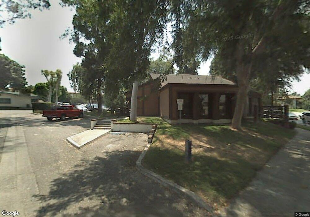
5702 Magnolia Ave Unit B Whittier, CA 90601
West Whittier Neighborhood
--
Bed
--
Bath
8,230
Sq Ft
0.82
Acres
About This Home
This home is located at 5702 Magnolia Ave Unit B, Whittier, CA 90601. 5702 Magnolia Ave Unit B is a home located in Los Angeles County with nearby schools including Longfellow Elementary School, Walter F. Dexter Middle School, and Whittier High School.
Ownership History
Date
Name
Owned For
Owner Type
Purchase Details
Closed on
Jun 6, 2012
Sold by
Buehler Charles E and Ford Kathryn Ann
Bought by
Magnolia Beverly Llc
Purchase Details
Closed on
May 6, 2009
Sold by
Buehler John Albert and Buehler Family Trust B
Bought by
Buehler Charles E and Ford Kathryn Ann
Purchase Details
Closed on
Feb 28, 2003
Sold by
Khan Aniqa and Asgher Aniqa
Bought by
Khan Aniqa
Home Financials for this Owner
Home Financials are based on the most recent Mortgage that was taken out on this home.
Original Mortgage
$40,000
Interest Rate
5.79%
Mortgage Type
Commercial
Purchase Details
Closed on
Mar 20, 1996
Sold by
Buehler Kathryn L and Buehler Family Trust
Bought by
Buehler Kathryn L and Buehler Family Trust
Create a Home Valuation Report for This Property
The Home Valuation Report is an in-depth analysis detailing your home's value as well as a comparison with similar homes in the area
Home Values in the Area
Average Home Value in this Area
Purchase History
| Date | Buyer | Sale Price | Title Company |
|---|---|---|---|
| Magnolia Beverly Llc | -- | None Available | |
| Buehler Charles E | -- | None Available | |
| Khan Aniqa | -- | Fidelity | |
| Buehler Kathryn L | -- | -- |
Source: Public Records
Mortgage History
| Date | Status | Borrower | Loan Amount |
|---|---|---|---|
| Previous Owner | Khan Aniqa | $40,000 |
Source: Public Records
Tax History Compared to Growth
Tax History
| Year | Tax Paid | Tax Assessment Tax Assessment Total Assessment is a certain percentage of the fair market value that is determined by local assessors to be the total taxable value of land and additions on the property. | Land | Improvement |
|---|---|---|---|---|
| 2025 | $16,206 | $990,448 | $233,868 | $756,580 |
| 2024 | $16,206 | $971,029 | $229,283 | $741,746 |
| 2023 | $15,930 | $951,990 | $224,788 | $727,202 |
| 2022 | $15,658 | $933,325 | $220,381 | $712,944 |
| 2021 | $15,087 | $915,025 | $216,060 | $698,965 |
| 2020 | $14,950 | $905,643 | $213,845 | $691,798 |
| 2019 | $14,014 | $887,886 | $209,652 | $678,234 |
| 2018 | $13,532 | $870,478 | $205,542 | $664,936 |
| 2016 | $13,560 | $836,678 | $197,561 | $639,117 |
| 2015 | $13,602 | $824,111 | $194,594 | $629,517 |
| 2014 | $13,427 | $807,969 | $190,783 | $617,186 |
Source: Public Records
Map
Nearby Homes
- 11905 Mendenhall Ln
- 11840 Nixon Ln
- 12031 Beverly Blvd Unit 1D
- 5840 Citrus Ave
- 12417 Rose Dr
- 6222 Magnolia Ave
- 11447 Broadway Ave
- 5655 Pickering Ave
- 6225 Gretna Ave
- 6240 Gretna Ave
- 11511 Beverly Dr
- 6266 Western Ave
- 11759 S Circle Dr
- 5307 Woodward Ln
- 5315 Bihr Ct
- 11730 Whittier Blvd Unit 27
- 11730 Whittier Blvd Unit 39
- 11730 Whittier Blvd Unit 54
- 11730 Whittier Blvd Unit 55
- 6251 Milton Ave
- 11809 Floral Dr
- 11803 Floral Dr
- 11798 Beverly Blvd Unit C
- 11798 Beverly Blvd Unit A
- 11798 Beverly Blvd Unit D
- 11798 Beverly Blvd
- 11815 Floral Dr
- 11794 Beverly Blvd
- 11821 Floral Dr
- 5653 Magnolia Ave
- 5737 Magnolia Ave Unit Magnolia Apartments
- 5646 Magnolia Ave
- 5727 Magnolia Ave
- 11827 Floral Dr
- 11833 Floral Dr
- 11783 Beverly Blvd
- 5640 Magnolia Ave
- 11827 Beverly Blvd Unit 5
- 11827 Beverly Blvd Unit 11
- 11827 Beverly Blvd Unit 9