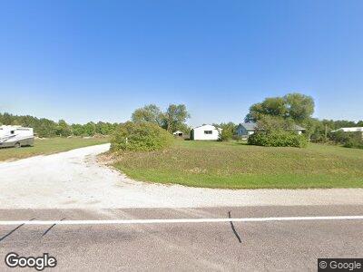
5702 State Highway M77 Germfask, MI 49836
Estimated Value: $46,000 - $139,700
3
Beds
1
Bath
1,456
Sq Ft
$67/Sq Ft
Est. Value
About This Home
This home is located at 5702 State Highway M77, Germfask, MI 49836 and is currently estimated at $97,675, approximately $67 per square foot. 5702 State Highway M77 is a home located in Schoolcraft County with nearby schools including Emerald Elementary School and Manistique Middle/High School.
Ownership History
Date
Name
Owned For
Owner Type
Purchase Details
Closed on
Apr 20, 2017
Sold by
Castlerock 2017 Llc
Bought by
Ott Cody
Current Estimated Value
Home Financials for this Owner
Home Financials are based on the most recent Mortgage that was taken out on this home.
Original Mortgage
$28,800
Outstanding Balance
$24,645
Interest Rate
4.23%
Mortgage Type
Purchase Money Mortgage
Estimated Equity
$63,592
Purchase Details
Closed on
Feb 13, 2017
Sold by
Department Of Housing & Urban Dev
Bought by
Castlerock 2107 Llc
Purchase Details
Closed on
Nov 8, 2007
Sold by
Chamberlin Scott A and Chamberline Tammy M
Bought by
Mattson Duane and Mattson Kristy
Home Financials for this Owner
Home Financials are based on the most recent Mortgage that was taken out on this home.
Original Mortgage
$54,150
Interest Rate
6.47%
Mortgage Type
FHA
Create a Home Valuation Report for This Property
The Home Valuation Report is an in-depth analysis detailing your home's value as well as a comparison with similar homes in the area
Home Values in the Area
Average Home Value in this Area
Purchase History
| Date | Buyer | Sale Price | Title Company |
|---|---|---|---|
| Ott Cody | $26,600 | -- | |
| Castlerock 2107 Llc | $11,050 | -- | |
| Mattson Duane | $101 | -- |
Source: Public Records
Mortgage History
| Date | Status | Borrower | Loan Amount |
|---|---|---|---|
| Open | Ott Cody | $28,800 | |
| Previous Owner | Mattson Duane | $54,150 |
Source: Public Records
Tax History Compared to Growth
Tax History
| Year | Tax Paid | Tax Assessment Tax Assessment Total Assessment is a certain percentage of the fair market value that is determined by local assessors to be the total taxable value of land and additions on the property. | Land | Improvement |
|---|---|---|---|---|
| 2024 | $796 | $42,600 | $0 | $0 |
| 2023 | $307 | $37,400 | $0 | $0 |
| 2022 | $307 | $32,000 | $0 | $0 |
| 2021 | $1,166 | $26,500 | $0 | $0 |
| 2020 | $759 | $28,300 | $0 | $0 |
| 2019 | $324 | $31,800 | $0 | $0 |
| 2018 | $903 | $31,800 | $0 | $0 |
| 2017 | $948 | $36,600 | $0 | $0 |
| 2016 | $948 | $34,800 | $0 | $0 |
| 2014 | $948 | $35,900 | $0 | $0 |
| 2013 | $866 | $37,000 | $0 | $0 |
Source: Public Records
Map
Nearby Homes
- 0000 W Edge
- 1397 N Chip Lake Rd
- TBD E Ford Lake Rd
- N9941 Donner Dr
- N9941 Donner Dr Unit N9941
- 000 Donner Dr
- 00 Donner Dr
- TBD Milakokia Lake Rd
- 9944 Donner Dr Unit 9944 N
- 9944 Donner Dr
- 8950 N Wolfe Rd
- N8060 Norton Rd Unit 7
- N8060 Norton Rd
- 000 County Road 480
- N9400 Bon-I-quay Ln
- TBD County Road 436 Rd
- 17351 Main St
- 000 Main St
- 8820 N H-33 Rd
- 17266 Main St