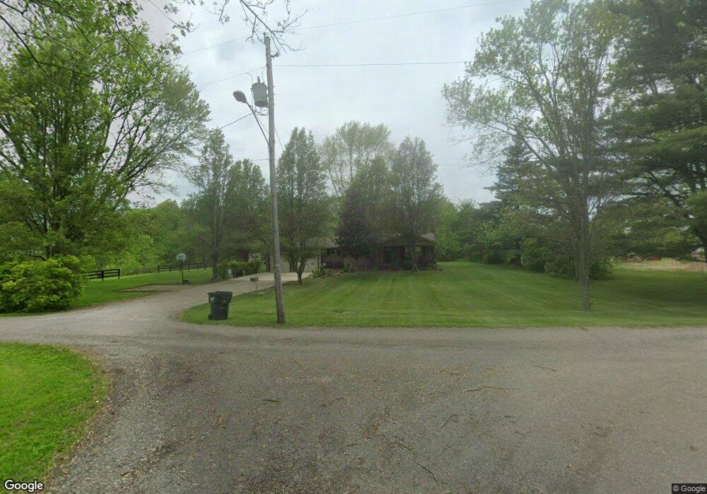
5709 Avon Ln New Concord, OH 43762
Estimated Value: $205,000 - $331,000
2
Beds
1
Bath
864
Sq Ft
$327/Sq Ft
Est. Value
About This Home
This home is located at 5709 Avon Ln, New Concord, OH 43762 and is currently estimated at $282,757, approximately $327 per square foot. 5709 Avon Ln is a home located in Muskingum County with nearby schools including New Concord Elementary School, East Muskingum Middle School, and Larry Miller Intermediate Elementary School.
Ownership History
Date
Name
Owned For
Owner Type
Purchase Details
Closed on
Apr 8, 2019
Sold by
Hill Bert Kevin and Hill Pamela
Bought by
Hill Bert Kevin and Hill Pamela
Current Estimated Value
Purchase Details
Closed on
Jul 17, 2003
Sold by
Barr Virginia
Bought by
Hill Bert Kevin
Home Financials for this Owner
Home Financials are based on the most recent Mortgage that was taken out on this home.
Original Mortgage
$84,550
Outstanding Balance
$36,055
Interest Rate
5.3%
Mortgage Type
Purchase Money Mortgage
Estimated Equity
$246,702
Create a Home Valuation Report for This Property
The Home Valuation Report is an in-depth analysis detailing your home's value as well as a comparison with similar homes in the area
Home Values in the Area
Average Home Value in this Area
Purchase History
| Date | Buyer | Sale Price | Title Company |
|---|---|---|---|
| Hill Bert Kevin | -- | None Available | |
| Hill Bert Kevin | $89,000 | -- |
Source: Public Records
Mortgage History
| Date | Status | Borrower | Loan Amount |
|---|---|---|---|
| Open | Hill Bert Kevin | $84,550 |
Source: Public Records
Tax History Compared to Growth
Tax History
| Year | Tax Paid | Tax Assessment Tax Assessment Total Assessment is a certain percentage of the fair market value that is determined by local assessors to be the total taxable value of land and additions on the property. | Land | Improvement |
|---|---|---|---|---|
| 2024 | $2,166 | $65,870 | $12,915 | $52,955 |
| 2023 | $1,757 | $49,945 | $9,800 | $40,145 |
| 2022 | $1,721 | $49,945 | $9,800 | $40,145 |
| 2021 | $1,700 | $49,945 | $9,800 | $40,145 |
| 2020 | $1,523 | $43,435 | $8,505 | $34,930 |
| 2019 | $1,515 | $43,435 | $8,505 | $34,930 |
| 2018 | $1,395 | $43,435 | $8,505 | $34,930 |
| 2017 | $1,209 | $32,935 | $8,015 | $24,920 |
| 2016 | $1,211 | $32,940 | $8,020 | $24,920 |
| 2015 | $1,241 | $32,940 | $8,020 | $24,920 |
| 2013 | $1,332 | $32,940 | $8,020 | $24,920 |
Source: Public Records
Map
Nearby Homes
- 5580 Friendship Dr
- 0 Norfield Unit 5124761
- 6825 Barr Rd
- 12985 John Glenn School Rd
- 2895 N Moose Eye Rd
- 1165 Friendship Dr
- 64895 Lovers Lane Rd
- 53 Paden Rd
- 930 Friendship Dr
- 760 Friendship Dr
- 154 Montgomery Blvd
- 112 Thompson Ave
- 2250 Indian Camp Run Rd
- 8 E Main St
- 67 E Main St
- 1420 Glenn Hwy
- 0 Haught Rd Unit LOTWP001 24504411
- 0 Haught Rd
- 60936 Patch Rd
- 0 Maple Ln
- 5736 Avon Ln
- 5710 Friendship Dr
- 5710 Friendship Dr
- 5650 Friendship Dr
- 5795 Friendship Dr
- 5635 Lower Bloomfield Rd
- 5825 Friendship Dr
- 5615 Lower Bloomfield Rd
- 5830 Friendship Dr
- 5690 Lower Bloomfield Rd
- 5445 Mcbride Dr
- 5525 Lower Bloomfield Rd
- 5645 Lower Bloomfield Rd
- 5645 Lower Bloomfield Rd
- 5575 Friendship Dr
- 5895 Friendship Dr
- 5670 Cambridge Rd
- 5470 Friendship Dr
- 5675 Cambridge Rd
- 5405 Lower Bloomfield Rd