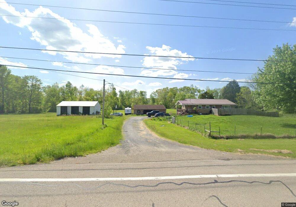
57093 Spencer Rd Cumberland, OH 43732
Estimated Value: $185,000 - $287,000
--
Bed
--
Bath
1,232
Sq Ft
$197/Sq Ft
Est. Value
About This Home
This home is located at 57093 Spencer Rd, Cumberland, OH 43732 and is currently estimated at $242,543, approximately $196 per square foot. 57093 Spencer Rd is a home with nearby schools including New Concord Elementary School, East Muskingum Middle School, and Larry Miller Intermediate Elementary School.
Ownership History
Date
Name
Owned For
Owner Type
Purchase Details
Closed on
Aug 22, 2019
Sold by
Mccoy Pamela R
Bought by
Mccoy Larry Wayne
Current Estimated Value
Home Financials for this Owner
Home Financials are based on the most recent Mortgage that was taken out on this home.
Original Mortgage
$120,800
Outstanding Balance
$108,672
Interest Rate
5.12%
Mortgage Type
Adjustable Rate Mortgage/ARM
Estimated Equity
$133,871
Create a Home Valuation Report for This Property
The Home Valuation Report is an in-depth analysis detailing your home's value as well as a comparison with similar homes in the area
Home Values in the Area
Average Home Value in this Area
Purchase History
| Date | Buyer | Sale Price | Title Company |
|---|---|---|---|
| Mccoy Larry Wayne | $151,000 | Mid Ohio Title Agency |
Source: Public Records
Mortgage History
| Date | Status | Borrower | Loan Amount |
|---|---|---|---|
| Open | Mccoy Larry Wayne | $120,800 |
Source: Public Records
Tax History Compared to Growth
Tax History
| Year | Tax Paid | Tax Assessment Tax Assessment Total Assessment is a certain percentage of the fair market value that is determined by local assessors to be the total taxable value of land and additions on the property. | Land | Improvement |
|---|---|---|---|---|
| 2024 | $2,530 | $64,515 | $10,801 | $53,714 |
| 2023 | $2,530 | $49,248 | $8,246 | $41,002 |
| 2022 | $2,115 | $49,240 | $8,240 | $41,000 |
| 2021 | $2,045 | $49,240 | $8,240 | $41,000 |
| 2020 | $1,407 | $33,980 | $6,770 | $27,210 |
| 2019 | $6 | $33,980 | $6,770 | $27,210 |
| 2018 | $1,296 | $33,980 | $6,770 | $27,210 |
| 2017 | $1,293 | $29,470 | $5,890 | $23,580 |
| 2016 | $1,170 | $29,470 | $5,890 | $23,580 |
| 2015 | $1,170 | $29,470 | $5,890 | $23,580 |
| 2014 | $1,057 | $25,770 | $4,550 | $21,220 |
| 2013 | $1,037 | $25,770 | $4,550 | $21,220 |
Source: Public Records
Map
Nearby Homes
- 3278 Rough & Ready Rd
- 6820 Crane Run Rd
- 4896 High Hill Rd
- 60040 Bliss Rd
- 55289 Iowa Rd
- 9797 Brick Church Rd
- 0 Richards Rd Unit 5161895
- 61220 Kadon Dr
- Lot 18 & 19 Greenbriar Dr
- 1420 Glenn Hwy
- 0 Maple Ln
- 3029 Best Rd
- 3859 Mayfair Ln
- 67 E Main St
- 110 Cherry Ln
- 0 Rix Mills Rd
- 8 E Main St
- 52088 Spencer Rd
- 52021 Spencer Rd
- 468 Carl St
- 57211 Spencer Rd
- 3700 Hillside Dr
- 57018 Spencer Rd
- 57035 Spencer Rd
- 57335 Spencer Rd
- 56930 Spencer Rd
- 57333 Boston Way
- 3800 Hillside Dr
- 57222 Boston Way
- 57435 Boston Way
- 3888 Hillside Dr
- 3446 Clay Pike Rd
- 3939 Hillside Dr
- 56901 Spencer Rd
- 57390 Boston Way
- 57257 Charles Dr
- 57410 Marlatt Rd
- 57444 Boston Way
- 57275 Charles Dr
- 3950 Hillside Dr