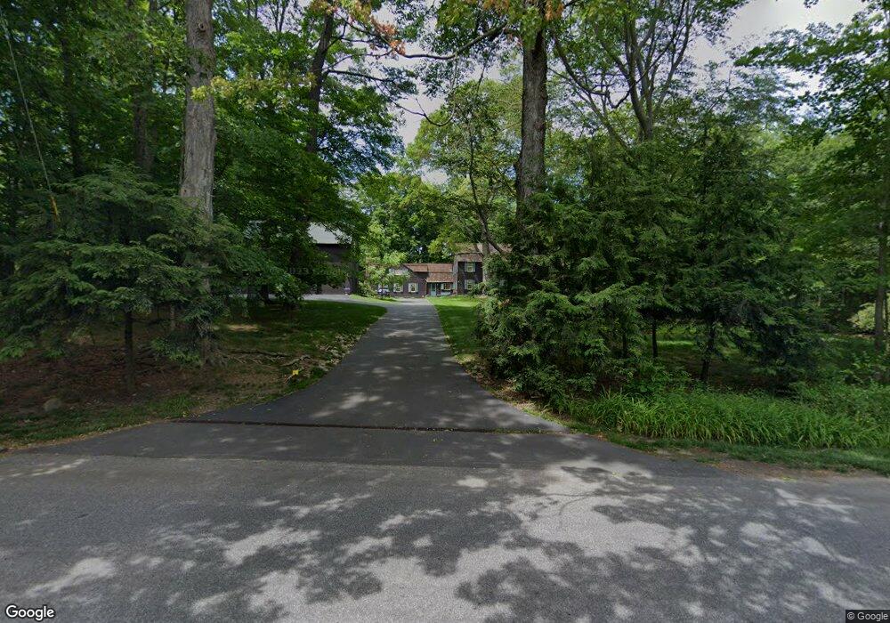
571 Canoe Hill Rd New Canaan, CT 06840
Estimated Value: $2,236,000 - $2,847,000
--
Bed
--
Bath
--
Sq Ft
2.97
Acres
About This Home
This home is located at 571 Canoe Hill Rd, New Canaan, CT 06840 and is currently estimated at $2,608,357. 571 Canoe Hill Rd is a home located in Fairfield County with nearby schools including East Elementary School, Saxe Middle School, and New Canaan High School.
Ownership History
Date
Name
Owned For
Owner Type
Purchase Details
Closed on
Jun 15, 2011
Sold by
Frantz Jack T
Bought by
Frantz Jack T and Frantz Georgene
Current Estimated Value
Purchase Details
Closed on
Jun 29, 1972
Bought by
Frantz Jack T and Frantz Georgene
Create a Home Valuation Report for This Property
The Home Valuation Report is an in-depth analysis detailing your home's value as well as a comparison with similar homes in the area
Home Values in the Area
Average Home Value in this Area
Purchase History
| Date | Buyer | Sale Price | Title Company |
|---|---|---|---|
| Frantz Jack T | -- | -- | |
| Frantz Jack T | $90,000 | -- |
Source: Public Records
Mortgage History
| Date | Status | Borrower | Loan Amount |
|---|---|---|---|
| Previous Owner | Frantz Jack T | $500,000 |
Source: Public Records
Tax History Compared to Growth
Tax History
| Year | Tax Paid | Tax Assessment Tax Assessment Total Assessment is a certain percentage of the fair market value that is determined by local assessors to be the total taxable value of land and additions on the property. | Land | Improvement |
|---|---|---|---|---|
| 2025 | $23,473 | $1,406,440 | $730,800 | $675,640 |
| 2024 | $22,700 | $1,406,440 | $730,800 | $675,640 |
| 2023 | $22,395 | $1,182,440 | $703,220 | $479,220 |
| 2022 | $21,721 | $1,182,440 | $703,220 | $479,220 |
| 2021 | $21,473 | $1,182,440 | $703,220 | $479,220 |
| 2020 | $21,473 | $1,182,440 | $703,220 | $479,220 |
| 2019 | $21,568 | $1,182,440 | $703,220 | $479,220 |
| 2018 | $24,384 | $1,437,730 | $781,410 | $656,320 |
| 2017 | $23,967 | $1,437,730 | $781,410 | $656,320 |
| 2016 | $23,449 | $1,437,730 | $781,410 | $656,320 |
| 2015 | $22,989 | $1,437,730 | $781,410 | $656,320 |
| 2014 | $22,342 | $1,437,730 | $781,410 | $656,320 |
Source: Public Records
Map
Nearby Homes
- 561 Smith Ridge Rd
- 122 Brookwood Ln
- 114 Ferris Hill Rd
- 48 Brookwood Ln
- 240 Rosebrook Rd
- 760 Valley Rd
- 52 Garibaldi Ln
- 101 Parade Hill Rd
- 262 Brushy Ridge Rd
- 61 Smith Ridge Rd
- 30L Huckleberry Hill Rd
- 204 Parade Hill Rd
- 565 Oenoke Ridge
- 145 River St
- 199 Mariomi Rd
- 650 Laurel Rd
- 22 Father Peters Ln
- 62 Summersweet Ln
- 67 Carter St
- 439 Cheese Spring Rd
- 562 Canoe Hill Rd
- 583 Canoe Hill Rd
- 563 Canoe Hill Rd
- 76 Laurel Rd
- 551 Canoe Hill Rd
- 592 Canoe Hill Rd
- 540 Canoe Hill Rd
- 507 Canoe Hill Rd
- 528 Canoe Hill Rd
- 74 Laurel Rd
- 78 Laurel Rd
- 80 Laurel Rd
- 621 Canoe Hill Rd
- 16 Sleepy Hollow Rd
- 356 Rosebrook Rd
- 0 Smith Ridge Rd
- 32 Twin Pond Ln
- 481 Canoe Hill Rd
- 56 Laurel Rd
- 494 Canoe Hill Rd