$490,000
SOLD JUL 8, 2022

571 Lewiston Rd Topsham, ME 04086

45 Acres
$10,889 Price per Acre
1,960,200 Sq Ft Lot

Recently Sold

36% Below List Price

4,574 Days on Market

Highlights

  • 45 Acre Lot
  • No HOA
  • Lot Has A Rolling Slope
  • Wooded Lot

About This Lot

As of July 2022

Topsham commercial land! Parcel represents approximately 45 acres of which 35 are zoned RCU with 276 feet of road frontage on Route 196 with approved commercial entrance. Per MDOT 75ft paved 200ft base.

Last Agent to Sell the Property

Don Spann

RE/MAX Riverside Listed on: 07/16/2008

RE/MAX Riverside

Co-Listed By

Theresa Fasciana

RE/MAX Riverside

Last Buyer's Agent

Peter Bettinger

RE/MAX Riverside

RE/MAX Riverside

Property Details

Property Type

  • Land

Est. Annual Taxes

  • $1,958

Lot Details

  • 45 Acre Lot
  • Rural Setting
  • Lot Has A Rolling Slope
  • Wooded Lot
  • Property is zoned RCU

Parking

  • Driveway
  • Paved Parking

Mobile Home

  • Mobile Home Allowed

Utilities

  • Electricity Not Available
  • Natural Gas Not Available
  • Water Not Available
  • Sewer Not Available

Community Details

  • No Home Owners Association

Listing and Financial Details

  • Tax Lot 44A84
  • Assessor Parcel Number 571Lewiston RoadRDTopshamR244A84

Property Details

Property Type

Land

Est. Annual Taxes

$1,958

Lot Details

0

Listing Details

  • Prop. Type: Land
  • Lot Size Acres: 45.0
  • Co List Office Mls Id: 1874
  • Co List Office Phone: 207-725-8505
  • MLS Status: Closed
  • Directions: Approximately 2.1 miles from Interstate 295 traveling on Route 196 towards Lewiston/Auburn on the right, just past Meadow Cross Road.
  • Property Information:Lot Size Acres -: 45.0
  • Water Info:Water Frontage2: No
  • Water Info:Water View2: No
  • Driveway:Paved2: Yes
  • Gas:No Gas: Yes
  • Location:Rural: Yes
  • Site:Wooded: Yes
  • Site:RollingSloping: Yes
  • Property Information:Mobile Homes Allowed: Yes
  • Electric:No Electric: Yes
  • Sewer:None4: Yes
  • Special Features: None
  • Property Sub Type: LotsLands

Exterior Features

  • Lot Features: Rolling Slope, Wooded, Rural
  • Waterfront: No

Garage/Parking

  • Parking Features: Paved

Utilities

  • Electric: No Electric
  • Sewer: None
  • Water Source: None

Condo/Co-op/Association

  • Association: No

Lot Info

  • Lot Size Sq Ft: 1960200.0
  • Parcel #: 571Lewiston RoadRDTopshamR244A84
  • Zoning: RCU

Tax Info

  • Tax Annual Amount: 1958.0
  • Tax Book Number: 2708
  • Tax Lot: 44A84
  • Tax Map Number: R2
  • Tax Year: 7

Ownership History

Date Name Owned For Owner Type

Purchase Details

Listed on
Jul 16, 2008
Closed on
Jul 8, 2022
Sold by
Robert B Williams Ret and Williams
Bought by
Nt Land 2 Inc
Seller's Agent
Don Spann
RE/MAX Riverside
Buyer's Agent
Peter Bettinger
RE/MAX Riverside
List Price
$760,000
Sold Price
$490,000
Premium/Discount to List
-$270,000
-35.53%
Total Days on Market
4574

Home Financials for this Owner

Home Financials are based on the most recent Mortgage that was taken out on this home.
Avg. Annual Appreciation
11.52%

Purchase Details

Closed on
Apr 10, 2006
Sold by
Williams Ruby F Est and Williams
Bought by
Williams Robert B
Source: Public Records

Similar Properties in the area

  • Unlisted Address

    $595,000

    • Land
    • 52 Acres
    • $11,390 per Acre

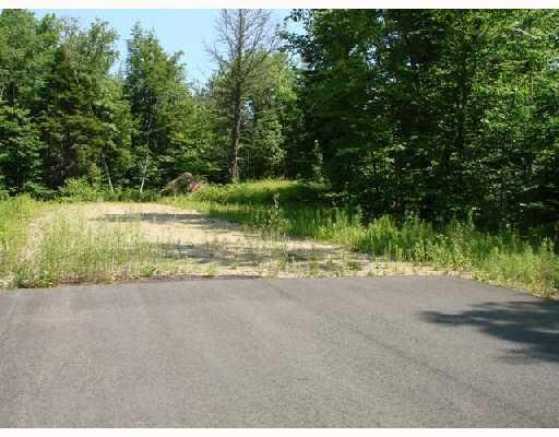
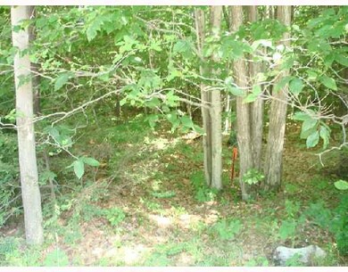
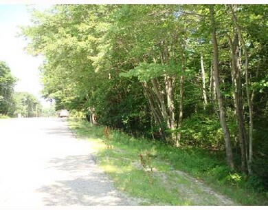
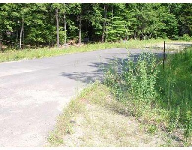
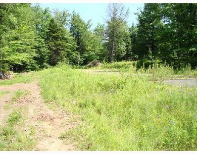
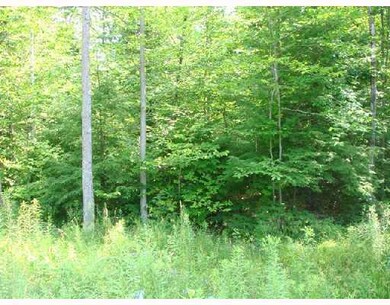
    This expansive 52.24 acre property offers a rare opportunity to escape to your own oasis bordered by a charming farm on one side and a quiet subdivision on the other side. The only road that goes anywhere near your property is Meadow Road at the other end of your 700-foot driveway. This property offers rural serenity minutes from vibrant communities like Brunswick, Harpswell and Freeport. An easy

    Shane Patrick Whitetail Property Real Estate, LLC

    Section Image
  • 571 Lewiston Rd, Topsham, ME 04086

    $599,000

    • Land
    • 47 Acres
    • $12,680 per Acre
    • 571 Lewiston Rd
    • Topsham, ME

    This 45-acre parcel in Topsham offers a versatile opportunity for various commercial and residential uses. Here's a summary of its key features:Size and Zoning: Approximately 45 acres total, with 35 +- acres zoned RCU (Rural Commercial Use) and 10 acres +- zoned R3 (Residential).Road Frontage: 276 feet along Route 196, featuring an approved MDOT commercial entrance with a 75-foot paved section

    Peter Bettinger RE/MAX Riverside

    Section Image

Range of Values:

Collateral Analytics

Collateral Analytics Collateral Analytics AVMs (Automated Valuation Model) employ a number of statistical approaches combined with neighborhood-specific comparable selection guarantees the most up-to-date and precise valuations.

Not Available

Collateral Analytics does not have data for the current month. Please view the chart for historical values.

ICE

ICE Mortgage Technology ICE Mortgage Technology’s AVM (Automated Valuation Model) is a state-of-the-art online residential property valuation tool that provides a quick and accurate estimate of the value of almost any home in the U.S.

Not Available

ICE Mortgage Technology does not have data for the current month. Please view the chart for historical values.

First American

First American First American Data & Analytics’ next-generation AVM combines unrivaled data assets with a blended ensemble of valuation models to produce highly accurate, reliable valuations you can trust.

Not Available

First American does not have data for the current month. Please view the chart for historical values.

Quantarium

Quantarium Quantarium’s valuation service, repeatedly proven the industry’s most accurate and comprehensive, is supercharged with a self-learning and auto-tuning AI engine that continually becomes smarter and more accurate as it processes daily inputs from the industry’s leading RE data lake.

Not Available

Quantarium does not have data for the current month. Please view the chart for historical values.

Average Value
Not Available
List Price
Sold Price
Create a Home Valuation Report for This Property
The Home Valuation Report is an in-depth analysis detailing your home's value as well as a comparison with similar homes in the area

Home Values in the Area

Source: Public Records

Average Home Value in this Area


Source: Public Records

Purchase History

Date Type Sale Price Title Company
Warranty Deed $490,000 None Available
Interfamily Deed Transfer -- --
Source: Public Records

Property History

Date Event Price Change Sq Ft Price
03/05/2025 03/05/25 Price Changed $599,000 -14.4% --
09/04/2024 09/04/24 For Sale $700,000 +42.9% --
07/08/2022 07/08/22 Sold $490,000 -35.5% --
01/24/2021 01/24/21 Pending -- -- --
07/16/2008 07/16/08 For Sale $760,000 -- --
Source: Maine Listings

Tax History Compared to Growth

Source: Public Records

Tax History

Year Tax Paid Tax Assessment Tax Assessment Total Assessment is a certain percentage of the fair market value that is determined by local assessors to be the total taxable value of land and additions on the property. Land Improvement
2024 $3,006 $240,500 $240,500 $0
2023 $3,218 $237,000 $237,000 $0
2022 $2,705 $187,600 $187,600 $0
2021 $2,909 $183,300 $183,300 $0
2020 $5,485 $307,100 $307,100 $0
2019 $5,881 $307,100 $307,100 $0
2018 $5,656 $302,000 $302,000 $0
2017 $5,472 $302,000 $302,000 $0
2016 $5,433 $302,000 $302,000 $0
2015 $5,424 $302,000 $302,000 $0
2014 $5,234 $302,000 $302,000 $0
2013 $5,028 $302,000 $302,000 $0
Source: Public Records

Agents Affiliated with this Home

  • Section Image
  • Section Image
  • Section Image
See All Agents

Map

Source: Maine Listings

MLS Number: 902306

Maine Listings

APN: TOPM-000002-000000-000084R