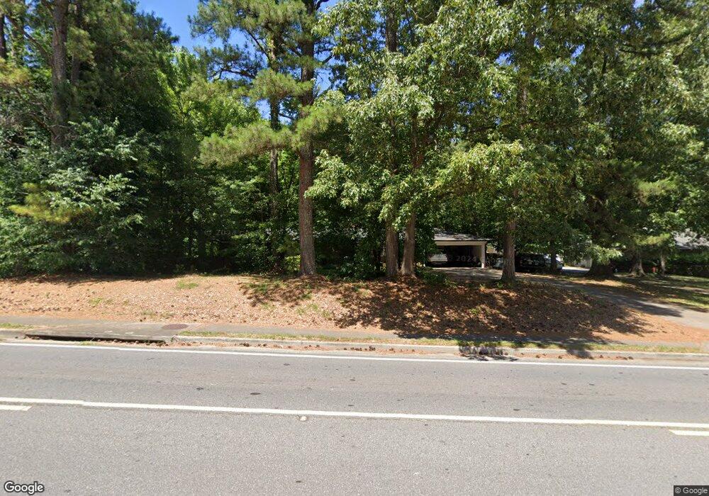
571 Powers Ferry Rd SE Marietta, GA 30067
Powers Park NeighborhoodEstimated Value: $363,000 - $397,000
3
Beds
2
Baths
1,680
Sq Ft
$226/Sq Ft
Est. Value
About This Home
This home is located at 571 Powers Ferry Rd SE, Marietta, GA 30067 and is currently estimated at $379,081, approximately $225 per square foot. 571 Powers Ferry Rd SE is a home located in Cobb County with nearby schools including Powers Ferry Elementary School, East Cobb Middle School, and Wheeler High School.
Ownership History
Date
Name
Owned For
Owner Type
Purchase Details
Closed on
Aug 13, 1999
Sold by
Burnett Barbara L
Bought by
Turner Clark M and Turner Janice T
Current Estimated Value
Home Financials for this Owner
Home Financials are based on the most recent Mortgage that was taken out on this home.
Original Mortgage
$88,000
Outstanding Balance
$25,802
Interest Rate
7.91%
Mortgage Type
New Conventional
Estimated Equity
$353,279
Create a Home Valuation Report for This Property
The Home Valuation Report is an in-depth analysis detailing your home's value as well as a comparison with similar homes in the area
Home Values in the Area
Average Home Value in this Area
Purchase History
| Date | Buyer | Sale Price | Title Company |
|---|---|---|---|
| Turner Clark M | $110,000 | -- |
Source: Public Records
Mortgage History
| Date | Status | Borrower | Loan Amount |
|---|---|---|---|
| Open | Turner Clark M | $88,000 |
Source: Public Records
Tax History Compared to Growth
Tax History
| Year | Tax Paid | Tax Assessment Tax Assessment Total Assessment is a certain percentage of the fair market value that is determined by local assessors to be the total taxable value of land and additions on the property. | Land | Improvement |
|---|---|---|---|---|
| 2024 | $2,407 | $106,608 | $41,160 | $65,448 |
| 2023 | $1,865 | $106,608 | $41,160 | $65,448 |
| 2022 | $1,839 | $79,780 | $36,752 | $43,028 |
| 2021 | $1,625 | $69,984 | $33,812 | $36,172 |
| 2020 | $1,625 | $69,984 | $33,812 | $36,172 |
| 2019 | $1,535 | $65,884 | $32,340 | $33,544 |
| 2018 | $1,535 | $65,884 | $32,340 | $33,544 |
| 2017 | $1,420 | $62,944 | $29,400 | $33,544 |
| 2016 | $1,358 | $60,004 | $26,460 | $33,544 |
| 2015 | $1,239 | $53,308 | $22,052 | $31,256 |
| 2014 | $1,248 | $53,308 | $0 | $0 |
Source: Public Records
Map
Nearby Homes
- 470 Oriole Dr SE
- 3155 Woodberry Ln SE
- 1051 Oriole Ln SE
- 402 Terrydale Dr SE
- 456 Sybil Ln SE
- 595 Harcourt Place SE
- 2059 Clearwater Dr SE
- 2330 Trellis Ln SE
- 2339 Engineers Dr SE
- 830 Bonnie Glen Dr SE
- 349 Virginia Place SE
- 2490 Freydale Rd SE
- 2164 Pawnee Dr SE Unit 1
- 2514 Sunny Ln SE
- 706 Twin Brooks Ct SE
- 190 Kenley Ct
- 720 Smithstone Rd SE
- 651 Inglis Dr SE
- 2238 Surrey Ct SE
- 2310 Old Sewell Rd
- 577 Powers Ferry Rd SE
- 547 Powers Ferry Rd SE
- 568 Powers Ferry Rd SE Unit 1
- 581 Powers Ferry Rd SE
- 578 Powers Ferry Rd SE
- 562 Powers Ferry Rd SE
- 556 Powers Ferry Rd SE
- 584 Powers Ferry Rd SE Unit 1
- 2213 Wood Glen Ln SE
- 2110 Wood Glen Ln SE
- 587 Powers Ferry Rd SE
- 2209 Wood Glen Ln SE
- 2203 Wood Glen Ln SE
- 592 Powers Ferry Rd SE
- 45 Oakland Dr SE
- 584 Castlewood Dr SE
- 583 Castlewood Dr SE
- 593 Powers Ferry Rd SE
- 550 Powers Ferry Rd SE
- 2199 Wood Glen Ln SE
