Estimated Value: $224,283 - $319,000
3
Beds
1
Bath
1,186
Sq Ft
$228/Sq Ft
Est. Value
About This Home
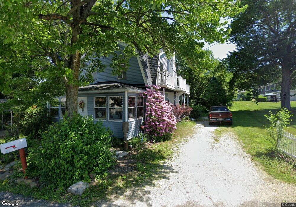
This home is located at 571 Saunders Ave, Akron, OH 44319 and is currently estimated at $270,071, approximately $227 per square foot. 571 Saunders Ave is a home located in Summit County with nearby schools including Coventry Middle School, Coventry High School, and St. Francis de Sales School.
Ownership History
Date
Name
Owned For
Owner Type
Purchase Details
Closed on
Nov 7, 2013
Sold by
Shreffler Merrilyn
Bought by
Shreffler Merrilyn and Watkins Shalee E
Current Estimated Value
Purchase Details
Closed on
Jan 19, 2007
Sold by
Shreffler Michael J
Bought by
Shreffler Michael J and Shreffler Merrilyn
Create a Home Valuation Report for This Property
The Home Valuation Report is an in-depth analysis detailing your home's value as well as a comparison with similar homes in the area
Home Values in the Area
Average Home Value in this Area
Purchase History
| Date | Buyer | Sale Price | Title Company |
|---|---|---|---|
| Shreffler Merrilyn | -- | None Available | |
| Shreffler Michael J | -- | Attorney |
Source: Public Records
Tax History
| Year | Tax Paid | Tax Assessment Tax Assessment Total Assessment is a certain percentage of the fair market value that is determined by local assessors to be the total taxable value of land and additions on the property. | Land | Improvement |
|---|---|---|---|---|
| 2024 | $2,919 | $59,826 | $9,023 | $50,803 |
| 2023 | $2,919 | $59,826 | $9,023 | $50,803 |
| 2022 | $2,214 | $40,446 | $6,055 | $34,391 |
| 2021 | $2,084 | $40,446 | $6,055 | $34,391 |
| 2020 | $2,022 | $40,450 | $6,060 | $34,390 |
| 2019 | $1,220 | $26,160 | $8,940 | $17,220 |
| 2018 | $1,208 | $26,160 | $8,940 | $17,220 |
| 2017 | $1,178 | $26,160 | $8,940 | $17,220 |
| 2016 | $1,175 | $25,500 | $8,940 | $16,560 |
| 2015 | $1,178 | $25,500 | $8,940 | $16,560 |
| 2014 | $1,145 | $25,500 | $8,940 | $16,560 |
| 2013 | $1,134 | $25,500 | $8,940 | $16,560 |
Source: Public Records
Map
Nearby Homes
- 428 Canova Dr
- 796 Portage Lakes Dr
- 584 Apple Dr
- 3809 Powell Ave
- 253 Aqua Blvd
- 231 Portage Lakes Dr
- 900 State Mill Rd
- 3826 Powell Ave
- 347 Dorwil Dr
- 206 Olivet Ave
- 449 W Long Lake Blvd
- 196 Olivet Ave
- 3462 Dollar Dr
- 3613 Manchester Rd
- 4216 State Rd
- 72 Weil Ave
- 265 E Pace Ave
- 3301 Cormany Rd
- 156 W Ingleside Dr
- 222 Olden Ave
- 566 Saunders Ave Unit 574
- 549 Saunders Ave Unit 553
- 560 Saunders Ave
- 550 Saunders Ave
- 3546 Birdland Ave
- 560 State Mill Rd
- 552 579 State Mill Rd
- 572 State Mill Rd
- 548 Saunders Ave
- 584 State Mill Rd
- 3524 Birdland Ave
- 3525 Birdland Ave
- 550 State Mill Rd
- 3533 Birdland Ave
- 3533 Birdland Ave
- 3560 Birdland Ave
- 3549 Birdland Ave
- 579 State Mill Rd
- 3520 Phyllis Ave
- 3520 Phyllis Ave
Your Personal Tour Guide
Ask me questions while you tour the home.