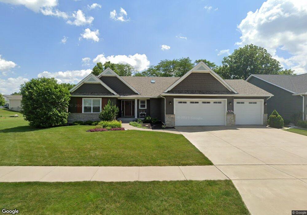
5715 Shawnee Dr Davenport, IA 52804
Outer Davenport/Bettendorf NeighborhoodEstimated Value: $475,000 - $538,000
2
Beds
4
Baths
2,230
Sq Ft
$230/Sq Ft
Est. Value
About This Home
This home is located at 5715 Shawnee Dr, Davenport, IA 52804 and is currently estimated at $512,030, approximately $229 per square foot. 5715 Shawnee Dr is a home located in Scott County with nearby schools including Walnut Hill Elementary School, Jackson Elementary School, and Frank L. Smart Intermediate School.
Ownership History
Date
Name
Owned For
Owner Type
Purchase Details
Closed on
May 8, 2019
Sold by
Miller Marvin J and Miller Karin L
Bought by
Karin L Miller Ret
Current Estimated Value
Purchase Details
Closed on
Nov 6, 2014
Sold by
Jp Condon Inc
Bought by
Miller Marvin L and Miller Karin L
Home Financials for this Owner
Home Financials are based on the most recent Mortgage that was taken out on this home.
Original Mortgage
$65,000
Interest Rate
4.19%
Mortgage Type
New Conventional
Create a Home Valuation Report for This Property
The Home Valuation Report is an in-depth analysis detailing your home's value as well as a comparison with similar homes in the area
Home Values in the Area
Average Home Value in this Area
Purchase History
| Date | Buyer | Sale Price | Title Company |
|---|---|---|---|
| Karin L Miller Ret | -- | -- | |
| Miller Marvin L | $342,000 | None Available |
Source: Public Records
Mortgage History
| Date | Status | Borrower | Loan Amount |
|---|---|---|---|
| Previous Owner | Miller Marvin L | $65,000 |
Source: Public Records
Tax History Compared to Growth
Tax History
| Year | Tax Paid | Tax Assessment Tax Assessment Total Assessment is a certain percentage of the fair market value that is determined by local assessors to be the total taxable value of land and additions on the property. | Land | Improvement |
|---|---|---|---|---|
| 2025 | $8,282 | $513,340 | $46,170 | $467,170 |
| 2024 | $7,996 | $487,390 | $46,170 | $441,220 |
| 2023 | $8,504 | $475,920 | $46,170 | $429,750 |
| 2022 | $8,542 | $407,040 | $41,550 | $365,490 |
| 2021 | $8,542 | $407,040 | $41,550 | $365,490 |
| 2020 | $8,074 | $380,450 | $41,550 | $338,900 |
| 2019 | $7,824 | $357,200 | $41,550 | $315,650 |
| 2018 | $7,288 | $357,200 | $41,550 | $315,650 |
| 2017 | $7,550 | $340,580 | $41,550 | $299,030 |
| 2016 | $7,268 | $340,580 | $0 | $0 |
| 2015 | $7,268 | $41,550 | $0 | $0 |
| 2014 | $922 | $6,200 | $0 | $0 |
| 2013 | $136 | $0 | $0 | $0 |
| 2012 | -- | $7,830 | $7,830 | $0 |
Source: Public Records
Map
Nearby Homes
- 5803 Shawnee Dr
- 5809 Shawnee Dr
- 1528 Westport Dr
- 1538 Westport Dr
- 1520 Westport Dr
- 1544 Westport Dr
- 5710 Shawnee Dr
- 5815 Shawnee Dr
- 5808 Shawnee Dr
- 1512 Westport Dr
- 1604 Westport Dr
- 1525 Westport Dr
- 5819 Shawnee Dr
- 5820 Shawnee Dr
- 1605 Carson Ct
- 1601 Carson Ct
- 1610 Westport Dr
- 1602 Carson Ct
- 1608 Carson Ct
- 1616 Westport Dr