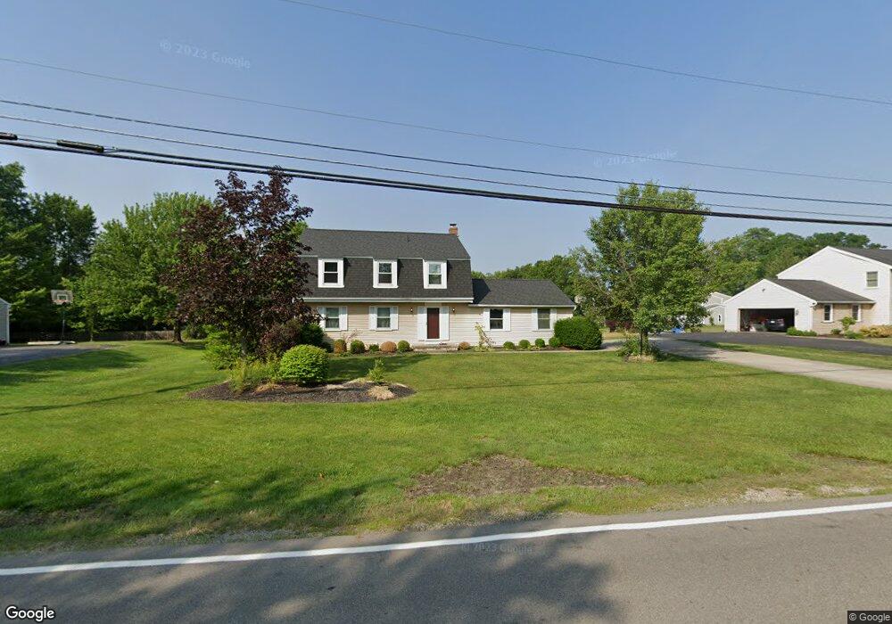
5718 Young Rd Hudson, OH 44236
Estimated Value: $356,000 - $371,000
4
Beds
3
Baths
1,792
Sq Ft
$203/Sq Ft
Est. Value
About This Home
This home is located at 5718 Young Rd, Hudson, OH 44236 and is currently estimated at $364,056, approximately $203 per square foot. 5718 Young Rd is a home located in Summit County with nearby schools including Ellsworth Hill Elementary School, East Woods Intermediate School, and Hudson Middle School.
Ownership History
Date
Name
Owned For
Owner Type
Purchase Details
Closed on
Nov 30, 2011
Sold by
Schulte Edward A
Bought by
Jones Chad E
Current Estimated Value
Home Financials for this Owner
Home Financials are based on the most recent Mortgage that was taken out on this home.
Original Mortgage
$148,146
Outstanding Balance
$101,876
Interest Rate
4.12%
Mortgage Type
FHA
Estimated Equity
$262,180
Purchase Details
Closed on
Sep 2, 2011
Sold by
Kaemmerer Julie L and Schulte Julie L
Bought by
Schulte Edward A
Purchase Details
Closed on
Apr 27, 2004
Sold by
Richert Randy L and Richert Sharon L
Bought by
Schulte Edward A and Schulte Julie L
Home Financials for this Owner
Home Financials are based on the most recent Mortgage that was taken out on this home.
Original Mortgage
$182,700
Interest Rate
5.46%
Mortgage Type
Purchase Money Mortgage
Create a Home Valuation Report for This Property
The Home Valuation Report is an in-depth analysis detailing your home's value as well as a comparison with similar homes in the area
Home Values in the Area
Average Home Value in this Area
Purchase History
| Date | Buyer | Sale Price | Title Company |
|---|---|---|---|
| Jones Chad E | $152,000 | Chicago Title Insurance Co | |
| Schulte Edward A | -- | Attorney | |
| Schulte Edward A | $203,000 | Midland Commerce Group |
Source: Public Records
Mortgage History
| Date | Status | Borrower | Loan Amount |
|---|---|---|---|
| Open | Jones Chad E | $148,146 | |
| Previous Owner | Schulte Edward A | $182,700 |
Source: Public Records
Tax History
| Year | Tax Paid | Tax Assessment Tax Assessment Total Assessment is a certain percentage of the fair market value that is determined by local assessors to be the total taxable value of land and additions on the property. | Land | Improvement |
|---|---|---|---|---|
| 2024 | $5,303 | $101,385 | $19,296 | $82,089 |
| 2023 | $5,303 | $101,385 | $19,296 | $82,089 |
| 2022 | $5,230 | $83,896 | $15,817 | $68,079 |
| 2021 | $4,833 | $83,896 | $15,817 | $68,079 |
| 2020 | $4,749 | $83,900 | $15,820 | $68,080 |
| 2019 | $4,199 | $66,890 | $15,820 | $51,070 |
| 2018 | $4,185 | $66,890 | $15,820 | $51,070 |
| 2017 | $4,564 | $66,890 | $15,820 | $51,070 |
| 2016 | $3,985 | $62,850 | $15,820 | $47,030 |
| 2015 | $4,564 | $62,850 | $15,820 | $47,030 |
| 2014 | $4,524 | $62,850 | $15,820 | $47,030 |
| 2013 | $4,686 | $65,770 | $15,820 | $49,950 |
Source: Public Records
Map
Nearby Homes
- 5518 Pond Ct
- 5361 Diana Lynn Dr
- 1995 Weston Dr
- 5163 Beckett Ridge
- 5150 Bayside Lake Blvd
- V/L Norton Rd
- 5091 Ridge Meadow Dr
- 2221 Crockett Cir
- 2352 Becket Cir
- 5123 Sodalite Dr
- 2353 W Hale Dr
- 2279 Becket Cir
- 5866 Ogilby Dr
- 1525 Spruce Hill Dr
- 4534 Foresthill Rd
- 4623 Cox Dr
- 4424 Timberdale Dr Unit 4428
- 2344 Echo Valley Dr
- 4556 Fishcreek Rd
- 4544 Fishcreek Rd
- 5706 Young Rd
- 5728 Young Rd
- 5659 Humelsine Dr
- 5694 Young Rd
- 5674 Humelsine Dr
- 5645 Humelsine Dr
- 5719 Young Rd
- 2455 Cottager Dr
- 5666 Humelsine Dr
- 5652 Humelsine Dr
- 5682 Young Rd
- 2591 Barlow Rd
- 2546 Barlow Rd
- 5705 Young Rd
- 2595 Barlow Rd
- 5638 Humelsine Dr
- 2555 Barlow Rd
- 2617 Barlow Rd
- 5623 Humelsine Dr
- 5691 Young Rd
Your Personal Tour Guide
Ask me questions while you tour the home.