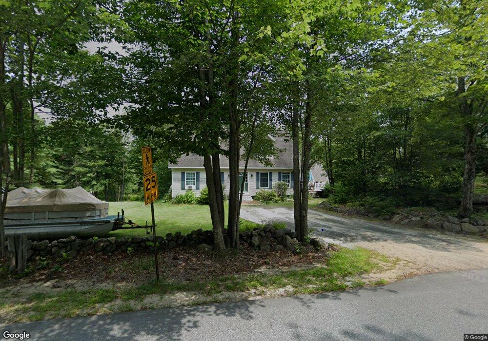
572 Dunbar Hill Rd Grantham, NH 03753
Estimated Value: $649,000 - $696,000
3
Beds
3
Baths
2,710
Sq Ft
$246/Sq Ft
Est. Value
About This Home
This home is located at 572 Dunbar Hill Rd, Grantham, NH 03753 and is currently estimated at $667,786, approximately $246 per square foot. 572 Dunbar Hill Rd is a home located in Sullivan County with nearby schools including Grantham Village School and Lebanon High School.
Ownership History
Date
Name
Owned For
Owner Type
Purchase Details
Closed on
Aug 24, 2001
Sold by
Tendler Barry F and Tendler Susan P
Bought by
Jarvis Brian D
Current Estimated Value
Home Financials for this Owner
Home Financials are based on the most recent Mortgage that was taken out on this home.
Original Mortgage
$24,750
Interest Rate
7.21%
Create a Home Valuation Report for This Property
The Home Valuation Report is an in-depth analysis detailing your home's value as well as a comparison with similar homes in the area
Home Values in the Area
Average Home Value in this Area
Purchase History
| Date | Buyer | Sale Price | Title Company |
|---|---|---|---|
| Jarvis Brian D | $16,000 | -- |
Source: Public Records
Mortgage History
| Date | Status | Borrower | Loan Amount |
|---|---|---|---|
| Open | Jarvis Brian D | $16,500 | |
| Closed | Jarvis Brian D | $24,750 |
Source: Public Records
Tax History Compared to Growth
Tax History
| Year | Tax Paid | Tax Assessment Tax Assessment Total Assessment is a certain percentage of the fair market value that is determined by local assessors to be the total taxable value of land and additions on the property. | Land | Improvement |
|---|---|---|---|---|
| 2024 | $9,162 | $467,200 | $90,700 | $376,500 |
| 2023 | $8,218 | $467,200 | $90,700 | $376,500 |
| 2022 | $7,681 | $467,200 | $90,700 | $376,500 |
| 2021 | $8,311 | $362,600 | $103,300 | $259,300 |
| 2020 | $8,507 | $362,600 | $103,300 | $259,300 |
| 2019 | $7,761 | $300,100 | $64,900 | $235,200 |
| 2018 | $7,830 | $300,100 | $64,900 | $235,200 |
| 2017 | $7,118 | $300,100 | $64,900 | $235,200 |
| 2016 | $7,154 | $300,100 | $64,900 | $235,200 |
| 2015 | $7,238 | $300,100 | $64,900 | $235,200 |
| 2014 | $7,378 | $331,300 | $108,400 | $222,900 |
| 2013 | $7,103 | $331,300 | $108,400 | $222,900 |
Source: Public Records
Map
Nearby Homes
- 689 Route 10 S
- 6 Brookside Dr Unit 6
- 27 Spring Valley Dr
- 9 Cradle Hill Ln Unit Lot 9
- 8 Cradle Hill Ln Unit Lot 8
- 119 Shedd Rd
- 0 Route 10 N Unit 5058175
- 50 Longwood Dr
- 3 Fairway Dr
- 27 Eagle Dr
- 16 Summit Dr
- 16 Clearwater Dr
- 8 Sandy Brae
- 236-43 Stocker Pond Rd
- 128 Stocker Pond Rd
- 27 Hummingbird Hill
- 26 Barn Owl Overlook
- 44 Hummingbird Hill
- 18 Pleasant Dr
- 9 Pleasant Dr
- 581 Dunbar Hill Rd
- 584 Dunbar Hill Rd
- 618 Dunbar Hill Rd
- 531 Dunbar Hill Rd
- 500 Dunbar Hill Rd
- 631 Dunbar Hill Rd
- 533 Dunbar Hill Rd
- 490 Dunbar Hill Rd
- 634 Dunbar Hill Rd
- 661 Dunbar Hill Rd
- 3 Barrister Path
- 21 Corbin Ct Unit 21
- 482 Dunbar Hill Rd
- 45 Wintercroft Cir Unit 9
- 33 Wintercroft Cir Unit 4
- 33 Wintercroft Cir
- 33 Wintercroft Circle L
- 33 Wintercroft Circle #4 Unit 4
- 27 Wintercroft Cir
- 21 Wintercroft Cir Unit 2