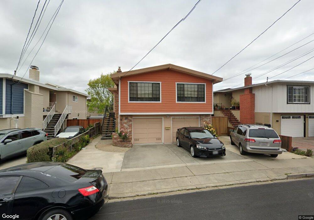
572 Maple Ave San Bruno, CA 94066
Mills Park NeighborhoodEstimated Value: $1,360,652 - $1,521,000
3
Beds
2
Baths
1,390
Sq Ft
$1,031/Sq Ft
Est. Value
About This Home
This home is located at 572 Maple Ave, San Bruno, CA 94066 and is currently estimated at $1,432,913, approximately $1,030 per square foot. 572 Maple Ave is a home located in San Mateo County with nearby schools including John Muir Elementary School, Parkside Intermediate School, and Capuchino High School.
Ownership History
Date
Name
Owned For
Owner Type
Purchase Details
Closed on
Dec 29, 2021
Sold by
Leung Anne Chen
Bought by
Leung Anne Chen and Leung Terrence Kit
Current Estimated Value
Purchase Details
Closed on
Aug 21, 2000
Sold by
Boehle Kenneth E and Boehle Patricia J
Bought by
Leung Randall and Leung Anne C
Home Financials for this Owner
Home Financials are based on the most recent Mortgage that was taken out on this home.
Original Mortgage
$375,000
Interest Rate
8.2%
Mortgage Type
Stand Alone First
Create a Home Valuation Report for This Property
The Home Valuation Report is an in-depth analysis detailing your home's value as well as a comparison with similar homes in the area
Home Values in the Area
Average Home Value in this Area
Purchase History
| Date | Buyer | Sale Price | Title Company |
|---|---|---|---|
| Leung Anne Chen | -- | None Listed On Document | |
| Leung Randall | -- | None Listed On Document | |
| Leung Randall | $571,000 | Fidelity National Title Co |
Source: Public Records
Mortgage History
| Date | Status | Borrower | Loan Amount |
|---|---|---|---|
| Previous Owner | Leung Randall | $375,000 |
Source: Public Records
Tax History
| Year | Tax Paid | Tax Assessment Tax Assessment Total Assessment is a certain percentage of the fair market value that is determined by local assessors to be the total taxable value of land and additions on the property. | Land | Improvement |
|---|---|---|---|---|
| 2025 | $10,364 | $860,388 | $430,194 | $430,194 |
| 2023 | $10,364 | $826,980 | $413,490 | $413,490 |
| 2022 | $8,948 | $810,766 | $405,383 | $405,383 |
| 2021 | $8,832 | $794,870 | $397,435 | $397,435 |
| 2020 | $8,748 | $786,720 | $393,360 | $393,360 |
| 2019 | $8,604 | $771,296 | $385,648 | $385,648 |
| 2018 | $8,176 | $756,174 | $378,087 | $378,087 |
| 2017 | $8,088 | $741,348 | $370,674 | $370,674 |
| 2016 | $7,923 | $726,812 | $363,406 | $363,406 |
| 2015 | $7,818 | $715,896 | $357,948 | $357,948 |
| 2014 | $7,702 | $701,874 | $350,937 | $350,937 |
Source: Public Records
Map
Nearby Homes
- 568 Maple Ave
- 539 Chestnut Ave
- 583 Hawthorne Ave
- 468 Cedar Ave
- 466 Oak Ave
- 498 Elm Ave
- 5202 Shelter Creek Ln
- 8124 Shelter Creek Ln
- 2316 Shelter Creek Ln Unit 2316
- 4359 Shelter Creek Ln Unit 4359
- 2150 Shelter Creek Ln Unit 2150
- 1332 Shelter Creek Ln
- 7246 Shelter Creek Ln
- 7224 Shelter Creek Ln
- 5137 Shelter Creek Ln
- 6148 Shelter Creek Ln
- 411 Elm Ave
- 326 Hazel Ave
- 273 Poplar Ave
- 271 El Camino Real
Your Personal Tour Guide
Ask me questions while you tour the home.