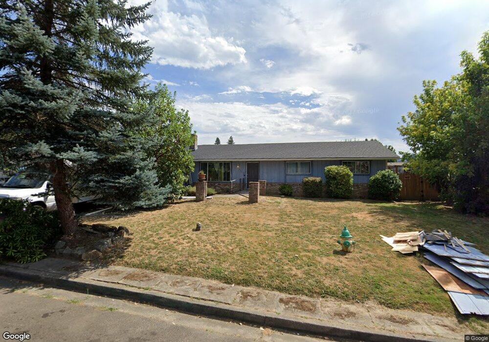
572 Opal St Sutherlin, OR 97479
Estimated Value: $303,000 - $432,000
4
Beds
2
Baths
2,024
Sq Ft
$182/Sq Ft
Est. Value
About This Home
This home is located at 572 Opal St, Sutherlin, OR 97479 and is currently estimated at $369,029, approximately $182 per square foot. 572 Opal St is a home located in Douglas County with nearby schools including East Sutherlin Primary School, West Sutherlin Intermediate School, and Sutherlin Middle School.
Ownership History
Date
Name
Owned For
Owner Type
Purchase Details
Closed on
Mar 23, 2011
Sold by
U S Bank National Association
Bought by
Olson David J
Current Estimated Value
Home Financials for this Owner
Home Financials are based on the most recent Mortgage that was taken out on this home.
Original Mortgage
$132,124
Outstanding Balance
$90,151
Interest Rate
4.72%
Mortgage Type
New Conventional
Estimated Equity
$278,878
Purchase Details
Closed on
Jul 19, 2010
Sold by
Nelsen Royal C and Nelsen Judie M
Bought by
U S Bank National Association
Purchase Details
Closed on
Dec 10, 2004
Sold by
Wilson Oleta P
Bought by
Nelsen Royal C and Nelsen Judie M
Home Financials for this Owner
Home Financials are based on the most recent Mortgage that was taken out on this home.
Original Mortgage
$150,750
Interest Rate
5.64%
Mortgage Type
Purchase Money Mortgage
Create a Home Valuation Report for This Property
The Home Valuation Report is an in-depth analysis detailing your home's value as well as a comparison with similar homes in the area
Home Values in the Area
Average Home Value in this Area
Purchase History
| Date | Buyer | Sale Price | Title Company |
|---|---|---|---|
| Olson David J | $127,500 | Cascade Title Co | |
| U S Bank National Association | $159,765 | First American Title Ins Co | |
| Nelsen Royal C | $167,500 | Amerititle Inc |
Source: Public Records
Mortgage History
| Date | Status | Borrower | Loan Amount |
|---|---|---|---|
| Open | Olson David J | $132,124 | |
| Previous Owner | Nelsen Royal C | $150,750 |
Source: Public Records
Tax History
| Year | Tax Paid | Tax Assessment Tax Assessment Total Assessment is a certain percentage of the fair market value that is determined by local assessors to be the total taxable value of land and additions on the property. | Land | Improvement |
|---|---|---|---|---|
| 2025 | $2,540 | $205,178 | -- | -- |
| 2024 | $2,484 | $199,202 | -- | -- |
| 2023 | $2,413 | $193,400 | $0 | $0 |
| 2022 | $2,344 | $187,767 | $0 | $0 |
| 2021 | $2,276 | $182,299 | $0 | $0 |
| 2020 | $2,210 | $176,990 | $0 | $0 |
| 2019 | $2,146 | $171,835 | $0 | $0 |
| 2018 | $2,083 | $166,831 | $0 | $0 |
| 2017 | $2,130 | $161,972 | $0 | $0 |
| 2016 | $2,057 | $157,255 | $0 | $0 |
| 2015 | $1,929 | $147,045 | $0 | $0 |
| 2014 | $1,855 | $141,429 | $0 | $0 |
| 2013 | -- | $134,974 | $0 | $0 |
Source: Public Records
Map
Nearby Homes
- 560 St John St
- 1774 E Fourth Ave
- 1708 Jasper Ave
- 229 N Grove Ln
- 1234 E Fourth Ave
- 1204 E Second Ave
- 266 Sherwood Dr
- 1200 E Central Ave Unit 128
- 1200 E Central Ave Unit 80
- 1200 E Central Ave Unit 84
- 1200 E Central Ave Unit 62
- 642 Terrace Ln
- 1000 E Central Ave Unit 21
- 1000 E Central Ave Unit 51
- 776 E Fourth Ave
- 402 Northside Rd
- 323 Easy St
- 1853 Ridge Water Dr
- 0 S Side Rd Unit 604296746
- 662 Brooks Loop
Your Personal Tour Guide
Ask me questions while you tour the home.