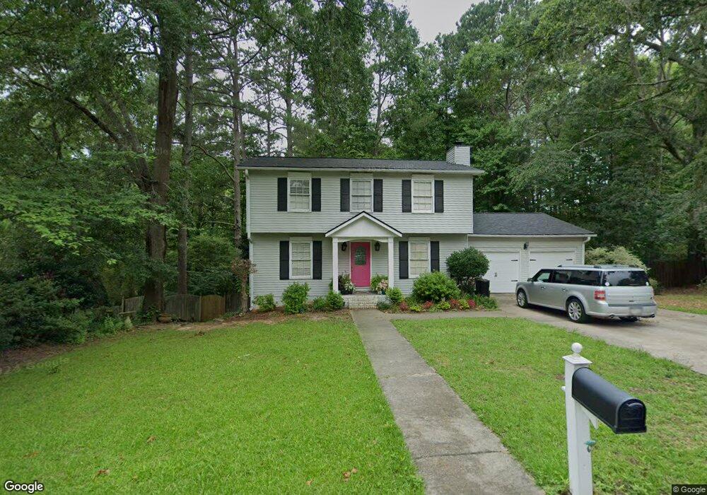
572 Westchester Cir SW Unit 2 Marietta, GA 30064
Southwestern Marietta NeighborhoodEstimated Value: $445,000 - $539,000
3
Beds
3
Baths
1,600
Sq Ft
$309/Sq Ft
Est. Value
About This Home
This home is located at 572 Westchester Cir SW Unit 2, Marietta, GA 30064 and is currently estimated at $494,386, approximately $308 per square foot. 572 Westchester Cir SW Unit 2 is a home located in Cobb County with nearby schools including A.L. Burruss Elementary School, Marietta Sixth Grade Academy, and Marietta Middle School.
Ownership History
Date
Name
Owned For
Owner Type
Purchase Details
Closed on
Oct 29, 1993
Sold by
Nort Tom
Bought by
Denney Izzay R Patricia
Current Estimated Value
Home Financials for this Owner
Home Financials are based on the most recent Mortgage that was taken out on this home.
Original Mortgage
$75,900
Interest Rate
7.03%
Purchase Details
Closed on
Aug 3, 1993
Sold by
Green Brady D Trudy
Bought by
Nort Tom
Purchase Details
Closed on
Mar 2, 1993
Sold by
Green Brady D Trudy D
Bought by
Brashier Tammy
Create a Home Valuation Report for This Property
The Home Valuation Report is an in-depth analysis detailing your home's value as well as a comparison with similar homes in the area
Home Values in the Area
Average Home Value in this Area
Purchase History
| Date | Buyer | Sale Price | Title Company |
|---|---|---|---|
| Denney Izzay R Patricia | $94,900 | -- | |
| Nort Tom | $64,000 | -- | |
| Brashier Tammy | $63,000 | -- |
Source: Public Records
Mortgage History
| Date | Status | Borrower | Loan Amount |
|---|---|---|---|
| Closed | Denney Izzay R Patricia | $75,900 |
Source: Public Records
Tax History Compared to Growth
Tax History
| Year | Tax Paid | Tax Assessment Tax Assessment Total Assessment is a certain percentage of the fair market value that is determined by local assessors to be the total taxable value of land and additions on the property. | Land | Improvement |
|---|---|---|---|---|
| 2025 | $463 | $190,000 | $52,000 | $138,000 |
| 2024 | $463 | $197,576 | $52,000 | $145,576 |
| 2023 | $311 | $165,348 | $44,000 | $121,348 |
| 2022 | $463 | $142,664 | $36,000 | $106,664 |
| 2021 | $473 | $76,800 | $20,000 | $56,800 |
| 2020 | $473 | $76,800 | $20,000 | $56,800 |
| 2019 | $473 | $76,000 | $18,000 | $58,000 |
| 2018 | $473 | $76,000 | $18,000 | $58,000 |
| 2017 | $380 | $78,912 | $18,000 | $60,912 |
| 2016 | $370 | $63,364 | $14,000 | $49,364 |
| 2015 | $289 | $48,020 | $14,000 | $34,020 |
| 2014 | $299 | $48,020 | $0 | $0 |
Source: Public Records
Map
Nearby Homes
- 563 Hillandale Cir SW
- 305 Brookwood Dr SW
- 199 Brookwood Dr SW
- 798 Sentinel Ridge SW
- 80 Lindley Ave NW Unit 1
- 260 Manning Rd SW Unit 110
- 873 Cavalry Dr SW
- 32 Durham St SW
- 838 Cannon Run SW
- 834 Cannon Run SW
- 916 Cannongate Crossing SW Unit 916
- 839 Manning Villas Ct SW
- 916 Cannon Gate Crossing
- 290 Westland Way SW
- 1121 Cannongate Crossing SW
- 920 Wemberley Ln
- 1017 Cannongate Crossing SW
- 1011 Cannongate Crossing SW
- 909 Wemberley Ln
- 984 Wemberley Ln
- 576 Westchester Cir SW
- 568 Westchester Cir SW
- 0 Westchester Cir SW Unit 7340418
- 0 Westchester Cir SW Unit 8604759
- 0 Westchester Cir SW Unit 8191597
- 0 Westchester Cir SW Unit 7539078
- 0 Westchester Cir SW
- 571 Westchester Cir SW
- 575 Westchester Cir SW
- 575 Westchester Cir SW Unit 2
- 564 Westchester Cir SW
- 577 Westchester Cir SW
- 580 Westchester Cir SW
- 559 Westchester Cir SW
- 560 Westchester Cir SW
- 585 Westchester Cir SW
- 585 Westchester Cir SW
- 584 Westchester Cir SW Unit 2
- 134 Patrick Way
- 162 Kirkpatrick Dr SW