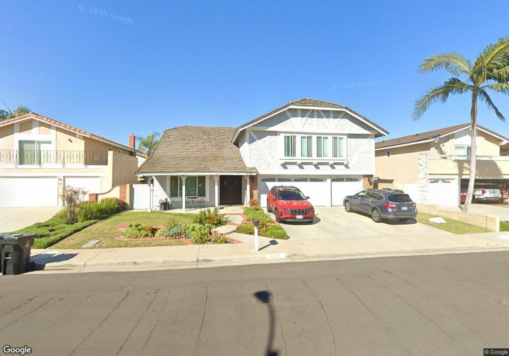
5721 David Webster Cir Garden Grove, CA 92845
West Garden Grove NeighborhoodEstimated Value: $1,328,000 - $1,680,000
5
Beds
3
Baths
2,836
Sq Ft
$524/Sq Ft
Est. Value
About This Home
This home is located at 5721 David Webster Cir, Garden Grove, CA 92845 and is currently estimated at $1,484,682, approximately $523 per square foot. 5721 David Webster Cir is a home located in Orange County with nearby schools including Loyal Barker Elementary School, Hilton D. Bell Intermediate School, and Pacifica High School.
Ownership History
Date
Name
Owned For
Owner Type
Purchase Details
Closed on
Sep 17, 2001
Sold by
Stonge Paul T and Stonge Deanna
Bought by
Stonge Paul T and Stonge Deanna
Current Estimated Value
Home Financials for this Owner
Home Financials are based on the most recent Mortgage that was taken out on this home.
Original Mortgage
$325,500
Outstanding Balance
$134,298
Interest Rate
7.79%
Estimated Equity
$1,350,384
Purchase Details
Closed on
Sep 5, 1997
Sold by
St Onge Deanna & Paul T
Bought by
Stonge Paul T and Stonge Deanna
Create a Home Valuation Report for This Property
The Home Valuation Report is an in-depth analysis detailing your home's value as well as a comparison with similar homes in the area
Home Values in the Area
Average Home Value in this Area
Purchase History
| Date | Buyer | Sale Price | Title Company |
|---|---|---|---|
| Stonge Paul T | -- | Orange Coast Title | |
| Stonge Paul T | -- | Guardian Title Company |
Source: Public Records
Mortgage History
| Date | Status | Borrower | Loan Amount |
|---|---|---|---|
| Open | Stonge Paul T | $325,500 |
Source: Public Records
Tax History Compared to Growth
Tax History
| Year | Tax Paid | Tax Assessment Tax Assessment Total Assessment is a certain percentage of the fair market value that is determined by local assessors to be the total taxable value of land and additions on the property. | Land | Improvement |
|---|---|---|---|---|
| 2025 | $4,368 | $318,427 | $169,059 | $149,368 |
| 2024 | $4,368 | $312,184 | $165,744 | $146,440 |
| 2023 | $4,275 | $306,063 | $162,494 | $143,569 |
| 2022 | $4,171 | $300,062 | $159,308 | $140,754 |
| 2021 | $4,123 | $294,179 | $156,184 | $137,995 |
| 2020 | $4,069 | $291,163 | $154,582 | $136,581 |
| 2019 | $3,957 | $285,454 | $151,551 | $133,903 |
| 2018 | $3,875 | $279,857 | $148,579 | $131,278 |
| 2017 | $3,815 | $274,370 | $145,666 | $128,704 |
| 2016 | $3,637 | $268,991 | $142,810 | $126,181 |
| 2015 | $3,582 | $264,951 | $140,665 | $124,286 |
| 2014 | $3,500 | $259,761 | $137,909 | $121,852 |
Source: Public Records
Map
Nearby Homes
- 12586 George Reyburn Rd
- 12581 George Reyburn Rd
- 12671 Saint Mark St
- 5832 Ludlow Ave
- 13100 Melanie Ln Unit 99
- 12581 Bartlett St
- 5902 Belgrave Ave
- 3831 Wisteria St
- 12871 Taylor St
- 5302 Clark Cir
- 12441 Interior Cir
- 5041 Lampson Ave
- 13040 Springarden Ln
- 13036 Springarden Ln
- 5021 Apollo Cir
- 13371 Springdale St
- 4765 Ironwood Ave
- 13392 Anawood Way
- 11901 Saint Mark St
- 4725 Elder Ave
- 5731 David Webster Cir
- 5711 David Webster Cir
- 5722 John Chaffey Cir
- 5732 John Chaffey Cir
- 5712 John Chaffey Cir
- 5701 David Webster Cir
- 5722 David Webster Cir
- 5732 David Webster Cir
- 5712 David Webster Cir
- 5702 John Chaffey Cir
- 12752 Alonzo Cook St
- 5702 David Webster Cir
- 12742 Alonzo Cook St
- 12762 Alonzo Cook St
- 12732 Alonzo Cook St
- 12772 Alonzo Cook St
- 5721 Converse Howe Cir
- 5711 Converse Howe Cir
- 5731 Converse Howe Cir
- 5731 John Chaffey Cir