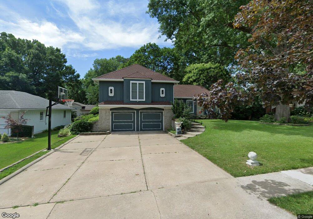
5721 W 84th St Overland Park, KS 66207
Estimated Value: $508,011 - $551,000
4
Beds
3
Baths
1,611
Sq Ft
$326/Sq Ft
Est. Value
About This Home
This home is located at 5721 W 84th St, Overland Park, KS 66207 and is currently estimated at $525,253, approximately $326 per square foot. 5721 W 84th St is a home located in Johnson County with nearby schools including Briarwood Elementary School, Indian Hills Middle School, and Shawnee Mission East High School.
Ownership History
Date
Name
Owned For
Owner Type
Purchase Details
Closed on
Jul 2, 2010
Sold by
Miller Jay C and Miller Amy L
Bought by
Mirza Moben
Current Estimated Value
Home Financials for this Owner
Home Financials are based on the most recent Mortgage that was taken out on this home.
Original Mortgage
$243,002
Outstanding Balance
$161,720
Interest Rate
4.75%
Mortgage Type
FHA
Estimated Equity
$363,533
Purchase Details
Closed on
Jul 20, 2007
Sold by
Simoes Aristides M and Simoes Erma L
Bought by
Miller Jay C and Miller Amy L
Home Financials for this Owner
Home Financials are based on the most recent Mortgage that was taken out on this home.
Original Mortgage
$55,000
Interest Rate
6.42%
Mortgage Type
New Conventional
Create a Home Valuation Report for This Property
The Home Valuation Report is an in-depth analysis detailing your home's value as well as a comparison with similar homes in the area
Home Values in the Area
Average Home Value in this Area
Purchase History
| Date | Buyer | Sale Price | Title Company |
|---|---|---|---|
| Mirza Moben | -- | Coffelt Land Title Inc | |
| Miller Jay C | -- | Chicago Title Ins Co |
Source: Public Records
Mortgage History
| Date | Status | Borrower | Loan Amount |
|---|---|---|---|
| Open | Mirza Moben | $243,002 | |
| Previous Owner | Miller Jay C | $55,000 |
Source: Public Records
Tax History Compared to Growth
Tax History
| Year | Tax Paid | Tax Assessment Tax Assessment Total Assessment is a certain percentage of the fair market value that is determined by local assessors to be the total taxable value of land and additions on the property. | Land | Improvement |
|---|---|---|---|---|
| 2024 | $5,327 | $54,797 | $9,969 | $44,828 |
| 2023 | $4,976 | $50,669 | $9,969 | $40,700 |
| 2022 | $4,628 | $47,460 | $9,969 | $37,491 |
| 2021 | $4,301 | $42,090 | $8,676 | $33,414 |
| 2020 | $4,070 | $39,860 | $6,935 | $32,925 |
| 2019 | $3,946 | $38,686 | $5,337 | $33,349 |
| 2018 | $3,654 | $35,684 | $5,337 | $30,347 |
| 2017 | $3,493 | $33,557 | $5,337 | $28,220 |
| 2016 | $3,406 | $32,188 | $5,337 | $26,851 |
| 2015 | $3,126 | $30,130 | $5,337 | $24,793 |
| 2013 | -- | $28,888 | $5,337 | $23,551 |
Source: Public Records
Map
Nearby Homes
- 8326 Maple Ln
- 8331 Beverly Dr
- 8252 Outlook Ln
- 6108 W 85th Terrace
- 5506 W 82nd Terrace
- 5482 W 85th Terrace
- 6116 W 85th Terrace
- 8204 Tomahawk Rd
- 8100 Beverly Dr
- 6201 W 86th Terrace
- 5516 W 87th Terrace
- 7928 Dearborn Dr
- 8134 Walmer St
- 6655 W 82nd St
- 8101 Rosewood Dr
- 6725 W 85th Terrace
- 7841 Dearborn Dr
- 4969 W 88th St
- 5400 W 79th St
- 8144 Rosewood Dr
- 5711 W 84th St
- 5811 W 84th St
- 5720 W 84th Terrace
- 5710 W 84th Terrace
- 5814 W 84th Terrace
- 5819 W 84th St
- 5701 W 84th St
- 5710 W 84th St
- 5812 W 84th St
- 5700 W 84th Terrace
- 5820 W 84th Terrace
- 5700 W 84th St
- 5814 W 84th St
- 5629 W 84th St
- 5901 W 84th St
- 5900 W 84th Terrace
- 5630 W 84th Terrace
- 5721 W 84th Terrace
- 5711 W 84th Terrace
- 8318 Reeds Rd