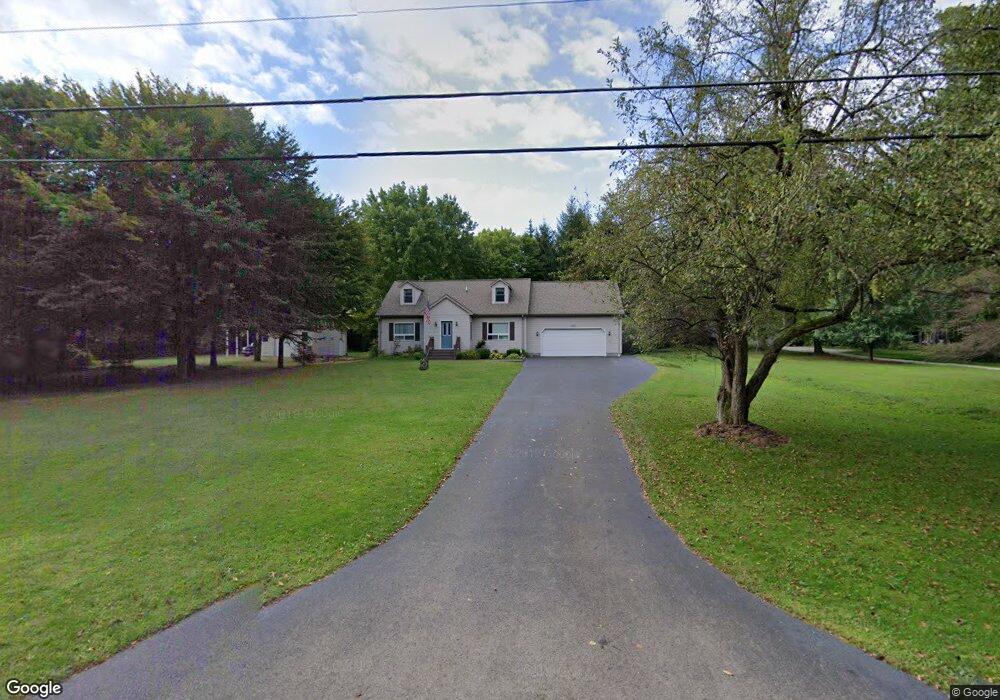
5724 King Graves Rd Fowler, OH 44418
Estimated Value: $62,026 - $144,000
--
Bed
--
Bath
--
Sq Ft
2.63
Acres
About This Home
This home is located at 5724 King Graves Rd, Fowler, OH 44418 and is currently estimated at $103,013. 5724 King Graves Rd is a home located in Trumbull County with nearby schools including Brookfield Elementary School, Brookfield Middle School, and Brookfield High School.
Ownership History
Date
Name
Owned For
Owner Type
Purchase Details
Closed on
Oct 29, 2016
Sold by
Russo Joan E
Bought by
Russo Joan Elaine
Current Estimated Value
Purchase Details
Closed on
Apr 12, 2016
Sold by
Andrew Russo J
Bought by
Andrew Russo Jr Joan Elaine Russo T
Home Financials for this Owner
Home Financials are based on the most recent Mortgage that was taken out on this home.
Interest Rate
3.59%
Purchase Details
Closed on
Jun 5, 2003
Sold by
Russo Andrew and Russo Joan E
Bought by
Russo Andrew and Russo Joan E
Purchase Details
Closed on
Jan 1, 1990
Bought by
Andrew Russo
Create a Home Valuation Report for This Property
The Home Valuation Report is an in-depth analysis detailing your home's value as well as a comparison with similar homes in the area
Home Values in the Area
Average Home Value in this Area
Purchase History
| Date | Buyer | Sale Price | Title Company |
|---|---|---|---|
| Russo Joan Elaine | -- | None Available | |
| Andrew Russo Jr Joan Elaine Russo T | -- | -- | |
| Russo Andrew | -- | -- | |
| Andrew Russo | -- | -- |
Source: Public Records
Mortgage History
| Date | Status | Borrower | Loan Amount |
|---|---|---|---|
| Closed | Russo Andrew | -- |
Source: Public Records
Tax History Compared to Growth
Tax History
| Year | Tax Paid | Tax Assessment Tax Assessment Total Assessment is a certain percentage of the fair market value that is determined by local assessors to be the total taxable value of land and additions on the property. | Land | Improvement |
|---|---|---|---|---|
| 2024 | $587 | $12,500 | $7,530 | $4,970 |
| 2023 | $587 | $12,500 | $7,530 | $4,970 |
| 2022 | $667 | $11,520 | $7,000 | $4,520 |
| 2021 | $625 | $11,520 | $7,000 | $4,520 |
| 2020 | $622 | $11,520 | $7,000 | $4,520 |
| 2019 | $608 | $10,510 | $6,480 | $4,030 |
| 2018 | $603 | $10,510 | $6,480 | $4,030 |
| 2017 | $602 | $10,510 | $6,480 | $4,030 |
| 2016 | $570 | $9,560 | $7,000 | $2,560 |
| 2015 | $571 | $9,560 | $7,000 | $2,560 |
| 2014 | $568 | $9,560 | $7,000 | $2,560 |
| 2013 | $568 | $9,730 | $7,000 | $2,730 |
Source: Public Records
Map
Nearby Homes
- 2486 Waynewood Dr NE
- 2009 Sodom Hutchings Rd NE
- 1565 Sodom Hutchings Rd NE
- 1555 Sodom Hutchings Rd NE
- 0 Albright McKay Rd NE
- 2728 Sodom Hutchings Rd
- 4875 Cadwallader-Sonk Rd
- 6130 Warren Sharon Rd
- 1440 Youngstown Kingsville Rd
- 5050 Warren Sharon Rd
- 6333 Warren Sharon Rd
- 1212 State Route 7 NE
- 4920 Warren Sharon Rd
- 209 Wyngate Dr
- 7131 Drake Stateline Rd NE
- 7155 Drake State Line Rd
- 4274 Cadwallader-Sonk Rd
- 550 Warner Rd
- 391 Centennial Dr
- 1921 Custer Orangeville Rd
- 5724 King Graves Rd
- 5714 King Graves Rd
- 5698 King Graves Rd
- 5756 King Graves Rd
- 5688 King Graves Rd
- 5680 King Graves Rd
- 5683 King Graves Rd
- 5636 King Graves Rd
- 5813 King Graves Rd
- 5813 King Graves Rd
- 5626 King Graves Rd
- 5615 King Graves Rd
- 1954 Warner Rd NE
- 2066 Warner Rd
- 1946 Warner Rd
- 1910 Warner Rd
- 1972 Warner Rd
- 1954 Warner Rd
- 1988 Warner Rd
- 1910 Warner Rd NE