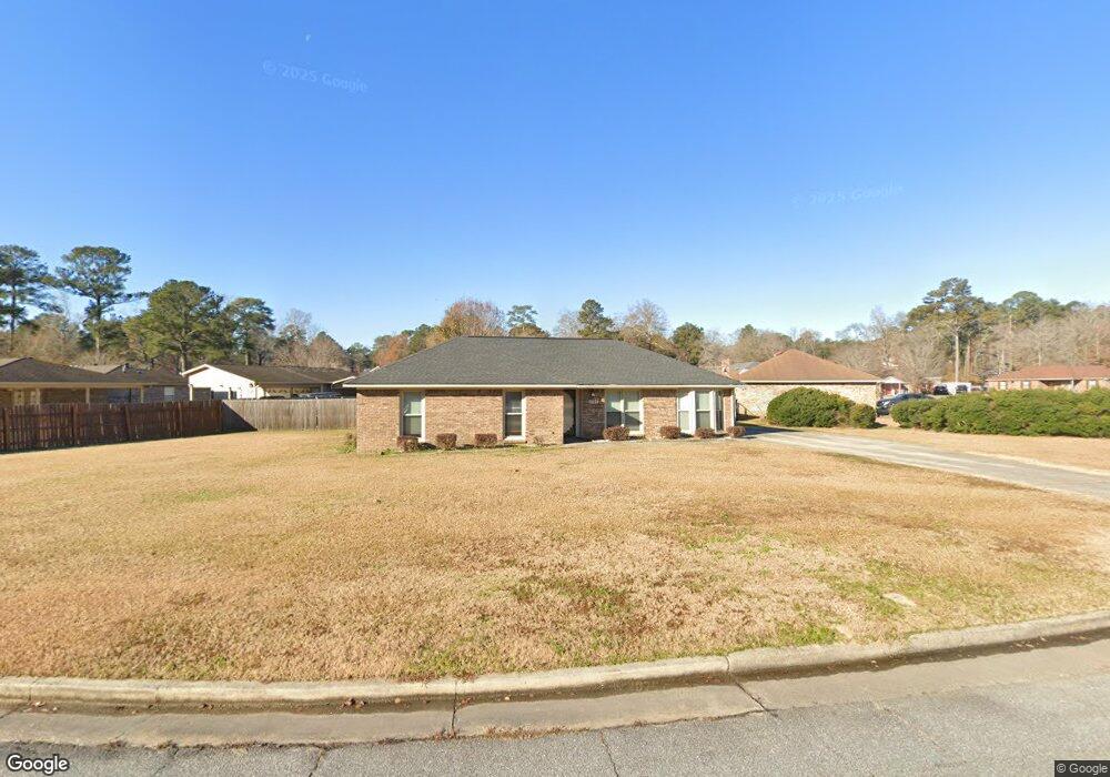
5727 Lexington Dr Columbus, GA 31907
Eastern Columbus NeighborhoodEstimated Value: $142,000 - $188,154
4
Beds
3
Baths
1,785
Sq Ft
$94/Sq Ft
Est. Value
About This Home
This home is located at 5727 Lexington Dr, Columbus, GA 31907 and is currently estimated at $167,039, approximately $93 per square foot. 5727 Lexington Dr is a home located in Muscogee County with nearby schools including Dawson Elementary School, East Columbus Magnet Academy, and Spencer High School.
Ownership History
Date
Name
Owned For
Owner Type
Purchase Details
Closed on
Mar 4, 2016
Sold by
Sec Of Veterans Affa
Bought by
Johnson Forest and Johnson Anita
Current Estimated Value
Purchase Details
Closed on
Dec 30, 2015
Sold by
Bank Of America Na
Bought by
Secretary Of Veterans Affairs
Purchase Details
Closed on
Nov 3, 2015
Sold by
Little Lee R
Bought by
Bank Of America
Create a Home Valuation Report for This Property
The Home Valuation Report is an in-depth analysis detailing your home's value as well as a comparison with similar homes in the area
Home Values in the Area
Average Home Value in this Area
Purchase History
| Date | Buyer | Sale Price | Title Company |
|---|---|---|---|
| Johnson Forest | $61,900 | -- | |
| Secretary Of Veterans Affairs | $51,030 | -- | |
| Sec Of Veterans Affairs | $51,030 | -- | |
| Bank Of America | $51,030 | -- |
Source: Public Records
Tax History Compared to Growth
Tax History
| Year | Tax Paid | Tax Assessment Tax Assessment Total Assessment is a certain percentage of the fair market value that is determined by local assessors to be the total taxable value of land and additions on the property. | Land | Improvement |
|---|---|---|---|---|
| 2025 | $2,224 | $56,816 | $12,136 | $44,680 |
| 2024 | $2,224 | $56,816 | $12,136 | $44,680 |
| 2023 | $2,238 | $56,816 | $12,136 | $44,680 |
| 2022 | $1,905 | $46,668 | $12,136 | $34,532 |
| 2021 | $1,906 | $46,668 | $12,136 | $34,532 |
| 2020 | $1,906 | $46,668 | $12,136 | $34,532 |
| 2019 | $1,912 | $46,668 | $12,136 | $34,532 |
| 2018 | $1,912 | $46,668 | $12,136 | $34,532 |
| 2017 | $1,018 | $24,760 | $6,720 | $18,040 |
| 2016 | $1,427 | $34,587 | $6,040 | $28,547 |
| 2015 | $464 | $34,587 | $6,040 | $28,547 |
| 2014 | $466 | $34,587 | $6,040 | $28,547 |
| 2013 | -- | $34,587 | $6,040 | $28,547 |
Source: Public Records
Map
Nearby Homes
- 5728 Lexington Dr
- 5644 Quebec Dr
- 5613 Quebec Dr
- 5664 St Marys Rd
- 5310 Stoney Point Rd
- 1340 Bunker Ridge Ln
- 4462 Walking Stick Way
- 1513 Alamo Dr
- 1238 Brandywine Dr
- 5336 Gettysburg Way
- 4408 Walking Stick Way
- 1210 Bunker Hill Rd
- 5219 Argonne Dr
- 5109 Lexington Ln
- 5090 Lexington Ln
- 849 Bunker Hill Rd
- 780 Honey Do Ct
- 4939 Aaron Dr
- 1025 Belmar St
- 4965 Brightstar Ln
- 5747 Lexington Dr
- 0 Lexington Lake Dr Unit 7543242
- 0 Lexington Lake Dr
- 5675 Quebec Dr
- 5753 Lexington Dr
- 5667 Quebec Dr
- 5722 Lexington Dr
- 5716 Lexington Dr
- 5708 Lexington Dr
- 5740 Lexington Dr
- 5663 Quebec Dr
- 5759 Lexington Dr
- 5734 Lexington Dr
- 5700 Lexington Dr
- 5752 Lexington Dr
- 5657 Quebec Dr
- 5758 Lexington Dr
- 5686 Lexington Dr
- 5675 Lexington Dr
- 5770 Germantown Rd