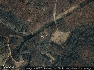
573 Mason Mill Rd Danielsville, GA 30633
Estimated Value: $373,000 - $489,000
--
Bed
--
Bath
1,860
Sq Ft
$231/Sq Ft
Est. Value
About This Home
This home is located at 573 Mason Mill Rd, Danielsville, GA 30633 and is currently estimated at $429,453, approximately $230 per square foot. 573 Mason Mill Rd is a home with nearby schools including Madison County High School.
Ownership History
Date
Name
Owned For
Owner Type
Purchase Details
Closed on
Oct 2, 1987
Sold by
Leach John T
Bought by
Bartlett Charles A and Bartlett Deborah J
Current Estimated Value
Create a Home Valuation Report for This Property
The Home Valuation Report is an in-depth analysis detailing your home's value as well as a comparison with similar homes in the area
Home Values in the Area
Average Home Value in this Area
Purchase History
| Date | Buyer | Sale Price | Title Company |
|---|---|---|---|
| Bartlett Charles A | $62,000 | -- |
Source: Public Records
Mortgage History
| Date | Status | Borrower | Loan Amount |
|---|---|---|---|
| Open | Bartlett Charles A | $100,000 | |
| Closed | Bartlett Charles A | $30,000 | |
| Closed | Bartlett Charles A | $148,000 | |
| Closed | Bartlett Charles A | $168,165 |
Source: Public Records
Tax History Compared to Growth
Tax History
| Year | Tax Paid | Tax Assessment Tax Assessment Total Assessment is a certain percentage of the fair market value that is determined by local assessors to be the total taxable value of land and additions on the property. | Land | Improvement |
|---|---|---|---|---|
| 2024 | $1,478 | $129,902 | $70,918 | $58,984 |
| 2023 | $3,856 | $126,318 | $70,918 | $55,400 |
| 2022 | $1,448 | $103,583 | $54,276 | $49,307 |
| 2021 | $1,484 | $81,196 | $42,400 | $38,796 |
| 2020 | $1,478 | $78,154 | $39,358 | $38,796 |
| 2019 | $1,466 | $77,388 | $39,358 | $38,030 |
| 2018 | $2,400 | $78,957 | $41,789 | $37,168 |
| 2017 | $2,203 | $76,499 | $41,370 | $35,129 |
| 2016 | $1,995 | $71,509 | $41,370 | $30,139 |
| 2015 | $1,996 | $71,509 | $41,370 | $30,139 |
| 2014 | $2,002 | $71,271 | $41,370 | $29,902 |
| 2013 | -- | $71,271 | $41,370 | $29,902 |
Source: Public Records
Map
Nearby Homes
- 4986 Highway 29 N
- 795 E Jones Chapel Rd
- 0 Carey Ford Rd Unit 10495957
- 0 Carey-Ford Rd
- 0 Cedar Ln Unit 1026097
- 0 Cedar Ln Unit 10530523
- 153 Cedar Ln
- 7100 Highway 29 N
- 1885 Highway 29 N
- 1241 Manley-Martin Rd
- 0 Hwy 191 Unit 1024987
- 417 Cheek Pulliam Rd
- 0 Highway 29 N Unit 10525658
- 0 Highway 29 N Unit 1025897
- 430 Sherwood Cir
- 0 Kirk Langford Rd Unit 7464056
- 0 Kirk Langford Rd Unit 10386945
- 670 Highway 29 N
- 210 Northridge Dr
- 210 Northridge Dr Unit 1
- 573 Mason Mill Rd
- 456 Mason Mill Rd
- 508 Mason Mill Rd
- 4768 Highway 29 N
- 452 Mason Mill Rd
- 467 Mason Mill Rd
- 467 Mason Mill Rd
- Tract C Mason Mill Rd
- 4764 Highway 29 N
- 367 Mason Mill Rd
- 346 Mason Mill Rd
- 101 Mason Mill Dr
- 0 Highway 29n
- 4774 Highway 29n
- 4774 Hwy 29n
- 295 Mason Mill Rd
- 225 Mason Mill Rd
- 118 Mason Mill Dr
- 230 Mason Mill Rd
- 4642 Highway 29 N
