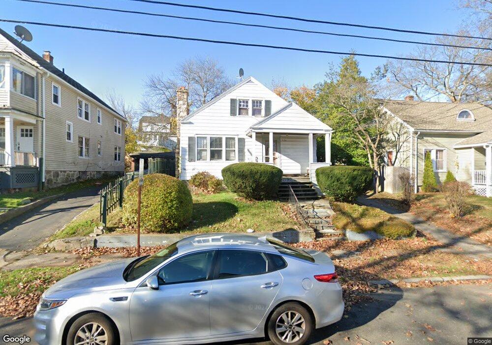
573 N Summerfield Ave Bridgeport, CT 06610
Boston Ave-Mill Hill NeighborhoodEstimated Value: $286,000 - $364,000
3
Beds
1
Bath
1,482
Sq Ft
$217/Sq Ft
Est. Value
About This Home
This home is located at 573 N Summerfield Ave, Bridgeport, CT 06610 and is currently estimated at $320,939, approximately $216 per square foot. 573 N Summerfield Ave is a home located in Fairfield County with nearby schools including Edison School and Harding High School.
Ownership History
Date
Name
Owned For
Owner Type
Purchase Details
Closed on
May 26, 1995
Sold by
Harrison Mary V
Bought by
Stackhouse Dianne
Current Estimated Value
Home Financials for this Owner
Home Financials are based on the most recent Mortgage that was taken out on this home.
Original Mortgage
$66,500
Interest Rate
8.33%
Mortgage Type
Unknown
Create a Home Valuation Report for This Property
The Home Valuation Report is an in-depth analysis detailing your home's value as well as a comparison with similar homes in the area
Home Values in the Area
Average Home Value in this Area
Purchase History
| Date | Buyer | Sale Price | Title Company |
|---|---|---|---|
| Stackhouse Dianne | $70,000 | -- | |
| Stackhouse Dianne | $70,000 | -- |
Source: Public Records
Mortgage History
| Date | Status | Borrower | Loan Amount |
|---|---|---|---|
| Open | Stackhouse Dianne | $144,000 | |
| Closed | Stackhouse Dianne | $130,000 | |
| Closed | Stackhouse Dianne | $17,000 | |
| Closed | Stackhouse Dianne | $66,500 |
Source: Public Records
Tax History Compared to Growth
Tax History
| Year | Tax Paid | Tax Assessment Tax Assessment Total Assessment is a certain percentage of the fair market value that is determined by local assessors to be the total taxable value of land and additions on the property. | Land | Improvement |
|---|---|---|---|---|
| 2025 | $5,595 | $128,770 | $59,730 | $69,040 |
| 2024 | $5,595 | $128,770 | $59,730 | $69,040 |
| 2023 | $5,595 | $128,770 | $59,730 | $69,040 |
| 2022 | $5,595 | $128,770 | $59,730 | $69,040 |
| 2021 | $5,595 | $128,770 | $59,730 | $69,040 |
| 2020 | $4,424 | $81,950 | $23,600 | $58,350 |
| 2019 | $4,424 | $81,950 | $23,600 | $58,350 |
| 2018 | $4,456 | $81,950 | $23,600 | $58,350 |
| 2017 | $4,456 | $81,950 | $23,600 | $58,350 |
| 2016 | $4,456 | $81,950 | $23,600 | $58,350 |
| 2015 | $4,900 | $116,110 | $33,320 | $82,790 |
| 2014 | $4,900 | $116,110 | $33,320 | $82,790 |
Source: Public Records
Map
Nearby Homes
- 357 Granfield Ave Unit B
- 43 Granfield Ave Unit 45
- 37 Granfield Ave Unit 39
- 1575 Boston Ave Unit B2
- 33 Granfield Ave
- 361 Granfield Ave Unit Bldg 8, A
- 3 Granfield Ave
- 332 Palisade Ave
- 5 Granfield Ave
- 401 Granfield Ave Unit 2
- 1922 Boston Ave Unit 1924
- 260 Success Ave Unit 21
- 14 Court a
- 242 Pearl Harbor St
- 302 Dover St
- 334 Dover St
- 287 Dover St Unit 293
- 295 N Bishop Bld 92 Ave Unit 13
- 290 N Bishop Bishop Ave Unit 12
- 215 Summerfield Ave
- 579 N Summerfield Ave
- 561 N Summerfield Ave
- 551 N Summerfield Ave
- 130 Boston Terrace
- 110 Boston Terrace
- 572 N Summerfield Ave
- 597 N Summerfield Ave
- 100 Boston Terrace
- 578 N Summerfield Ave
- 560 N Summerfield Ave
- 98 Boston Terrace
- 120 Boston Terrace
- 191 Birdsey St
- 590 N Summerfield Ave
- 541 N Summerfield Ave
- 550 N Summerfield Ave
- 90 Boston Terrace
- 542 N Summerfield Ave
- 607 N Summerfield Ave
- 531 N Summerfield Ave