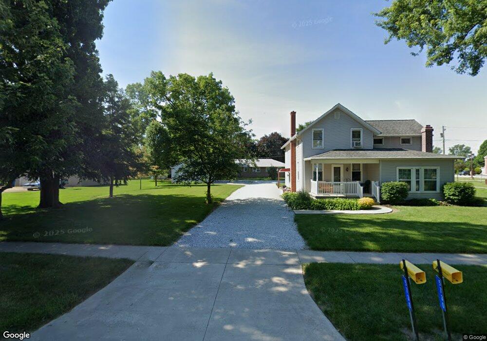
5733 W Oak St Bascom, OH 44809
Estimated Value: $215,000 - $288,000
3
Beds
2
Baths
2,665
Sq Ft
$89/Sq Ft
Est. Value
About This Home
This home is located at 5733 W Oak St, Bascom, OH 44809 and is currently estimated at $238,067, approximately $89 per square foot. 5733 W Oak St is a home with nearby schools including Hopewell-Loudon Local Elementary School and North Central Academy - Fremont.
Ownership History
Date
Name
Owned For
Owner Type
Purchase Details
Closed on
Mar 27, 2023
Sold by
Union United Church Of Christ Of Bascom
Bought by
Cooper Robert E and Cooper Stacy A
Current Estimated Value
Home Financials for this Owner
Home Financials are based on the most recent Mortgage that was taken out on this home.
Original Mortgage
$166,920
Outstanding Balance
$161,119
Interest Rate
6.32%
Mortgage Type
FHA
Estimated Equity
$76,948
Create a Home Valuation Report for This Property
The Home Valuation Report is an in-depth analysis detailing your home's value as well as a comparison with similar homes in the area
Purchase History
| Date | Buyer | Sale Price | Title Company |
|---|---|---|---|
| Cooper Robert E | $170,000 | Assured Title | |
| Cooper Robert E | $170,000 | Assured Title |
Source: Public Records
Mortgage History
| Date | Status | Borrower | Loan Amount |
|---|---|---|---|
| Open | Cooper Robert E | $166,920 | |
| Closed | Cooper Robert E | $166,920 |
Source: Public Records
Tax History
| Year | Tax Paid | Tax Assessment Tax Assessment Total Assessment is a certain percentage of the fair market value that is determined by local assessors to be the total taxable value of land and additions on the property. | Land | Improvement |
|---|---|---|---|---|
| 2025 | $2,614 | $69,090 | $10,500 | $58,590 |
| 2024 | $2,568 | $69,090 | $10,500 | $58,590 |
| 2023 | $2,760 | $69,090 | $10,500 | $58,590 |
| 2022 | $2,216 | $52,780 | $10,500 | $42,280 |
| 2021 | $2,228 | $52,780 | $10,500 | $42,280 |
| 2020 | $2,203 | $52,781 | $10,497 | $42,284 |
| 2019 | $1,892 | $44,899 | $9,125 | $35,774 |
| 2018 | $1,974 | $44,899 | $9,125 | $35,774 |
| 2017 | $1,857 | $44,899 | $9,125 | $35,774 |
| 2016 | $1,731 | $42,155 | $6,087 | $36,068 |
| 2015 | $1,709 | $42,155 | $6,087 | $36,068 |
| 2014 | $1,621 | $42,155 | $6,087 | $36,068 |
| 2013 | $1,730 | $42,155 | $6,087 | $36,068 |
Source: Public Records
Map
Nearby Homes
- 2945 W State Route 18
- 0 Shaffer Park Dr Unit 20251435
- 3007 W County Road 52
- 2400 S Township Road 119 Unit 36
- 3166 N County Road 11
- 2400 S Twp Rd 119 Unit 16
- 0 Tr 0113
- 0 Township Road 198a Unit Parcel 4
- 0 Township Road 198a Unit 10003057
- 0 W Tr 198a Unit 20260135
- 0 Miami St Unit 10003054
- 0 Miami St Unit Parcel 2
- 0 Miami St Unit 20260131
- 376 W Perry St
- 96 Lindsay Ave
- 127 Wentz St
- 311 W Perry St
- 795 S Sandusky St
- 109 -111 Wall St
- 109 Wall St
- 6800 Cliffside Dr
- 5823 W Oak St
- 5910 W Tiffin St
- 6149 W Tiffin St
- 6275 W Tiffin St
- 5752 W Oak St
- 5752 W Oak St
- 5680 W Tiffin St
- 5740 W Tiffin St
- 5730 W Tiffin St
- 5750 W State Route 18
- 5772 W Oak St
- 5760 W Tiffin St
- 5770 W Tiffin St
- 585 N Ash St
- 5707 W State Route 18
- 5731 W Tiffin St
- 5640 W Tiffin St
- 5741 W Tiffin St
- 5636 W State Route 18
Your Personal Tour Guide
Ask me questions while you tour the home.