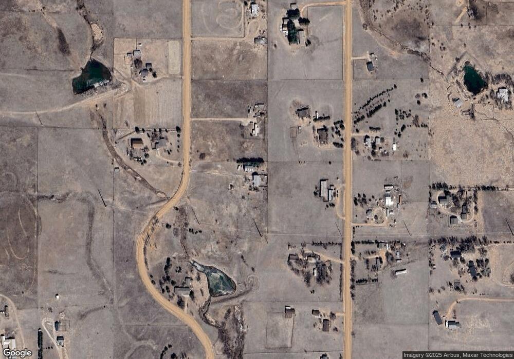
5735 W Condor Rd Peyton, CO 80831
Falcon NeighborhoodEstimated Value: $586,000 - $835,000
3
Beds
3
Baths
2,157
Sq Ft
$328/Sq Ft
Est. Value
About This Home
This home is located at 5735 W Condor Rd, Peyton, CO 80831 and is currently estimated at $706,960, approximately $327 per square foot. 5735 W Condor Rd is a home located in El Paso County with nearby schools including Falcon Elementary School Of Technology, Clifford Street Elementary School, and City Terrace Elementary School.
Ownership History
Date
Name
Owned For
Owner Type
Purchase Details
Closed on
Jul 2, 2025
Sold by
Hobson Terrance J and Hobson Karen J
Bought by
Hobson Karen J
Current Estimated Value
Purchase Details
Closed on
Feb 27, 1996
Sold by
Serna Amos and Serna Donna A
Bought by
Hobson Terrance J and Hobson Karen J
Home Financials for this Owner
Home Financials are based on the most recent Mortgage that was taken out on this home.
Original Mortgage
$179,400
Interest Rate
7%
Mortgage Type
VA
Purchase Details
Closed on
Aug 31, 1992
Bought by
Hobson Terrance J and Hobson Karen J
Purchase Details
Closed on
Sep 13, 1991
Bought by
Hobson Terrance J and Hobson Karen J
Purchase Details
Closed on
Jul 1, 1983
Bought by
Hobson Terrance J and Hobson Karen J
Create a Home Valuation Report for This Property
The Home Valuation Report is an in-depth analysis detailing your home's value as well as a comparison with similar homes in the area
Home Values in the Area
Average Home Value in this Area
Purchase History
| Date | Buyer | Sale Price | Title Company |
|---|---|---|---|
| Hobson Karen J | -- | None Listed On Document | |
| Hobson Terrance J | $175,900 | -- | |
| Hobson Terrance J | $110,400 | -- | |
| Hobson Terrance J | -- | -- | |
| Hobson Terrance J | $17,500 | -- | |
| Hobson Terrance J | -- | -- |
Source: Public Records
Mortgage History
| Date | Status | Borrower | Loan Amount |
|---|---|---|---|
| Previous Owner | Hobson Terrance J | $179,400 |
Source: Public Records
Tax History Compared to Growth
Tax History
| Year | Tax Paid | Tax Assessment Tax Assessment Total Assessment is a certain percentage of the fair market value that is determined by local assessors to be the total taxable value of land and additions on the property. | Land | Improvement |
|---|---|---|---|---|
| 2025 | $2,871 | $44,360 | -- | -- |
| 2024 | $2,759 | $44,060 | $8,720 | $35,340 |
| 2023 | $2,759 | $44,060 | $8,720 | $35,340 |
| 2022 | $1,820 | $26,220 | $6,720 | $19,500 |
| 2021 | $1,894 | $26,980 | $6,920 | $20,060 |
| 2020 | $1,704 | $24,170 | $5,400 | $18,770 |
| 2019 | $1,689 | $24,170 | $5,400 | $18,770 |
| 2018 | $1,345 | $18,920 | $4,900 | $14,020 |
| 2017 | $1,232 | $18,920 | $4,900 | $14,020 |
| 2016 | $1,154 | $17,490 | $5,180 | $12,310 |
| 2015 | $1,155 | $17,490 | $5,180 | $12,310 |
| 2014 | $1,099 | $16,340 | $4,780 | $11,560 |
Source: Public Records
Map
Nearby Homes
- 5865 E Blaney Rd
- 12565 Richardson Ln
- 6275 Meridian Rd
- 12480 Partridge Ln
- 11401 Highway 24
- 10970 Garrett Rd
- 6545 Connie Lee Ct
- 7110 Old Meridian Rd
- 7335 Chelsey Way
- The Plum Creek Plan at Rolling Hills Ranch
- The Kirkland Plan at Rolling Hills Ranch
- The Raintree Plan at Rolling Hills Ranch
- The Whitman Plan at Rolling Hills Ranch
- The Thoreau Plan at Rolling Hills Ranch
- The Newton Plan at Rolling Hills Ranch
- The Edison Plan at Rolling Hills Ranch
- The Montarbor Plan at Rolling Hills Ranch
- The Monarch Plan at Rolling Hills Ranch
- The Hemingway Plan at Rolling Hills Ranch
- The Emerson Plan at Rolling Hills Ranch
- 5825 W Condor Rd
- 5820 Sunset Trail
- 5780 W Condor Rd
- 5650 Sunset Trail
- 5725 Sunset Trail
- 5835 Sunset Trail
- 5635 W Condor Rd
- 5850 W Condor Rd
- 5590 Sunset Trail
- 5910 Sunset Trail
- 5905 Sunset Trail
- 5720 E Blaney Rd
- 5530 W Condor Rd
- 5520 Sunset Trail
- 6010 Sunset Trail
- 6015 W Condor Rd
- 5610 E Blaney Rd
- 5555 Sunset Trail
- 5960 W Condor Rd
- 5660 E Blaney Rd
