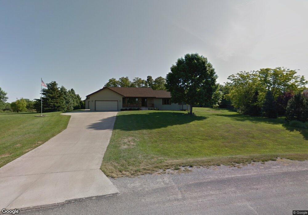
5738 Hunt Ridge Dr Cedar Rapids, IA 52411
Estimated Value: $390,000 - $477,000
3
Beds
3
Baths
1,608
Sq Ft
$263/Sq Ft
Est. Value
About This Home
This home is located at 5738 Hunt Ridge Dr, Cedar Rapids, IA 52411 and is currently estimated at $422,902, approximately $262 per square foot. 5738 Hunt Ridge Dr is a home located in Linn County with nearby schools including T.C. Cherry Elementary School, Hiawatha Elementary School, and Ponderosa Elementary School.
Ownership History
Date
Name
Owned For
Owner Type
Purchase Details
Closed on
Apr 24, 1998
Sold by
Auman Rick A and Auman Martha K
Bought by
Houser John D and Houser Susan Kay
Current Estimated Value
Home Financials for this Owner
Home Financials are based on the most recent Mortgage that was taken out on this home.
Original Mortgage
$88,600
Interest Rate
6.75%
Create a Home Valuation Report for This Property
The Home Valuation Report is an in-depth analysis detailing your home's value as well as a comparison with similar homes in the area
Home Values in the Area
Average Home Value in this Area
Purchase History
| Date | Buyer | Sale Price | Title Company |
|---|---|---|---|
| Houser John D | $180,000 | -- |
Source: Public Records
Mortgage History
| Date | Status | Borrower | Loan Amount |
|---|---|---|---|
| Previous Owner | Houser John D | $88,600 |
Source: Public Records
Tax History Compared to Growth
Tax History
| Year | Tax Paid | Tax Assessment Tax Assessment Total Assessment is a certain percentage of the fair market value that is determined by local assessors to be the total taxable value of land and additions on the property. | Land | Improvement |
|---|---|---|---|---|
| 2025 | $3,594 | $362,400 | $71,500 | $290,900 |
| 2024 | $3,524 | $327,000 | $71,500 | $255,500 |
| 2023 | $3,524 | $327,000 | $71,500 | $255,500 |
| 2022 | $3,480 | $258,200 | $71,500 | $186,700 |
| 2021 | $3,540 | $258,200 | $71,500 | $186,700 |
| 2020 | $3,540 | $243,000 | $52,700 | $190,300 |
| 2019 | $3,270 | $229,600 | $52,700 | $176,900 |
| 2018 | $3,198 | $229,600 | $52,700 | $176,900 |
| 2017 | $3,253 | $220,500 | $52,700 | $167,800 |
| 2016 | $3,253 | $220,500 | $52,700 | $167,800 |
| 2015 | $3,275 | $220,500 | $52,700 | $167,800 |
| 2014 | $3,146 | $220,500 | $52,700 | $167,800 |
| 2013 | $3,080 | $220,500 | $52,700 | $167,800 |
Source: Public Records
Map
Nearby Homes
- 3012 Prairielight Ct
- 3003 Prairielight Dr
- 3003 Prairielight Ct
- 3534 Reed Rd
- 3551 Mclain Way
- 2858 Mary Green Rd
- 2856 Mary Green Rd
- 3553 Mclain Way
- Roland Plan at Rolling Prairie Estates
- Hamilton Plan at Rolling Prairie Estates
- Bellhaven Plan at Rolling Prairie Estates
- Harmony Plan at Rolling Prairie Estates
- 2861 Prairielight Dr
- 2852 Mary Green Rd
- 3526 Reed Rd
- 2850 Mary Green Rd
- 2857 Prairielight Dr
- 2853 Mary Green Rd
- 2851 Mary Green Rd
- 3658 Mclain Way
- 5752 Hunt Ridge Dr
- 5722 Hunt Ridge Dr
- 5737 Hunt Ridge Dr
- 3044 Savannah Ct
- 5708 Hunt Ridge Dr
- 5766 Hunt Ridge Dr
- 5719 Hunt Ridge Dr
- 3043 Savannah Ct
- 5759 Hunt Ridge Dr
- 3042 Savannah Ct
- 3041 Savannah Ct
- 5697 Hunt Ridge Dr
- 5694 Hunt Ridge Dr
- 5780 Hunt Ridge Dr
- 3040 Savannah Ct
- 2863 Hunt Trail
- 3039 Savannah Ct
- 2859 Hunt Trail
- 5781 Hunt Ridge Dr
- 5606 Hunt Rd