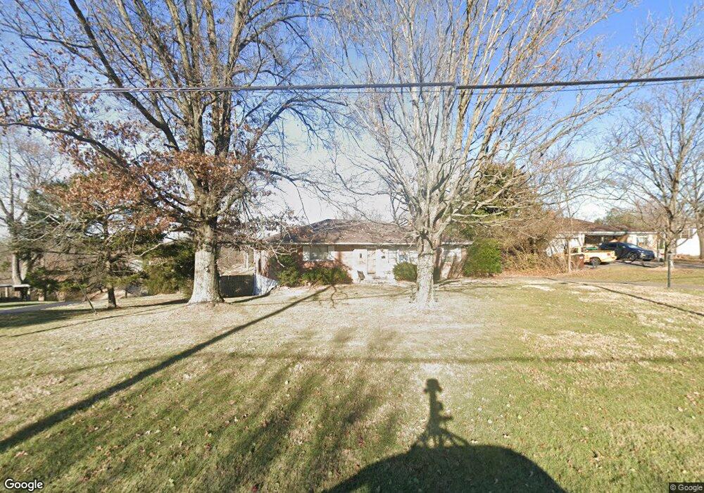
5738 W Fork Rd Cincinnati, OH 45247
West Monfort Heights NeighborhoodEstimated Value: $274,000 - $330,000
3
Beds
2
Baths
1,634
Sq Ft
$178/Sq Ft
Est. Value
About This Home
This home is located at 5738 W Fork Rd, Cincinnati, OH 45247 and is currently estimated at $290,869, approximately $178 per square foot. 5738 W Fork Rd is a home located in Hamilton County with nearby schools including Monfort Heights Elementary School, White Oak Middle School, and Colerain High School.
Ownership History
Date
Name
Owned For
Owner Type
Purchase Details
Closed on
Mar 18, 1998
Sold by
Hensley Karen S and Trinkle Jerry W
Bought by
Tarpoff John and Tarpoff Georgia
Current Estimated Value
Purchase Details
Closed on
Mar 16, 1998
Sold by
Hensley Fred and Hensley Karen S
Bought by
Tarpoff John and Tarpoff Georgia
Purchase Details
Closed on
Mar 14, 1998
Sold by
Trinkle Jerry W and Trinkle Lisa L
Bought by
Tarpoff John and Tarpoff Georgia
Purchase Details
Closed on
Mar 10, 1997
Sold by
Trinkle Carl K
Bought by
Trinkle Carl K and Hensley Karen S
Create a Home Valuation Report for This Property
The Home Valuation Report is an in-depth analysis detailing your home's value as well as a comparison with similar homes in the area
Home Values in the Area
Average Home Value in this Area
Purchase History
| Date | Buyer | Sale Price | Title Company |
|---|---|---|---|
| Tarpoff John | $2,500 | -- | |
| Tarpoff John | $114,900 | -- | |
| Tarpoff John | -- | -- | |
| Tarpoff John | -- | -- | |
| Trinkle Carl K | -- | -- |
Source: Public Records
Tax History
| Year | Tax Paid | Tax Assessment Tax Assessment Total Assessment is a certain percentage of the fair market value that is determined by local assessors to be the total taxable value of land and additions on the property. | Land | Improvement |
|---|---|---|---|---|
| 2025 | $3,177 | $68,664 | $17,574 | $51,090 |
| 2024 | $3,112 | $68,664 | $17,574 | $51,090 |
| 2023 | $3,170 | $68,664 | $17,574 | $51,090 |
| 2022 | $2,788 | $51,468 | $18,452 | $33,016 |
| 2021 | $2,546 | $51,468 | $18,452 | $33,016 |
| 2020 | $2,584 | $51,468 | $18,452 | $33,016 |
| 2019 | $2,684 | $49,018 | $17,574 | $31,444 |
| 2018 | $2,391 | $49,018 | $17,574 | $31,444 |
| 2017 | $2,253 | $49,018 | $17,574 | $31,444 |
| 2016 | $2,388 | $50,873 | $17,521 | $33,352 |
| 2015 | $2,417 | $50,873 | $17,521 | $33,352 |
| 2014 | $2,421 | $50,873 | $17,521 | $33,352 |
| 2013 | $2,292 | $51,388 | $17,700 | $33,688 |
Source: Public Records
Map
Nearby Homes
- 5876 Sutters Mill Dr
- 5563 Haft Rd
- 5588 W Fork Rd
- 5804 Cedaridge Dr
- 6051 Shelrich Ct
- Site 1 Brierly Creek Rd
- 5339 Race Rd
- 5547 Hubble Rd
- 5080 Jessup Rd
- 6670 Gaines Rd
- 4643 Whispering Oak Trail
- 5221 Clearlake Dr
- 5442 Bluesky Dr
- 4600 Farcrest Ct
- 4491 W Fork Rd
- 6150 Wilmer Rd
- 4192 Timberpoint Dr
- 5104 Jonkard Ln
- 6707 Weiss Rd
- 6660 Weiss Rd
- 5726 W Fork Rd
- 5754 W Fork Rd
- 5716 W Fork Rd
- 5758 W Fork Rd
- 5765 W Fork Rd
- 5737 W Fork Rd
- 5729 W Fork Rd
- 5708 W Fork Rd
- 5746 W Fork Rd
- 5664 Fox Ridge Ct
- 5730 Sutters Mill Dr
- 5771 W Fork Rd
- 5745 Sutters Mill Dr
- 5696 W Fork Rd
- 5707 W Fork Rd
- 5721 W Fork Rd
- 5715 W Fork Rd
- 5777 W Fork Rd
- 5656 Fox Ridge Ct
- 5748 Sutters Mill Dr
Your Personal Tour Guide
Ask me questions while you tour the home.