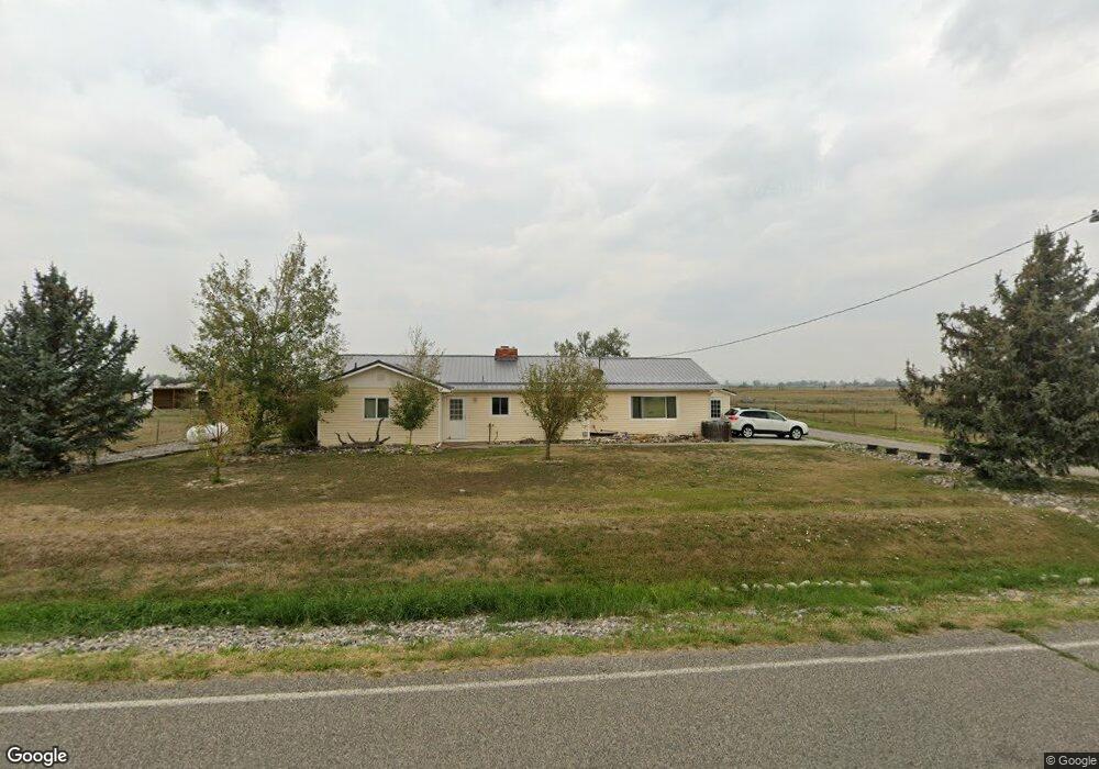
5739 Chicago Rd Shepherd, MT 59079
Estimated Value: $433,379 - $472,000
3
Beds
2
Baths
1,726
Sq Ft
$263/Sq Ft
Est. Value
About This Home
This home is located at 5739 Chicago Rd, Shepherd, MT 59079 and is currently estimated at $454,345, approximately $263 per square foot. 5739 Chicago Rd is a home located in Yellowstone County with nearby schools including Shepherd Elementary School, Shepherd Middle School, and Shepherd High School.
Ownership History
Date
Name
Owned For
Owner Type
Purchase Details
Closed on
Feb 24, 2016
Sold by
Williams Darla L and Williams Charles B
Bought by
Fluckiger Blaine H
Current Estimated Value
Home Financials for this Owner
Home Financials are based on the most recent Mortgage that was taken out on this home.
Original Mortgage
$240,463
Outstanding Balance
$189,656
Interest Rate
3.79%
Mortgage Type
FHA
Estimated Equity
$264,689
Purchase Details
Closed on
Feb 3, 2006
Sold by
Williams Darla L
Bought by
Williams Darla L and Williams Charles B
Home Financials for this Owner
Home Financials are based on the most recent Mortgage that was taken out on this home.
Original Mortgage
$152,706
Interest Rate
6.16%
Mortgage Type
FHA
Create a Home Valuation Report for This Property
The Home Valuation Report is an in-depth analysis detailing your home's value as well as a comparison with similar homes in the area
Purchase History
| Date | Buyer | Sale Price | Title Company |
|---|---|---|---|
| Fluckiger Blaine H | -- | Stewart Title Of Billings | |
| Williams Darla L | -- | None Available |
Source: Public Records
Mortgage History
| Date | Status | Borrower | Loan Amount |
|---|---|---|---|
| Open | Fluckiger Blaine H | $240,463 | |
| Previous Owner | Williams Darla L | $152,706 |
Source: Public Records
Tax History
| Year | Tax Paid | Tax Assessment Tax Assessment Total Assessment is a certain percentage of the fair market value that is determined by local assessors to be the total taxable value of land and additions on the property. | Land | Improvement |
|---|---|---|---|---|
| 2025 | $2,964 | $451,100 | $81,018 | $370,082 |
| 2024 | $2,964 | $342,300 | $63,508 | $278,792 |
| 2023 | $3,015 | $342,300 | $63,508 | $278,792 |
| 2022 | $2,528 | $268,800 | $0 | $0 |
| 2021 | $2,649 | $268,800 | $0 | $0 |
| 2020 | $2,434 | $237,900 | $0 | $0 |
| 2019 | $2,021 | $237,900 | $0 | $0 |
| 2018 | $2,303 | $256,900 | $0 | $0 |
| 2017 | $2,056 | $256,900 | $0 | $0 |
| 2016 | $2,073 | $245,300 | $0 | $0 |
| 2015 | $2,062 | $245,300 | $0 | $0 |
| 2014 | $1,487 | $93,757 | $0 | $0 |
Source: Public Records
Map
Nearby Homes
- 0 SHepherd Road lot Shepherd Rd
- 0 Shepherd Road Lot Shepherd Rd
- 6447 US Highway 312
- 5430 Cerkoney Ln
- 0000 Florian Ave
- 6610 S 12th St
- 4142 McGirl Rd
- 8020 Wade St
- 1266 Chipper Ln
- 1251 Chipper Ln
- 1246 Chipper Ln
- 5652 Bengston Rd
- L5B4 Trumbo Cir
- 1794 N 4th Rd
- L11B3 High Noon Dr
- L13B2 High Noon Dr
- L3B4 Trumbo Cir
- 7306 Kendra Lynn Dr
- L11B2 Rio Lobo Cir
- L12B3 Molly Dr
- 5815 Chicago Rd
- 5810 Chicago Rd
- 5730 Chicago Rd
- 5824 Chicago Rd
- 5822 Chicago Rd
- 6044 Hitching Post Dr
- 5705 Chicago Rd
- 5839 Chicago Rd
- 5708 Chicago Rd
- 5838 Chicago Rd
- 5675 Chicago Rd
- 5639 Chicago Rd
- 5840,5850,5904 Lunder Ln
- 5852 Chicago Rd
- 5642 Chicago Rd
- 6118 Hitching Post Dr
- 5631 Chicago Rd
- 5840 Lunder Ln
- 5914 Chicago Rd
- 5615 Chicago Rd
Your Personal Tour Guide
Ask me questions while you tour the home.