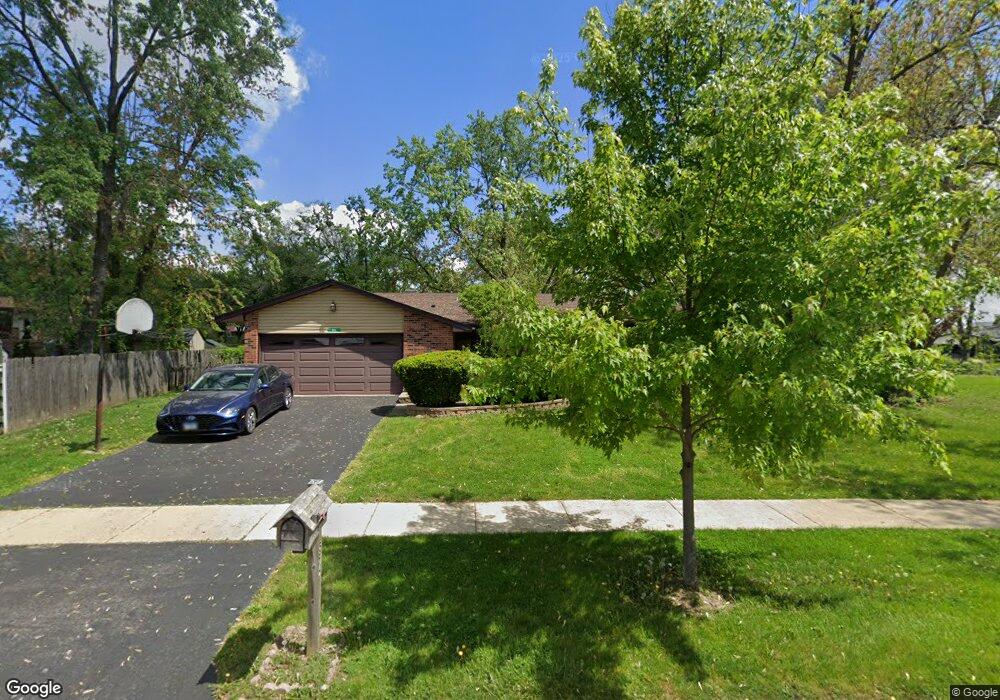
574 Miner Dr Bolingbrook, IL 60440
East Bolingbrook NeighborhoodEstimated Value: $334,316 - $350,000
3
Beds
2
Baths
1,587
Sq Ft
$218/Sq Ft
Est. Value
About This Home
This home is located at 574 Miner Dr, Bolingbrook, IL 60440 and is currently estimated at $345,329, approximately $217 per square foot. 574 Miner Dr is a home located in Will County with nearby schools including Jonas E Salk Elementary School, Hubert H Humphrey Middle School, and Brooks Middle School.
Ownership History
Date
Name
Owned For
Owner Type
Purchase Details
Closed on
Aug 18, 2003
Sold by
Comerford Gwen
Bought by
Boswell Wendy
Current Estimated Value
Home Financials for this Owner
Home Financials are based on the most recent Mortgage that was taken out on this home.
Original Mortgage
$144,000
Interest Rate
5.46%
Mortgage Type
Purchase Money Mortgage
Purchase Details
Closed on
Jul 31, 2003
Sold by
Deutsche Bank National Trust Co
Bought by
Comerford Gwen
Home Financials for this Owner
Home Financials are based on the most recent Mortgage that was taken out on this home.
Original Mortgage
$144,000
Interest Rate
5.46%
Mortgage Type
Purchase Money Mortgage
Purchase Details
Closed on
Jun 24, 1999
Sold by
Va
Bought by
Bankers Trust Company Of California Na and Vendee Mtg Trust 1999-2
Purchase Details
Closed on
Aug 26, 1998
Sold by
Johnson Steven J and Johnson Diane R
Bought by
Va
Create a Home Valuation Report for This Property
The Home Valuation Report is an in-depth analysis detailing your home's value as well as a comparison with similar homes in the area
Home Values in the Area
Average Home Value in this Area
Purchase History
| Date | Buyer | Sale Price | Title Company |
|---|---|---|---|
| Boswell Wendy | $180,000 | Ticor Title | |
| Comerford Gwen | -- | Ticor Title | |
| Bankers Trust Company Of California Na | -- | Stewart Title Company | |
| Va | -- | Wheatland Title |
Source: Public Records
Mortgage History
| Date | Status | Borrower | Loan Amount |
|---|---|---|---|
| Previous Owner | Boswell Wendy | $144,000 |
Source: Public Records
Tax History Compared to Growth
Tax History
| Year | Tax Paid | Tax Assessment Tax Assessment Total Assessment is a certain percentage of the fair market value that is determined by local assessors to be the total taxable value of land and additions on the property. | Land | Improvement |
|---|---|---|---|---|
| 2024 | $8,385 | $98,786 | $19,228 | $79,558 |
| 2023 | $8,385 | $88,885 | $17,301 | $71,584 |
| 2022 | $7,328 | $80,135 | $15,598 | $64,537 |
| 2021 | $6,939 | $74,927 | $14,584 | $60,343 |
| 2020 | $6,723 | $72,463 | $14,104 | $58,359 |
| 2019 | $6,501 | $69,012 | $13,432 | $55,580 |
| 2018 | $6,237 | $66,053 | $12,856 | $53,197 |
| 2017 | $5,933 | $62,610 | $12,186 | $50,424 |
| 2016 | $5,756 | $59,600 | $11,600 | $48,000 |
| 2015 | $5,671 | $57,100 | $11,100 | $46,000 |
| 2014 | $5,671 | $57,100 | $11,100 | $46,000 |
| 2013 | $5,671 | $53,900 | $10,500 | $43,400 |
Source: Public Records
Map
Nearby Homes
- 233 Charlotte Ln
- 231 Charlotte Ln
- 601 Derbyshire Ln
- 7 Purchase Ct
- 557 Monroe Rd
- 409 N Ashbury Ave
- 424 Van Gogh Cir Unit 1
- 704 N Pinecrest Rd
- 9 Marquette Ct
- 168 Winston Dr
- 187 Roberts Rd Unit 187
- 461 Rockhurst Rd
- 316 Bedford Rd
- 488 Ridge Ln
- 490 Ridge Ln
- 492 Ridge Ln
- 322 Rockhurst Rd
- 462 Ridge Ln
- 535 Jordan Way
- 458 Ridge Ln