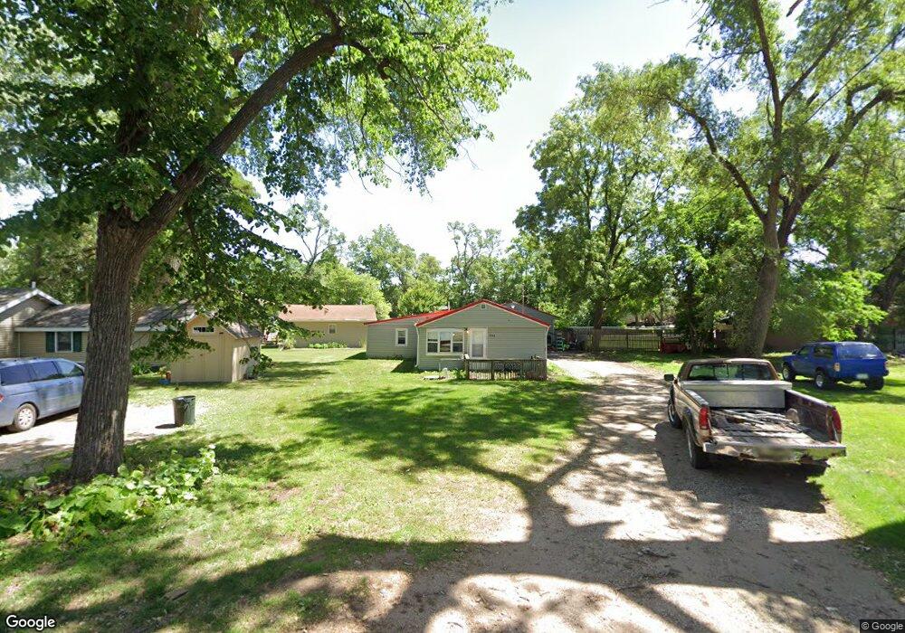
5740 SE Robbie Rd Carlisle, IA 50047
Avon Lake NeighborhoodEstimated Value: $123,000 - $207,000
2
Beds
1
Bath
920
Sq Ft
$179/Sq Ft
Est. Value
About This Home
This home is located at 5740 SE Robbie Rd, Carlisle, IA 50047 and is currently estimated at $164,774, approximately $179 per square foot. 5740 SE Robbie Rd is a home located in Polk County with nearby schools including Carlisle Elementary School, Hartford Upper Elementary School, and Carlisle Middle School.
Ownership History
Date
Name
Owned For
Owner Type
Purchase Details
Closed on
Sep 29, 2016
Sold by
Grubb Randy S
Bought by
Gayland Enterprises Llc
Current Estimated Value
Purchase Details
Closed on
May 7, 2004
Sold by
Gayland Llc
Bought by
Grubb Randy S
Home Financials for this Owner
Home Financials are based on the most recent Mortgage that was taken out on this home.
Original Mortgage
$40,000
Interest Rate
5.63%
Mortgage Type
Purchase Money Mortgage
Purchase Details
Closed on
Sep 25, 2003
Sold by
Jones Nunez Sylvia J
Bought by
Deutsche Bank National Trust Co
Create a Home Valuation Report for This Property
The Home Valuation Report is an in-depth analysis detailing your home's value as well as a comparison with similar homes in the area
Home Values in the Area
Average Home Value in this Area
Purchase History
| Date | Buyer | Sale Price | Title Company |
|---|---|---|---|
| Gayland Enterprises Llc | $33,000 | None Available | |
| Grubb Randy S | $49,500 | -- | |
| Deutsche Bank National Trust Co | $44,200 | -- |
Source: Public Records
Mortgage History
| Date | Status | Borrower | Loan Amount |
|---|---|---|---|
| Previous Owner | Grubb Randy S | $40,000 |
Source: Public Records
Tax History Compared to Growth
Tax History
| Year | Tax Paid | Tax Assessment Tax Assessment Total Assessment is a certain percentage of the fair market value that is determined by local assessors to be the total taxable value of land and additions on the property. | Land | Improvement |
|---|---|---|---|---|
| 2024 | $1,776 | $109,300 | $22,000 | $87,300 |
| 2023 | $1,592 | $109,300 | $22,000 | $87,300 |
| 2022 | $1,562 | $82,600 | $17,500 | $65,100 |
| 2021 | $1,636 | $82,600 | $17,500 | $65,100 |
| 2020 | $1,612 | $83,200 | $17,600 | $65,600 |
| 2019 | $1,554 | $83,200 | $17,600 | $65,600 |
| 2018 | $1,522 | $77,200 | $15,900 | $61,300 |
| 2017 | $1,322 | $77,200 | $15,900 | $61,300 |
| 2016 | $1,292 | $73,700 | $15,000 | $58,700 |
| 2015 | $1,292 | $73,700 | $15,000 | $58,700 |
| 2014 | $1,028 | $60,600 | $14,700 | $45,900 |
Source: Public Records
Map
Nearby Homes
- 5756 SE 66th Place
- 325 Pennsylvania St
- 535 N 4th St
- 2820 Gateway Dr
- 340 Crescent Dr
- 50 Park St
- 80 Pennsylvania St
- 1115 Pleasant St
- 4695 E Spring St
- 20937 5th St
- 000 5th St
- 220 N 1st St
- 1588 Highway 5
- 390 Commons Dr
- 415 Commons Dr
- 1000 Commons Ct
- 415 Jefferson St
- 450 Commons Dr
- 205 Jefferson St
- 490 Commons Dr
- 5732 SE Robbie Rd
- 5748 SE Robbie Rd
- 5753 SE Elm Dr
- 5771 SE Circle Dr
- 5739 SE Robbie Rd
- 5726 SE Robbie Rd
- 5711 SE Robbie Rd
- 5752 SE Robbie Rd
- 5878 SE 66th Place
- 5736 SE 66th Place
- 5746 SE Elm Dr
- 5770 SE 66th Place
- 5790 SE Circle Dr
- 5730 SE Circle Dr
- 5710 SE 66th Place
- 5718 SE Robbie Rd
- 5706 SE 66th Place
- 5792 SE Circle Dr
- 5944 SE Circle Dr
- 5689 SE Robbie Rd