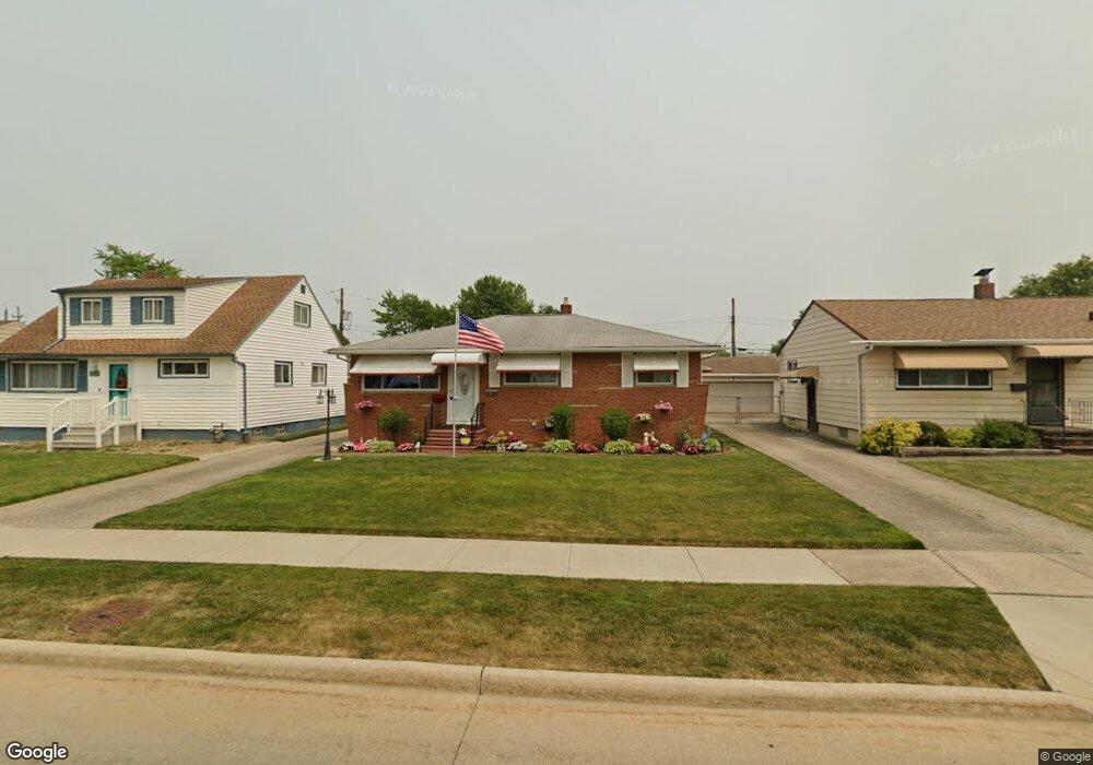
5743 Michael Dr Brookpark, OH 44142
Estimated Value: $206,938 - $228,000
3
Beds
1
Bath
999
Sq Ft
$218/Sq Ft
Est. Value
About This Home
This home is located at 5743 Michael Dr, Brookpark, OH 44142 and is currently estimated at $217,985, approximately $218 per square foot. 5743 Michael Dr is a home located in Cuyahoga County with nearby schools including Berea-Midpark Middle School, Berea-Midpark High School, and Huber Heights Preparatory Academy Parma Academy.
Ownership History
Date
Name
Owned For
Owner Type
Purchase Details
Closed on
Apr 1, 2019
Sold by
Mcnamara Paul R and Mcnamara Debora L
Bought by
Mcnamara Paul R and Mcnamara Debora L
Current Estimated Value
Purchase Details
Closed on
Feb 27, 1980
Bought by
Mcnamara Paul R
Purchase Details
Closed on
Feb 4, 1980
Sold by
Bonham Charles C
Bought by
Equitable Life Assurance
Purchase Details
Closed on
Dec 19, 1978
Sold by
Davis John W
Bought by
Bonham Charles C
Purchase Details
Closed on
Sep 8, 1975
Sold by
Davis Helen G
Bought by
Davis John W
Purchase Details
Closed on
Jan 1, 1975
Bought by
Davis Helen G
Create a Home Valuation Report for This Property
The Home Valuation Report is an in-depth analysis detailing your home's value as well as a comparison with similar homes in the area
Home Values in the Area
Average Home Value in this Area
Purchase History
| Date | Buyer | Sale Price | Title Company |
|---|---|---|---|
| Mcnamara Paul R | -- | None Available | |
| Mcnamara Paul R | $53,900 | -- | |
| Equitable Life Assurance | $56,000 | -- | |
| Bonham Charles C | $56,000 | -- | |
| Davis John W | $32,000 | -- | |
| Davis Helen G | -- | -- |
Source: Public Records
Tax History Compared to Growth
Tax History
| Year | Tax Paid | Tax Assessment Tax Assessment Total Assessment is a certain percentage of the fair market value that is determined by local assessors to be the total taxable value of land and additions on the property. | Land | Improvement |
|---|---|---|---|---|
| 2024 | $3,345 | $66,325 | $10,640 | $55,685 |
| 2023 | $3,233 | $53,070 | $8,160 | $44,910 |
| 2022 | $3,210 | $53,060 | $8,160 | $44,910 |
| 2021 | $3,191 | $53,060 | $8,160 | $44,910 |
| 2020 | $2,877 | $42,110 | $6,480 | $35,630 |
| 2019 | $2,791 | $120,300 | $18,500 | $101,800 |
| 2018 | $2,667 | $42,110 | $6,480 | $35,630 |
| 2017 | $2,767 | $38,720 | $6,480 | $32,240 |
| 2016 | $2,744 | $38,720 | $6,480 | $32,240 |
| 2015 | $2,710 | $38,720 | $6,480 | $32,240 |
| 2014 | $2,710 | $40,750 | $6,830 | $33,920 |
Source: Public Records
Map
Nearby Homes
- 5677 Gateway Ln Unit E504
- 14417 Parkman Blvd
- 14344 Fayette Blvd
- 5348 W 147th St
- 5198 W 148th St
- 14055 Donald Dr
- 13489 Havendale Dr
- 13602 Holland Rd
- 6330 Michael Dr
- 15450 Holland Rd
- 13971 Park Dr
- 15665 Holland Rd
- 15800 Holland Rd
- 13931 Franklyn Blvd
- 16051 Holland Rd
- 6363 Lockhaven Dr
- 6378 Edgehurst Dr
- 13879 Zaremba Dr
- 6321 W 130th St
- 6274 Anita Dr
- 5751 Michael Dr
- 5735 Michael Dr
- 5757 Michael Dr
- 5727 Michael Dr
- 5746 Champaign Ave
- 5754 Champaign Ave
- 5732 Champaign Ave
- 5763 Michael Dr
- 5721 Michael Dr
- 5742 Michael Dr
- 5760 Champaign Ave
- 5750 Michael Dr
- 5734 Michael Dr
- 5724 Champaign Ave
- 5713 Michael Dr
- 5771 Michael Dr
- 5758 Michael Dr
- 5726 Michael Dr
- 5768 Champaign Ave
- 5716 Champaign Ave