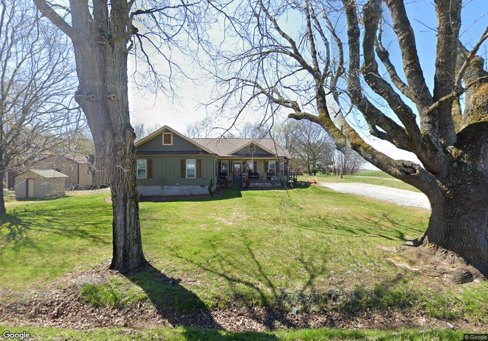
5744 Highway 161 Springfield, TN 37172
Estimated Value: $349,000 - $581,000
Studio
1
Bath
2,275
Sq Ft
$205/Sq Ft
Est. Value
About This Home
This home is located at 5744 Highway 161, Springfield, TN 37172 and is currently estimated at $466,065, approximately $204 per square foot. 5744 Highway 161 is a home located in Robertson County with nearby schools including Cheatham Park Elementary School, Westside Elementary School, and Innovation Academy.
Ownership History
Date
Name
Owned For
Owner Type
Purchase Details
Closed on
Sep 13, 2021
Sold by
Rainwater David L
Bought by
Rainwater David L and Rainwater Tara L
Current Estimated Value
Home Financials for this Owner
Home Financials are based on the most recent Mortgage that was taken out on this home.
Original Mortgage
$161,800
Outstanding Balance
$119,326
Interest Rate
2.1%
Mortgage Type
Construction
Estimated Equity
$346,739
Purchase Details
Closed on
Mar 5, 2020
Sold by
Leavell Elder L and Leavell Garnettia
Bought by
Rainwater David L
Home Financials for this Owner
Home Financials are based on the most recent Mortgage that was taken out on this home.
Original Mortgage
$15,505
Interest Rate
3.4%
Mortgage Type
Commercial
Purchase Details
Closed on
Apr 30, 1985
Bought by
Leavell Elder L
Create a Home Valuation Report for This Property
The Home Valuation Report is an in-depth analysis detailing your home's value as well as a comparison with similar homes in the area
Home Values in the Area
Average Home Value in this Area
Purchase History
| Date | Buyer | Sale Price | Title Company |
|---|---|---|---|
| Rainwater David L | -- | None Listed On Document | |
| Rainwater David L | $17,000 | Dba Waranty Title Ins Co | |
| Leavell Elder L | -- | -- |
Source: Public Records
Mortgage History
| Date | Status | Borrower | Loan Amount |
|---|---|---|---|
| Open | Rainwater David L | $161,800 | |
| Previous Owner | Rainwater David L | $15,505 |
Source: Public Records
Tax History
| Year | Tax Paid | Tax Assessment Tax Assessment Total Assessment is a certain percentage of the fair market value that is determined by local assessors to be the total taxable value of land and additions on the property. | Land | Improvement |
|---|---|---|---|---|
| 2025 | $1,860 | $103,350 | $14,275 | $89,075 |
| 2024 | $1,860 | $103,350 | $14,275 | $89,075 |
| 2023 | $1,860 | $103,350 | $14,275 | $89,075 |
| 2022 | $815 | $31,625 | $3,750 | $27,875 |
| 2021 | $116 | $4,500 | $3,750 | $750 |
| 2020 | $116 | $4,500 | $3,750 | $750 |
| 2019 | $116 | $4,500 | $3,750 | $750 |
| 2018 | $116 | $4,500 | $3,750 | $750 |
| 2017 | $77 | $2,500 | $1,800 | $700 |
| 2016 | $77 | $2,500 | $1,800 | $700 |
| 2015 | $74 | $2,500 | $1,800 | $700 |
| 2014 | $74 | $2,500 | $1,800 | $700 |
Source: Public Records
Map
Nearby Homes
- 4436 Barren Plains Rd
- 4352 Dot Rd
- 5535 Highway 161
- 5699 Minnis Rd
- 2 Minnis Rd Unit 2
- 5439 Minnis Rd
- 4067 Woodard Rd
- 5 Highway161
- 11 Highway161
- 10 Highway161
- 4 Highway161
- 12 Highway161
- 8 Highway161
- 2908 Gunn Rd
- 0 Wayman Dunn Rd
- 5954 Valley Rd
- 5963 Wayman Dunn Rd
- 6212 H B Lee Rd
- 6442 Highway 161
- 5220 Jones Chapel Rd
- 5743 Highway 161
- 5738 Highway 161
- 5734 Highway 161
- 5755 Highway 161
- 5748 Highway 161
- 4532 Corbin Sneed Rd
- 4528 Corbin Sneed Rd
- 4524 Corbin Sneed Rd
- 4402 Barren Plains Rd
- 4406 Barren Plains Rd
- 4522 Corbin Sneed Rd
- 4426 Barren Plains Rd
- 5718 Highway 161
- 4527 Corbin Sneed Rd
- 5830 Highway 161
- 5830 Highway 161
- 4435 Barren Plains Rd
- 5712 Highway 161
- 4553 Corbin Sneed Rd
- 4507 Corbin Sneed Rd
Your Personal Tour Guide
Ask me questions while you tour the home.