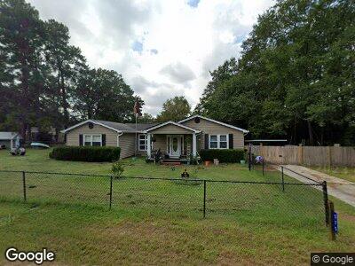
575 Brooks Ave West Columbia, SC 29169
Estimated Value: $197,271 - $263,000
3
Beds
2
Baths
1,940
Sq Ft
$114/Sq Ft
Est. Value
About This Home
This home is located at 575 Brooks Ave, West Columbia, SC 29169 and is currently estimated at $221,318, approximately $114 per square foot. 575 Brooks Ave is a home with nearby schools including Cayce Elementary, Cyril B. Busbee Creative Arts Academy, and Brookland-Cayce High School.
Ownership History
Date
Name
Owned For
Owner Type
Purchase Details
Closed on
Dec 29, 2023
Sold by
Patterson Elizabeth B
Bought by
Bagley Jamie R and Bagley Jacob S
Current Estimated Value
Home Financials for this Owner
Home Financials are based on the most recent Mortgage that was taken out on this home.
Original Mortgage
$134,615
Outstanding Balance
$133,468
Interest Rate
7.44%
Mortgage Type
FHA
Estimated Equity
$53,994
Purchase Details
Closed on
Jun 8, 2018
Sold by
Bagley Carolyn Mcswain
Bought by
Bagley Carolyn Mcswain and Bagley Thomas K
Create a Home Valuation Report for This Property
The Home Valuation Report is an in-depth analysis detailing your home's value as well as a comparison with similar homes in the area
Home Values in the Area
Average Home Value in this Area
Purchase History
| Date | Buyer | Sale Price | Title Company |
|---|---|---|---|
| Bagley Jamie R | $150,000 | None Listed On Document | |
| Bagley Carolyn Mcswain | $500 | None Available |
Source: Public Records
Mortgage History
| Date | Status | Borrower | Loan Amount |
|---|---|---|---|
| Open | Bagley Jamie R | $134,615 | |
| Previous Owner | Bagley Carolyn Mcswain | $112,000 |
Source: Public Records
Tax History Compared to Growth
Tax History
| Year | Tax Paid | Tax Assessment Tax Assessment Total Assessment is a certain percentage of the fair market value that is determined by local assessors to be the total taxable value of land and additions on the property. | Land | Improvement |
|---|---|---|---|---|
| 2024 | $3,553 | $9,000 | $1,200 | $7,800 |
| 2023 | $3,553 | $5,361 | $640 | $4,721 |
| 2022 | $993 | $5,361 | $640 | $4,721 |
| 2020 | $512 | $5,361 | $640 | $4,721 |
| 2019 | $520 | $5,327 | $640 | $4,687 |
| 2018 | $530 | $5,327 | $640 | $4,687 |
| 2017 | $498 | $5,327 | $640 | $4,687 |
| 2016 | $523 | $5,326 | $640 | $4,686 |
| 2014 | $405 | $5,506 | $720 | $4,786 |
| 2013 | -- | $5,510 | $720 | $4,790 |
Source: Public Records
Map
Nearby Homes
- 641 Brooks Ave
- 139 Silver Run Place
- 141 Silver Run Place
- 212 Alexandria St
- 217 Alexandria St
- 175 Silver Run Place
- 154 Manning Dr
- 258 Gum Swamp Trail
- 159 Alexandria St
- 2312 Rainbow Dr
- 348 Gum Swamp Trail
- 1903 Platt Springs Rd
- 2405 Rainbow Dr
- 311 Denham Ave
- 940 Glenn St Unit 901
- 1010 Sox St
- 1 Janice Faye Trail
- 917 Beth Dr
- 1610 Crapps Ave
- 224 17th St
- 575 Brooks Ave
- 600 Westside Dr
- 601 Brooks Ave
- 604 Westside Dr
- 605 Brooks Ave
- 610 Westside Dr
- 607 Brooks Ave
- 601 Westside Dr
- 604 Brooks Ave
- 609 Westside Dr
- 614 Westside Dr
- 609 Brooks Ave
- 608 Brooks Ave
- 613 Westside Dr
- 102 Whiteside Cir
- 619 Brooks Ave
- 105 Whiteside Cir
- 618 Westside Dr
- 183 Whiteside Cir
- 302 Dreher Rd