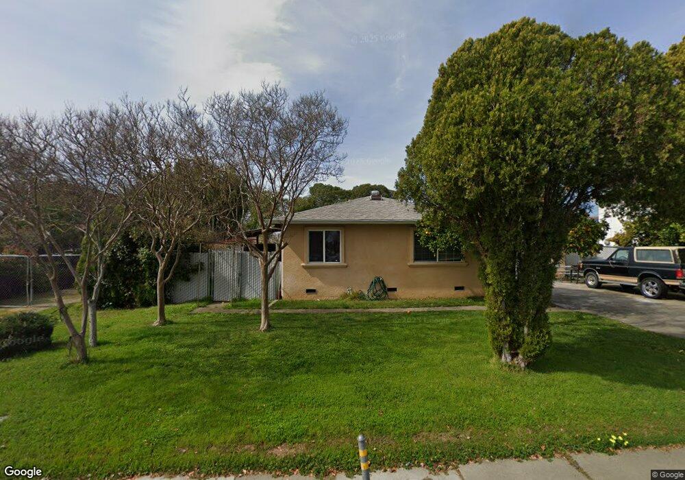
5752 71st St Sacramento, CA 95824
Avondale NeighborhoodEstimated Value: $239,828 - $335,000
1
Bed
1
Bath
548
Sq Ft
$525/Sq Ft
Est. Value
About This Home
This home is located at 5752 71st St, Sacramento, CA 95824 and is currently estimated at $287,707, approximately $525 per square foot. 5752 71st St is a home located in Sacramento County with nearby schools including Earl Warren Elementary School, Will C. Wood Middle School, and Hiram W. Johnson High School.
Ownership History
Date
Name
Owned For
Owner Type
Purchase Details
Closed on
Dec 26, 2023
Sold by
Riordan Family Trust
Bought by
Riordan Survivors Trust and Riordan
Current Estimated Value
Purchase Details
Closed on
Nov 10, 1999
Sold by
Walker Family Trust & Robert Riordan and Susan E
Bought by
Riordan Robert J and Riordan Family Trust
Purchase Details
Closed on
Nov 30, 1998
Sold by
Walker Susan
Bought by
Walker Susan E and The Walker Family Trust
Purchase Details
Closed on
May 9, 1996
Sold by
Riordan Robert
Bought by
Walker Susan and Riordan Robert
Home Financials for this Owner
Home Financials are based on the most recent Mortgage that was taken out on this home.
Original Mortgage
$42,000
Interest Rate
7.68%
Create a Home Valuation Report for This Property
The Home Valuation Report is an in-depth analysis detailing your home's value as well as a comparison with similar homes in the area
Home Values in the Area
Average Home Value in this Area
Purchase History
| Date | Buyer | Sale Price | Title Company |
|---|---|---|---|
| Riordan Survivors Trust | -- | None Listed On Document | |
| Riordan Robert J | -- | -- | |
| Walker Susan E | -- | -- | |
| Walker Susan | -- | North American Title Co | |
| Walker Susan | -- | North American Title Co |
Source: Public Records
Mortgage History
| Date | Status | Borrower | Loan Amount |
|---|---|---|---|
| Previous Owner | Walker Susan | $42,000 |
Source: Public Records
Tax History Compared to Growth
Tax History
| Year | Tax Paid | Tax Assessment Tax Assessment Total Assessment is a certain percentage of the fair market value that is determined by local assessors to be the total taxable value of land and additions on the property. | Land | Improvement |
|---|---|---|---|---|
| 2025 | $1,316 | $97,005 | $62,952 | $34,053 |
| 2024 | $1,316 | $95,104 | $61,718 | $33,386 |
| 2023 | $1,285 | $93,240 | $60,508 | $32,732 |
| 2022 | $1,262 | $91,413 | $59,322 | $32,091 |
| 2021 | $1,207 | $89,621 | $58,159 | $31,462 |
| 2020 | $1,212 | $88,703 | $57,563 | $31,140 |
| 2019 | $1,188 | $86,965 | $56,435 | $30,530 |
| 2018 | $1,158 | $85,261 | $55,329 | $29,932 |
| 2017 | $1,141 | $83,591 | $54,245 | $29,346 |
| 2016 | $1,122 | $81,953 | $53,182 | $28,771 |
| 2015 | $913 | $63,930 | $44,753 | $19,177 |
| 2014 | $893 | $62,679 | $43,877 | $18,802 |
Source: Public Records
Map
Nearby Homes
- 5 Enniskillen Ct
- 7021 Fruitridge Rd
- 5411 70th St
- 5351 Whittier Dr
- 5853 64th St
- 7440 38th Ave
- 5211 Whittier Dr
- 5618 Wilkinson St
- 5240 Emerson Rd
- 6314 37th Ave
- 7330 Peacock Way
- 5111 71st St
- 5331 Standish Rd
- 5020 Emerson Rd
- 7441 Peacock Way
- 6152 Lemon Bell Way
- 5290 64th St
- 6280 40th Ave
- 4941 Alcott Dr
- 7909 35th Ave