Estimated Value: $299,000 - $388,083
4
Beds
2
Baths
2,112
Sq Ft
$166/Sq Ft
Est. Value
About This Home
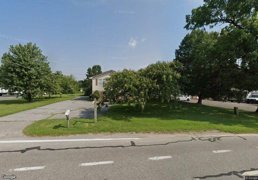
This home is located at 5752 Forrest Ave, Dover, DE 19904 and is currently estimated at $351,271, approximately $166 per square foot. 5752 Forrest Ave is a home located in Kent County with nearby schools including Hartly Elementary School, William Henry Middle School, and Central Middle School.
Ownership History
Date
Name
Owned For
Owner Type
Purchase Details
Closed on
Apr 7, 2025
Sold by
Beachy Daniel H
Bought by
Beachy Benjamin P
Current Estimated Value
Home Financials for this Owner
Home Financials are based on the most recent Mortgage that was taken out on this home.
Original Mortgage
$268,000
Outstanding Balance
$248,995
Interest Rate
6.85%
Mortgage Type
Seller Take Back
Estimated Equity
$102,276
Purchase Details
Closed on
Mar 17, 2011
Sold by
Beachy Daniel H and Beachy Katie
Bought by
State Of Delaware and Department Of Transportation
Purchase Details
Closed on
Sep 23, 2003
Bought by
Beachy Daniel H and Mcdougall Paul L
Create a Home Valuation Report for This Property
The Home Valuation Report is an in-depth analysis detailing your home's value as well as a comparison with similar homes in the area
Home Values in the Area
Average Home Value in this Area
Purchase History
| Date | Buyer | Sale Price | Title Company |
|---|---|---|---|
| Beachy Benjamin P | -- | None Listed On Document | |
| Beachy Benjamin P | -- | None Listed On Document | |
| State Of Delaware | $4,820 | None Available | |
| Beachy Daniel H | $400,000 | -- |
Source: Public Records
Mortgage History
| Date | Status | Borrower | Loan Amount |
|---|---|---|---|
| Open | Beachy Benjamin P | $268,000 | |
| Closed | Beachy Benjamin P | $268,000 |
Source: Public Records
Tax History
| Year | Tax Paid | Tax Assessment Tax Assessment Total Assessment is a certain percentage of the fair market value that is determined by local assessors to be the total taxable value of land and additions on the property. | Land | Improvement |
|---|---|---|---|---|
| 2025 | $2,202 | $371,500 | $91,400 | $280,100 |
| 2024 | $1,628 | $371,500 | $91,400 | $280,100 |
| 2023 | $0 | $55,800 | $10,000 | $45,800 |
| 2022 | $1,106 | $55,800 | $10,000 | $45,800 |
| 2021 | $1,148 | $55,800 | $10,000 | $45,800 |
| 2020 | $1,096 | $55,800 | $10,000 | $45,800 |
| 2019 | $1,015 | $55,800 | $10,000 | $45,800 |
| 2018 | $893 | $55,800 | $10,000 | $45,800 |
| 2017 | $872 | $55,800 | $0 | $0 |
| 2016 | $1,277 | $55,800 | $0 | $0 |
| 2015 | $1,276 | $55,800 | $0 | $0 |
| 2014 | $1,279 | $55,800 | $0 | $0 |
Source: Public Records
Map
Nearby Homes
- 0 Halltown Rd Unit DEKT2042778
- 84 Spotted Acres Farm Ln
- 1950 Pearsons Corner Rd
- 108 Birchfield Dr
- 3384 Pearsons Corner Rd
- 855 Brittney Ln
- 5380 Halltown Rd
- 5120 Halltown Rd
- 1851 Hartly Rd
- 0 Winding Creek Rd
- 45 Mitchlyn Way
- 139 Mitchlyn Way
- 128 Meadow Ridge Pkwy
- 37 Silver Ct
- 143 Pearsons Corner Rd
- 1932 Bryants Corner Rd
- Lot Hourglass Rd
- 1340 Hazlettville Rd
- 86 Longbow Ln Unit 86
- 568 Road 172
- 5734 Forrest Ave
- 2364 Pearsons Corner Rd
- 5779 Forrest Ave
- 2333 Pearsons Corner Rd
- 2400 Pearsons Corner Rd
- 2383 Pearsons Corner Rd
- 2448 Pearsons Corner Rd
- 2417 Pearsons Corner Rd
- 0 Halltown Rd Unit 1006528026
- 0 Halltown Rd Unit 5495605
- 0 Halltown Rd Unit LOT 6
- 2457 Pearsons Corner Rd
- 2474 Pearsons Corner Rd
- 5610 Forrest Ave
- 2407 Pearsons Corner Rd
- 0 Hartly Rd
- 3399 Hartly Rd
- 2532 Pearsons Corner Rd
- 2523 Pearsons Corner Rd
- 6433 Halltown Rd
Your Personal Tour Guide
Ask me questions while you tour the home.