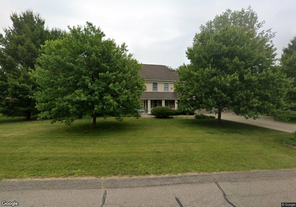
5756 Swallow Ave Kalamazoo, MI 49009
Estimated Value: $557,028 - $665,000
5
Beds
4
Baths
3,636
Sq Ft
$167/Sq Ft
Est. Value
About This Home
This home is located at 5756 Swallow Ave, Kalamazoo, MI 49009 and is currently estimated at $606,757, approximately $166 per square foot. 5756 Swallow Ave is a home located in Kalamazoo County with nearby schools including Amberly Elementary School, Portage West Middle School, and Portage Central High School.
Ownership History
Date
Name
Owned For
Owner Type
Purchase Details
Closed on
Jul 16, 2010
Sold by
Nosal Patrick J and Nosal Lori A
Bought by
Nosal Patrick J
Current Estimated Value
Purchase Details
Closed on
Sep 19, 2008
Sold by
Mann Richard A and Mann Virginia L
Bought by
Nosal Patrick J and Nosal Lori A
Home Financials for this Owner
Home Financials are based on the most recent Mortgage that was taken out on this home.
Original Mortgage
$344,250
Outstanding Balance
$229,521
Interest Rate
6.57%
Mortgage Type
Purchase Money Mortgage
Estimated Equity
$377,236
Create a Home Valuation Report for This Property
The Home Valuation Report is an in-depth analysis detailing your home's value as well as a comparison with similar homes in the area
Home Values in the Area
Average Home Value in this Area
Purchase History
| Date | Buyer | Sale Price | Title Company |
|---|---|---|---|
| Nosal Patrick J | $347,077 | Chicago Title | |
| Nosal Patrick J | $382,500 | Chicago Title |
Source: Public Records
Mortgage History
| Date | Status | Borrower | Loan Amount |
|---|---|---|---|
| Open | Nosal Patrick J | $344,250 |
Source: Public Records
Tax History Compared to Growth
Tax History
| Year | Tax Paid | Tax Assessment Tax Assessment Total Assessment is a certain percentage of the fair market value that is determined by local assessors to be the total taxable value of land and additions on the property. | Land | Improvement |
|---|---|---|---|---|
| 2025 | $8,098 | $277,200 | $0 | $0 |
| 2024 | $2,390 | $253,700 | $0 | $0 |
| 2023 | $2,279 | $227,800 | $0 | $0 |
| 2022 | $7,350 | $210,000 | $0 | $0 |
| 2021 | $7,139 | $206,600 | $0 | $0 |
| 2020 | $6,970 | $202,600 | $0 | $0 |
| 2019 | $6,408 | $196,200 | $0 | $0 |
| 2018 | $3,989 | $195,000 | $0 | $0 |
| 2017 | -- | $195,100 | $0 | $0 |
| 2016 | -- | $195,200 | $0 | $0 |
| 2015 | -- | $180,200 | $20,000 | $160,200 |
| 2014 | -- | $180,200 | $0 | $0 |
Source: Public Records
Map
Nearby Homes
- 5727 Bob White Ave
- 5353 Chickadee Dr
- 5420 Whippoorwill Dr
- 5284 Green Pine Ln
- 5660 Saddle Club Dr
- 8420 S 12th St
- 5825 Saddle Club Dr
- 7873 Shepherds Glen Ct
- 5191 W R Ave
- 5151 W R Ave
- 8022 Magistrate St
- 6139 Delasala Ct
- 7839 Clydesdale Ave Unit 93
- 5456 Stoney Brook Rd
- 7620 Stablebrook Cir
- 6737 W Q Ave
- 7440 Brindle Trail Unit 194
- 6061 Equestrian Woods Ct
- 6107 Equestrian Woods Ct Unit 267
- 4788 Norfolk Cir
- 5710 Swallow Ave
- 5788 Swallow Ave
- 5755 Bobwhite Ave
- 5727 Bobwhite Ave
- 5753 Swallow Ave
- 5700 Swallow Ave
- 5785 Bobwhite Ave
- 5777 Swallow Ave
- 5707 Swallow Ave
- 5705 Bob White Ave
- 5705 Bobwhite Ave
- 5695 Swallow Ave
- 5680 Swallow Ave
- 5807 Swallow Ave
- 5826 Swallow Ave
- 8535 Old Stone Cir
- 5677 Swallow Ave
- 5772 Bob White Ave
- 5750 Bobwhite Ave
- 5772 Bobwhite Ave