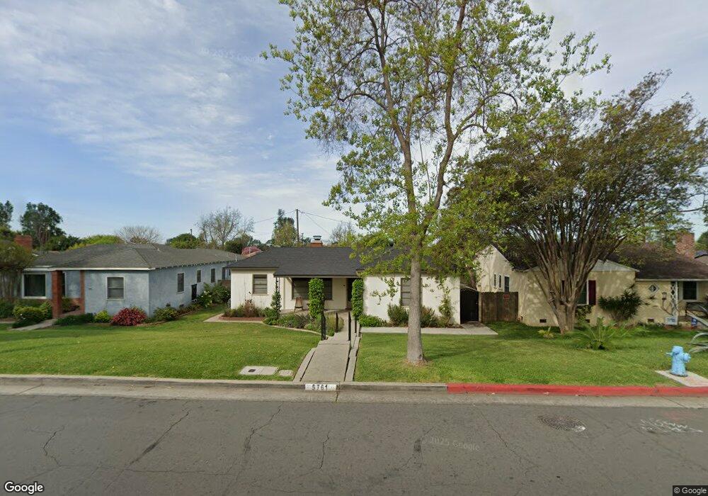
5761 El Rancho Dr Whittier, CA 90606
West Whittier NeighborhoodEstimated Value: $731,226 - $797,000
2
Beds
1
Bath
1,124
Sq Ft
$674/Sq Ft
Est. Value
About This Home
This home is located at 5761 El Rancho Dr, Whittier, CA 90606 and is currently estimated at $757,557, approximately $673 per square foot. 5761 El Rancho Dr is a home located in Los Angeles County with nearby schools including Longfellow Elementary School, Walter F. Dexter Middle School, and Whittier High School.
Ownership History
Date
Name
Owned For
Owner Type
Purchase Details
Closed on
Jan 13, 2021
Sold by
Biggs Family Trust and Biggs Michael L
Bought by
Biggs Michael Loring and Biggs Katie Eileen
Current Estimated Value
Home Financials for this Owner
Home Financials are based on the most recent Mortgage that was taken out on this home.
Original Mortgage
$336,000
Outstanding Balance
$299,194
Interest Rate
2.71%
Mortgage Type
New Conventional
Estimated Equity
$458,363
Purchase Details
Closed on
Jul 20, 2019
Sold by
Biggs Michael L and Biggs Katie Eileen
Bought by
Biggs Michael L and Biggs Katie Eileen
Purchase Details
Closed on
Dec 2, 1996
Sold by
Federal National Mortgage Association
Bought by
Biggs Michael L and Biggs Katie
Home Financials for this Owner
Home Financials are based on the most recent Mortgage that was taken out on this home.
Original Mortgage
$135,800
Interest Rate
7.67%
Mortgage Type
Seller Take Back
Purchase Details
Closed on
Jun 26, 1996
Sold by
Jimenez Sylvia G and Federal National Mortgage Asso
Bought by
Federal National Mortgage Association
Create a Home Valuation Report for This Property
The Home Valuation Report is an in-depth analysis detailing your home's value as well as a comparison with similar homes in the area
Home Values in the Area
Average Home Value in this Area
Purchase History
| Date | Buyer | Sale Price | Title Company |
|---|---|---|---|
| Biggs Michael Loring | -- | Chicago Title | |
| Biggs Michael L | -- | None Available | |
| Biggs Michael L | $140,000 | American Title Company | |
| Federal National Mortgage Association | $119,500 | Landsafe Title |
Source: Public Records
Mortgage History
| Date | Status | Borrower | Loan Amount |
|---|---|---|---|
| Open | Biggs Michael Loring | $336,000 | |
| Previous Owner | Biggs Michael L | $135,800 |
Source: Public Records
Tax History Compared to Growth
Tax History
| Year | Tax Paid | Tax Assessment Tax Assessment Total Assessment is a certain percentage of the fair market value that is determined by local assessors to be the total taxable value of land and additions on the property. | Land | Improvement |
|---|---|---|---|---|
| 2025 | $3,547 | $231,115 | $142,332 | $88,783 |
| 2024 | $3,264 | $226,585 | $139,542 | $87,043 |
| 2023 | $3,166 | $222,143 | $136,806 | $85,337 |
| 2022 | $3,121 | $217,788 | $134,124 | $83,664 |
| 2021 | $3,142 | $213,519 | $131,495 | $82,024 |
| 2020 | $3,007 | $211,330 | $130,147 | $81,183 |
| 2019 | $2,964 | $207,188 | $127,596 | $79,592 |
| 2018 | $2,851 | $203,127 | $125,095 | $78,032 |
| 2017 | $96 | $199,145 | $122,643 | $76,502 |
| 2016 | $2,706 | $195,241 | $120,239 | $75,002 |
| 2015 | $2,714 | $192,309 | $118,433 | $73,876 |
| 2014 | $2,685 | $188,543 | $116,114 | $72,429 |
Source: Public Records
Map
Nearby Homes
- 11302 Maple St
- 11273 Dorland Dr
- 5518 Norwalk Blvd
- 11232 Dorland Dr
- 11447 Broadway Ave
- 5903 Redman Ave
- 10825 Loch Avon Dr
- 6225 Gretna Ave
- 11511 Beverly Dr
- 6266 Western Ave
- 6240 Gretna Ave
- 11905 Mendenhall Ln
- 10943 Loch Lomond Dr
- 12031 Beverly Blvd Unit 1D
- 11840 Nixon Ln
- 5315 Bihr Ct
- 5307 Woodward Ln
- 6222 Magnolia Ave
- 10605 Cordoba Ct
- 5593 Pioneer Blvd Unit 18
- 5757 El Rancho Dr
- 5765 El Rancho Dr
- 11031 Rose Dr
- 5753 El Rancho Dr
- 5769 El Rancho Dr
- 11025 Rose Dr
- 5749 El Rancho Dr
- 11019 Rose Dr
- 5745 El Rancho Dr
- 11038 Rose Dr
- 11044 Rose Dr
- 11032 Rose Dr
- 5775 El Rancho Dr
- 11013 Rose Dr
- 11026 Rose Dr
- 11050 Rose Dr
- 5741 El Rancho Dr
- 10860 Floral Dr
- 11020 Rose Dr
- 11007 Rose Dr