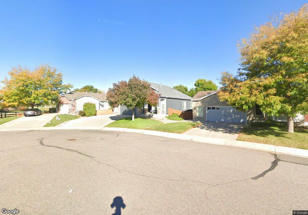
5763 E 132nd Way Thornton, CO 80602
Riverdale Park NeighborhoodEstimated Value: $541,000 - $598,000
3
Beds
3
Baths
2,038
Sq Ft
$282/Sq Ft
Est. Value
About This Home
This home is located at 5763 E 132nd Way, Thornton, CO 80602 and is currently estimated at $574,254, approximately $281 per square foot. 5763 E 132nd Way is a home located in Adams County with nearby schools including West Ridge Elementary School, Rodger Quist Middle School, and Riverdale Ridge High School.
Ownership History
Date
Name
Owned For
Owner Type
Purchase Details
Closed on
May 26, 2021
Sold by
Safi Ahmad Seer
Bought by
Safi Mariya and Safi Ahmad Seer
Current Estimated Value
Purchase Details
Closed on
Jul 12, 2010
Sold by
Montoya Nicole
Bought by
Safi Ahmad S
Purchase Details
Closed on
Sep 19, 2005
Sold by
Safi Ahmad S
Bought by
Safi Ahmad S and Montoya Nicole S
Purchase Details
Closed on
Jul 15, 2005
Sold by
Safi Ahmad S and Montoya Nicole S
Bought by
Safi Ahmad S
Purchase Details
Closed on
Jun 19, 2003
Sold by
Kdb Homes Inc
Bought by
Safi Ahmad S and Montoya Nicole S
Home Financials for this Owner
Home Financials are based on the most recent Mortgage that was taken out on this home.
Original Mortgage
$241,664
Interest Rate
5.44%
Mortgage Type
FHA
Create a Home Valuation Report for This Property
The Home Valuation Report is an in-depth analysis detailing your home's value as well as a comparison with similar homes in the area
Home Values in the Area
Average Home Value in this Area
Purchase History
| Date | Buyer | Sale Price | Title Company |
|---|---|---|---|
| Safi Mariya | -- | None Available | |
| Safi Ahmad S | -- | None Available | |
| Safi Ahmad S | -- | -- | |
| Safi Ahmad S | -- | -- | |
| Safi Ahmad S | $245,340 | First American Heritage Titl |
Source: Public Records
Mortgage History
| Date | Status | Borrower | Loan Amount |
|---|---|---|---|
| Previous Owner | Safi Ahmad S | $241,664 |
Source: Public Records
Tax History
| Year | Tax Paid | Tax Assessment Tax Assessment Total Assessment is a certain percentage of the fair market value that is determined by local assessors to be the total taxable value of land and additions on the property. | Land | Improvement |
|---|---|---|---|---|
| 2025 | $3,536 | $38,010 | $7,820 | $30,190 |
| 2024 | $3,536 | $34,940 | $7,190 | $27,750 |
| 2023 | $3,519 | $39,980 | $6,970 | $33,010 |
| 2022 | $2,773 | $28,270 | $7,160 | $21,110 |
| 2021 | $2,671 | $28,270 | $7,160 | $21,110 |
| 2020 | $2,493 | $27,540 | $7,360 | $20,180 |
| 2019 | $2,495 | $27,540 | $7,360 | $20,180 |
| 2018 | $2,274 | $25,080 | $6,840 | $18,240 |
| 2017 | $2,270 | $25,080 | $6,840 | $18,240 |
| 2016 | $1,935 | $21,300 | $4,460 | $16,840 |
| 2015 | $1,931 | $21,300 | $4,460 | $16,840 |
| 2014 | -- | $19,000 | $4,140 | $14,860 |
Source: Public Records
Map
Nearby Homes
- 13190 Kearney St
- 13427 Krameria St
- 13271 Holly St Unit B
- 12884 Jasmine St Unit C
- 12870 Jasmine St Unit A
- 5628 Hudson Cir
- 5341 E 129th Way
- 13455 Magnolia Ct
- 12856 Jasmine St Unit B
- 12822 Jasmine St Unit E
- 13664 Linden Ct
- 5375 E 128th Dr
- 6883 E 132nd Place
- 13808 Hudson Way
- 4756 E 129th Place
- 12774 Jasmine Ct
- 12770 Ivanhoe St
- 12767 Ivanhoe St
- 12768 Ivanhoe St
- 12761 Ivanhoe St
- 5751 E 132nd Way
- 5775 E 132nd Way
- 5797 E 132nd Way
- 5920 E 133rd Ave
- 5930 E 133rd Ave
- 5890 E 133rd Ave
- 5776 E 132nd Way
- 5819 E 132nd Way
- 5970 E 133rd Ave
- 5860 E 133rd Ave
- 5798 E 132nd Way
- 5831 E 132nd Way
- 13232 Ivy Ct
- 5990 E 133rd Ave
- 5820 E 132nd Way
- 13224 Ivy Ct
- 5830 E 133rd Ave
- 13314 Jersey St
- 13216 Ivy Ct
- 5233 E 133rd Ave
Your Personal Tour Guide
Ask me questions while you tour the home.