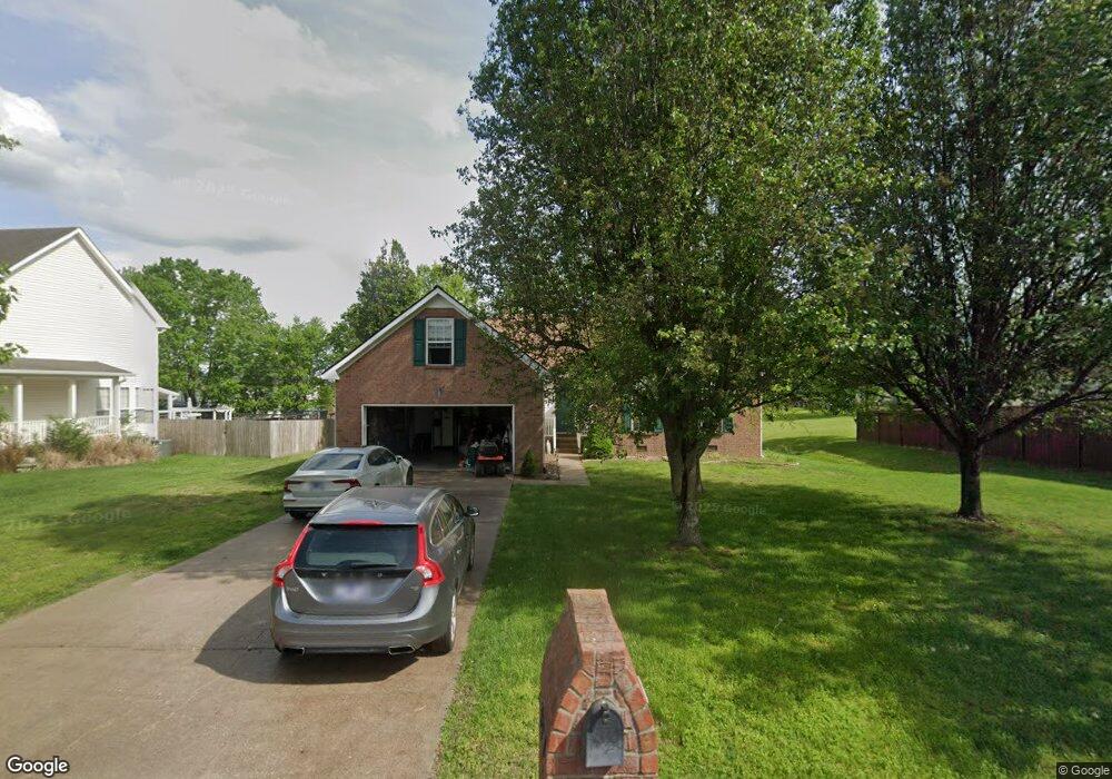
577 Bradford Dr Gallatin, TN 37066
Estimated Value: $397,744 - $444,000
--
Bed
2
Baths
1,992
Sq Ft
$215/Sq Ft
Est. Value
About This Home
This home is located at 577 Bradford Dr, Gallatin, TN 37066 and is currently estimated at $428,186, approximately $214 per square foot. 577 Bradford Dr is a home located in Sumner County with nearby schools including Howard Elementary School, Rucker Stewart Middle School, and Station Camp High School.
Ownership History
Date
Name
Owned For
Owner Type
Purchase Details
Closed on
Jun 23, 2000
Sold by
Goodall Inc Builders
Bought by
Hutton Clark A and Hutton Erin R
Current Estimated Value
Home Financials for this Owner
Home Financials are based on the most recent Mortgage that was taken out on this home.
Original Mortgage
$140,928
Outstanding Balance
$51,132
Interest Rate
8.63%
Mortgage Type
FHA
Estimated Equity
$377,054
Purchase Details
Closed on
Dec 28, 1999
Sold by
Tyree Woods Co
Bought by
Goodall Inc Builders
Create a Home Valuation Report for This Property
The Home Valuation Report is an in-depth analysis detailing your home's value as well as a comparison with similar homes in the area
Home Values in the Area
Average Home Value in this Area
Purchase History
| Date | Buyer | Sale Price | Title Company |
|---|---|---|---|
| Hutton Clark A | $141,000 | -- | |
| Goodall Inc Builders | $17,000 | -- |
Source: Public Records
Mortgage History
| Date | Status | Borrower | Loan Amount |
|---|---|---|---|
| Open | Hutton Clark A | $140,928 |
Source: Public Records
Tax History Compared to Growth
Tax History
| Year | Tax Paid | Tax Assessment Tax Assessment Total Assessment is a certain percentage of the fair market value that is determined by local assessors to be the total taxable value of land and additions on the property. | Land | Improvement |
|---|---|---|---|---|
| 2024 | $1,428 | $100,525 | $21,250 | $79,275 |
| 2023 | $1,877 | $61,500 | $16,250 | $45,250 |
| 2022 | $1,883 | $61,500 | $16,250 | $45,250 |
| 2021 | $1,883 | $61,500 | $16,250 | $45,250 |
| 2020 | $1,883 | $61,500 | $16,250 | $45,250 |
| 2019 | $1,883 | $0 | $0 | $0 |
| 2018 | $1,523 | $0 | $0 | $0 |
| 2017 | $1,523 | $0 | $0 | $0 |
| 2016 | $1,091 | $0 | $0 | $0 |
| 2015 | $1,523 | $0 | $0 | $0 |
| 2014 | $1,386 | $0 | $0 | $0 |
Source: Public Records
Map
Nearby Homes
- 608 Bradford Dr
- 540 Bradford Dr
- 1036 Middleton Ln
- 420 Dorchester Place
- 415 Buckingham Blvd
- 1273 Wentworth Dr
- 376 Huntington Dr
- 1239 Wentworth Dr
- 1328 Wentworth Dr
- 1017 Wickshire Dr
- 1017 Laurelwood Dr
- 294 Buckingham Blvd
- 300 Remington Ave
- 1245 Amherst Ct
- 305 Remington Ave
- 156 Hackney Ln
- 130 Saxony Way
- 806 Warrington Ct
- 139 Buckingham Blvd
- 638 Wassil Dr
- 583 Bradford Dr
- 461 Remington Ave
- 465 Remington Ave
- 457 Remington Ave
- 589 Bradford Dr
- 608 Worthington Place
- 614 Worthington Place
- 453 Remington Ave Unit 9
- 473 Remington Ave
- 595 Bradford Dr
- 580 Bradford Dr
- 584 Bradford Dr
- 449 Remington Ave
- 477 Remington Ave
- 588 Bradford Dr
- 618 Worthington Place
- 592 Bradford Dr
- 621 Worthington Place
- 605 Bradford Dr
- 452 Remington Ave