Estimated Value: $785,424 - $940,000
6
Beds
5
Baths
5,267
Sq Ft
$157/Sq Ft
Est. Value
About This Home
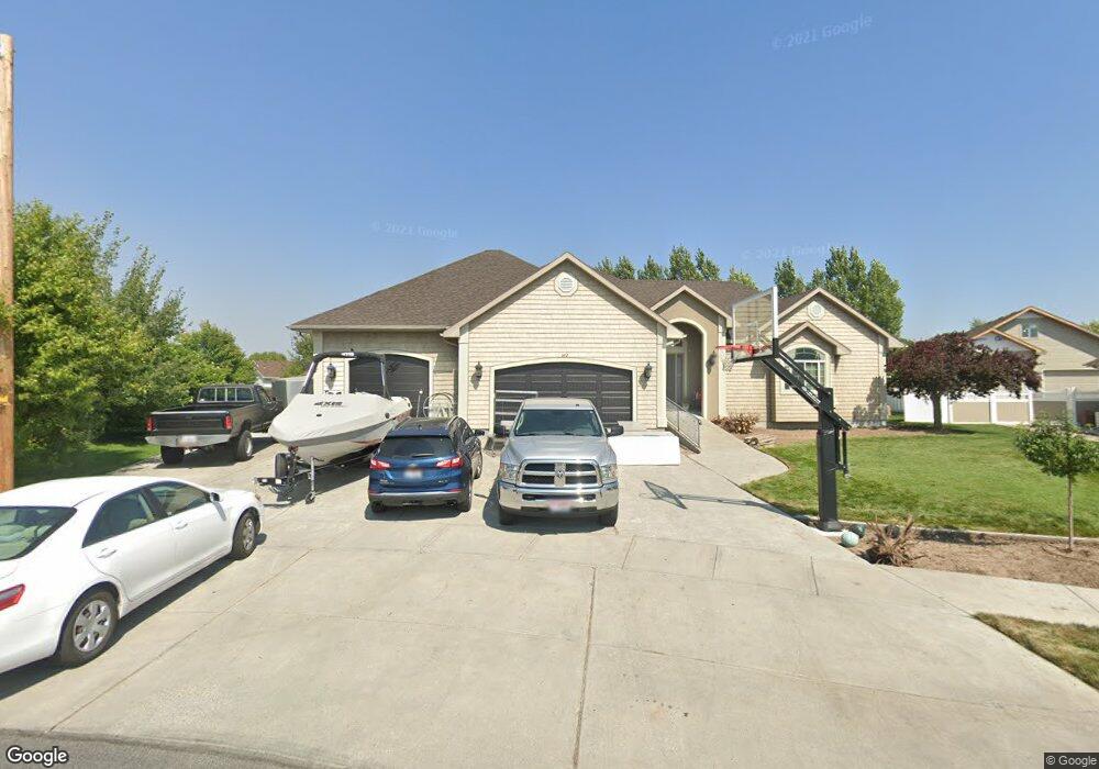
This home is located at 577 Holladay Cir, Ammon, ID 83406 and is currently estimated at $829,106, approximately $157 per square foot. 577 Holladay Cir is a home located in Bonneville County with nearby schools including Hillview Elementary School, Sandcreek Middle School, and Hillcrest High School.
Ownership History
Date
Name
Owned For
Owner Type
Purchase Details
Closed on
May 24, 2018
Sold by
Clark Janet R
Bought by
Bell Justin D
Current Estimated Value
Purchase Details
Closed on
May 23, 2018
Sold by
Bell Kalli G and Bell Justin D
Bought by
Bell Justin D
Purchase Details
Closed on
Nov 22, 2010
Sold by
Bell Justin and Bell Kalli G
Bought by
Bell Justin D and Bell Kalli G
Home Financials for this Owner
Home Financials are based on the most recent Mortgage that was taken out on this home.
Original Mortgage
$417,000
Interest Rate
4.16%
Mortgage Type
New Conventional
Purchase Details
Closed on
Oct 19, 2005
Sold by
Johnson Jay W and Johnson Brenda R
Bought by
Bell Justin and Bell Kalli G
Home Financials for this Owner
Home Financials are based on the most recent Mortgage that was taken out on this home.
Original Mortgage
$355,200
Interest Rate
5.67%
Mortgage Type
New Conventional
Create a Home Valuation Report for This Property
The Home Valuation Report is an in-depth analysis detailing your home's value as well as a comparison with similar homes in the area
Purchase History
| Date | Buyer | Sale Price | Title Company |
|---|---|---|---|
| Bell Justin D | -- | Alliance Title | |
| Bell Justin D | -- | Alliance Title & Escrow Corp | |
| Bell Justin D | -- | -- | |
| Bell Justin | -- | -- |
Source: Public Records
Mortgage History
| Date | Status | Borrower | Loan Amount |
|---|---|---|---|
| Previous Owner | Bell Justin D | $417,000 | |
| Previous Owner | Bell Justin | $355,200 | |
| Previous Owner | Bell Justin | $66,600 |
Source: Public Records
Tax History
| Year | Tax Paid | Tax Assessment Tax Assessment Total Assessment is a certain percentage of the fair market value that is determined by local assessors to be the total taxable value of land and additions on the property. | Land | Improvement |
|---|---|---|---|---|
| 2025 | $4,452 | $930,500 | $98,860 | $831,640 |
| 2024 | $4,627 | $967,480 | $98,860 | $868,620 |
| 2023 | $4,094 | $834,204 | $101,544 | $732,660 |
| 2022 | $4,523 | $659,482 | $64,002 | $595,480 |
| 2021 | $5,040 | $517,362 | $58,272 | $459,090 |
| 2019 | $5,653 | $472,008 | $50,728 | $421,280 |
| 2018 | $5,104 | $521,715 | $40,835 | $480,880 |
| 2017 | $5,108 | $470,467 | $28,897 | $441,570 |
| 2016 | $4,986 | $472,725 | $26,285 | $446,440 |
| 2015 | $3,663 | $360,055 | $26,285 | $333,770 |
| 2014 | $69,195 | $360,055 | $26,285 | $333,770 |
| 2013 | $3,732 | $361,575 | $26,285 | $335,290 |
Source: Public Records
Map
Nearby Homes
- 4139 Fairview Dr
- 243 S Bridger Dr
- 171 Robison Dr
- 4315 Stubblefield Ct
- 978 Edinburg Cir
- 169 S Heath Ln
- 820 S Adam Ln
- 225 Monte Vista Ave
- 3828 Briar Creek Cir
- 3684 Briar Creek Ln
- 3472 Leroy Dr
- 4170 E Spartina
- 3770 Wasatch Cir
- 1406 Bellagio Dr
- 370 Amy Ln
- TBD E 17th St
- 1468 Bellagio Dr
- 260 Clary Ave
- 1167 Jackson Dr
- 4922 Torcello Dr
- 573 Holladay Cir
- 583 Holladay Cir
- 4152 Rulon Cir
- 4136 Rulon Cir
- 4114 Rulon Dr
- 565 Holladay Dr
- 565 Holladay Cir
- 4086 Rulon Dr
- 609 Holladay Cir
- 609 Holladay Dr
- 4102 Rulon Dr
- 4156 Rulon Cir
- 4134 Rulon Cir
- 589 Holladay Cir
- 599 Holladay Cir
- 599 Holladay Cir
- 4068 Rulon Dr
- 561 Holladay Dr
- 561 Holladay Dr
- 595 Holladay Cir
Your Personal Tour Guide
Ask me questions while you tour the home.