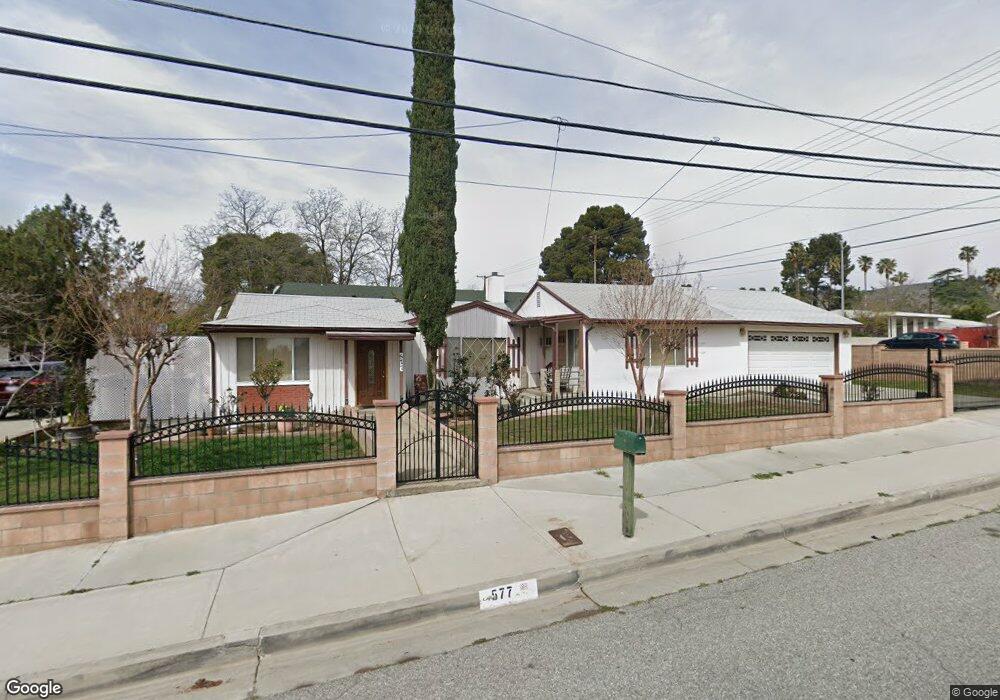
577 N 8th St Banning, CA 92220
Estimated Value: $363,790 - $398,000
3
Beds
2
Baths
1,345
Sq Ft
$289/Sq Ft
Est. Value
About This Home
This home is located at 577 N 8th St, Banning, CA 92220 and is currently estimated at $388,698, approximately $288 per square foot. 577 N 8th St is a home located in Riverside County with nearby schools including Banning High School and Young Scholar Education Center.
Ownership History
Date
Name
Owned For
Owner Type
Purchase Details
Closed on
Feb 26, 2014
Sold by
Mann Gheorghe I
Bought by
Mann Gheorghe I and Gheorghe I Mann Living Trust
Current Estimated Value
Home Financials for this Owner
Home Financials are based on the most recent Mortgage that was taken out on this home.
Original Mortgage
$52,000
Interest Rate
4.34%
Mortgage Type
New Conventional
Purchase Details
Closed on
Sep 16, 2013
Sold by
Mann Gheorghe Ilie and Man Gheorghe Ilie
Bought by
Mann Gheorghe I and The Gheorghe I Mann Living Trust
Create a Home Valuation Report for This Property
The Home Valuation Report is an in-depth analysis detailing your home's value as well as a comparison with similar homes in the area
Home Values in the Area
Average Home Value in this Area
Purchase History
| Date | Buyer | Sale Price | Title Company |
|---|---|---|---|
| Mann Gheorghe I | -- | None Available | |
| Mann Gheorghe I | -- | None Available | |
| Mann Gheorghe I | -- | None Available |
Source: Public Records
Mortgage History
| Date | Status | Borrower | Loan Amount |
|---|---|---|---|
| Closed | Mann Gheorghe I | $52,000 |
Source: Public Records
Tax History Compared to Growth
Tax History
| Year | Tax Paid | Tax Assessment Tax Assessment Total Assessment is a certain percentage of the fair market value that is determined by local assessors to be the total taxable value of land and additions on the property. | Land | Improvement |
|---|---|---|---|---|
| 2025 | $1,571 | $119,095 | $31,214 | $87,881 |
| 2023 | $1,571 | $114,471 | $30,002 | $84,469 |
| 2022 | $1,534 | $112,227 | $29,414 | $82,813 |
| 2021 | $1,503 | $110,028 | $28,838 | $81,190 |
| 2020 | $1,488 | $108,901 | $28,543 | $80,358 |
| 2019 | $1,463 | $106,767 | $27,984 | $78,783 |
| 2018 | $1,451 | $104,675 | $27,436 | $77,239 |
| 2017 | $1,425 | $102,624 | $26,899 | $75,725 |
| 2016 | $1,354 | $100,613 | $26,372 | $74,241 |
| 2015 | $1,334 | $99,104 | $25,977 | $73,127 |
| 2014 | $1,323 | $97,165 | $25,469 | $71,696 |
Source: Public Records
Map
Nearby Homes
- 740 Bennett Place
- 911 W George St
- 680 N 10th St
- 314 N 6th St
- 546 N 5th St
- 1078 W King St
- 339 W Wilson St
- 955 W Hays St
- 619 W Gilman St
- 545 N 2nd St
- 313 N 3rd St
- 1117 W Hays St
- Plan 2533 Modeled at Vista Robles
- Plan 3118 Modeled at Vista Robles
- Plan 1851 Modeled at Vista Robles
- Plan 2379 Modeled at Vista Robles
- Plan 2874 at Vista Robles
- Plan 2097 at Vista Robles
- 266 N 14th St
- 182 N 4th St
- 836 W George St
- 545 N 8th St
- 852 W George St
- 821 Cottonwood Rd
- 874 W George St
- 851 Cottonwood Rd
- 819 W George St
- 831 W George St
- 873 Cottonwood Rd
- 781 W George St
- 855 W George St
- 890 W George St
- 767 W George St
- 877 W George St
- 891 Cottonwood Rd
- 657 N 8th St
- 910 W George St
- 751 W George St
- 911 Cottonwood Rd
- 658 Bennett Place