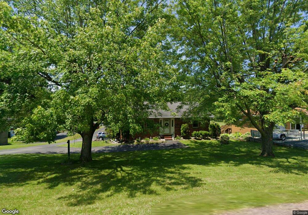
577 State Route 217 Latrobe, PA 15650
Estimated Value: $202,000 - $275,000
--
Bed
--
Bath
1,073
Sq Ft
$218/Sq Ft
Est. Value
About This Home
This home is located at 577 State Route 217, Latrobe, PA 15650 and is currently estimated at $234,313, approximately $218 per square foot. 577 State Route 217 is a home with nearby schools including Grandview Elementary School, Derry Area Middle School, and Derry Area Senior High School.
Ownership History
Date
Name
Owned For
Owner Type
Purchase Details
Closed on
Oct 5, 2012
Sold by
Mucino Helius R and Mucino Aimee M
Bought by
Volpe Martin J and Volpe Christine T
Current Estimated Value
Home Financials for this Owner
Home Financials are based on the most recent Mortgage that was taken out on this home.
Original Mortgage
$123,226
Outstanding Balance
$85,931
Interest Rate
3.66%
Mortgage Type
FHA
Estimated Equity
$148,382
Purchase Details
Closed on
Dec 14, 2001
Sold by
Hud
Bought by
Rudy Robert L and Rudy Lisa A
Home Financials for this Owner
Home Financials are based on the most recent Mortgage that was taken out on this home.
Original Mortgage
$61,940
Interest Rate
6.72%
Purchase Details
Closed on
Apr 18, 2001
Sold by
Principal Residential Mtg Inc
Bought by
Hud
Purchase Details
Closed on
Jan 18, 2001
Sold by
Snowden James E
Bought by
Principal Residential Mtg Inc
Create a Home Valuation Report for This Property
The Home Valuation Report is an in-depth analysis detailing your home's value as well as a comparison with similar homes in the area
Home Values in the Area
Average Home Value in this Area
Purchase History
| Date | Buyer | Sale Price | Title Company |
|---|---|---|---|
| Volpe Martin J | $125,500 | None Available | |
| Rudy Robert L | $65,200 | -- | |
| Hud | -- | -- | |
| Principal Residential Mtg Inc | -- | -- |
Source: Public Records
Mortgage History
| Date | Status | Borrower | Loan Amount |
|---|---|---|---|
| Open | Volpe Martin J | $123,226 | |
| Previous Owner | Rudy Robert L | $61,940 |
Source: Public Records
Tax History Compared to Growth
Tax History
| Year | Tax Paid | Tax Assessment Tax Assessment Total Assessment is a certain percentage of the fair market value that is determined by local assessors to be the total taxable value of land and additions on the property. | Land | Improvement |
|---|---|---|---|---|
| 2025 | $2,428 | $19,540 | $2,480 | $17,060 |
| 2024 | $2,428 | $19,540 | $2,480 | $17,060 |
| 2023 | $2,292 | $19,540 | $2,480 | $17,060 |
| 2022 | $2,272 | $19,540 | $2,480 | $17,060 |
| 2021 | $2,272 | $19,540 | $2,480 | $17,060 |
| 2020 | $2,233 | $19,540 | $2,480 | $17,060 |
| 2019 | $2,184 | $19,540 | $2,480 | $17,060 |
| 2018 | $2,087 | $19,540 | $2,480 | $17,060 |
| 2017 | $2,032 | $19,540 | $2,480 | $17,060 |
| 2016 | $1,944 | $19,540 | $2,480 | $17,060 |
| 2015 | $1,944 | $19,540 | $2,480 | $17,060 |
| 2014 | $1,944 | $19,540 | $2,480 | $17,060 |
Source: Public Records
Map
Nearby Homes
- 510 Pennsylvania 217
- 147 N Valley St
- 913 W 1st Ave
- 213 Greenfield Rd
- 211 10th St
- 1224 High St
- 104 Clifton St
- 604 W 4th Ave
- 520 W 2nd Ave
- 793 Victoria Way
- 417 Traction Ave
- 504 W 2nd Ave
- 707 Victoria Way
- 400 Ridge Ave
- 423 W 1st Ave
- 715 Victoria Way
- 518 W 5th Ave
- 498 Sunview Cir
- 765 Victoria Way
- 515 Sunview Cir
- 577 Pennsylvania 217
- 581 State Route 217
- 573 State Route 217
- 583 State Route 217
- 576 State Route 217
- 572 State Route 217
- 580 State Route 217
- 575 State Route 217
- 569 Pennsylvania 217
- 569 State Route 217
- 570 State Route 217
- 565 State Route 217
- 564 State Route 217
- 564 Pennsylvania 217
- 127 Simms Ln
- 611 State Route 217
- 609 Route 217
- 615 State Route 217
- 608 Pennsylvania 217
- 111 Amber Dr