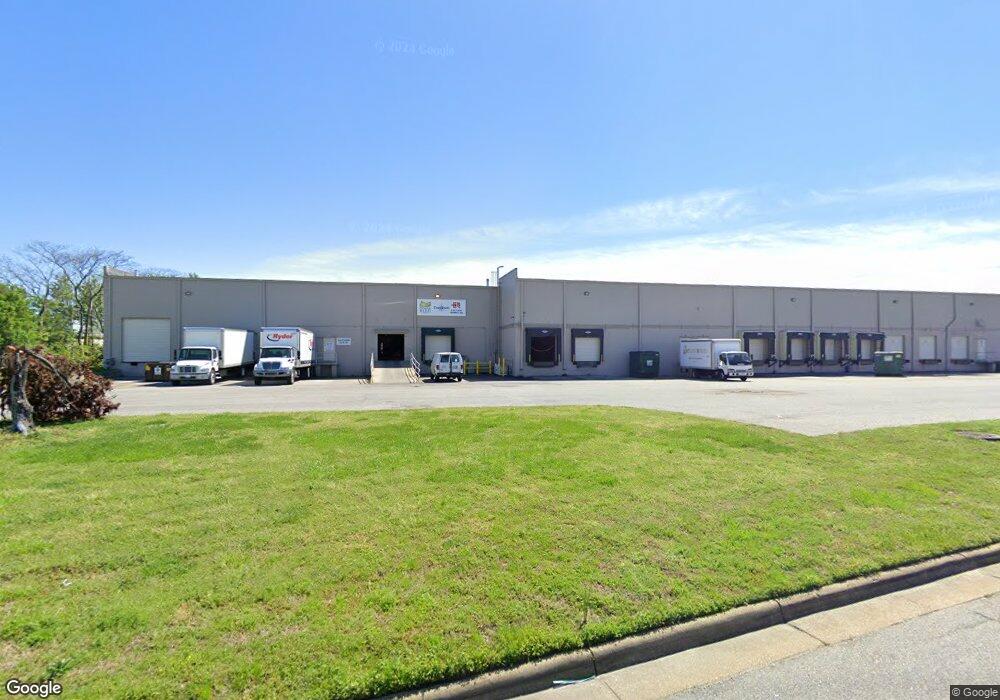
5770 Thurston Ave Virginia Beach, VA 23455
Bayside Neighborhood
--
Bed
--
Bath
50,600
Sq Ft
3.23
Acres
About This Home
This home is located at 5770 Thurston Ave, Virginia Beach, VA 23455. 5770 Thurston Ave is a home located in Virginia Beach City with nearby schools including Bayside Elementary School, Bayside 6th Grade Campus, and Bayside High School.
Ownership History
Date
Name
Owned For
Owner Type
Purchase Details
Closed on
Jun 21, 2021
Sold by
Hedgerow Llc
Bought by
5770 Thurston Llc
Home Financials for this Owner
Home Financials are based on the most recent Mortgage that was taken out on this home.
Original Mortgage
$30,000,000
Outstanding Balance
$18,302,269
Interest Rate
2.9%
Mortgage Type
Commercial
Create a Home Valuation Report for This Property
The Home Valuation Report is an in-depth analysis detailing your home's value as well as a comparison with similar homes in the area
Home Values in the Area
Average Home Value in this Area
Purchase History
| Date | Buyer | Sale Price | Title Company |
|---|---|---|---|
| 5770 Thurston Llc | -- | None Available | |
| Hedgerow Llc | -- | None Available |
Source: Public Records
Mortgage History
| Date | Status | Borrower | Loan Amount |
|---|---|---|---|
| Open | 5770 Thurston Llc | $30,000,000 |
Source: Public Records
Tax History Compared to Growth
Tax History
| Year | Tax Paid | Tax Assessment Tax Assessment Total Assessment is a certain percentage of the fair market value that is determined by local assessors to be the total taxable value of land and additions on the property. | Land | Improvement |
|---|---|---|---|---|
| 2025 | $48,159 | $5,095,400 | $775,200 | $4,320,200 |
| 2024 | $48,159 | $4,964,800 | $775,200 | $4,189,600 |
| 2023 | $37,618 | $3,799,800 | $775,200 | $3,024,600 |
| 2022 | $37,530 | $3,790,900 | $807,500 | $2,983,400 |
| 2021 | $37,231 | $3,760,700 | $775,200 | $2,985,500 |
| 2020 | $35,477 | $3,486,700 | $775,200 | $2,711,500 |
| 2019 | $31,029 | $3,131,600 | $597,600 | $2,534,000 |
| 2018 | $31,394 | $3,131,600 | $597,600 | $2,534,000 |
| 2017 | $32,337 | $3,225,600 | $597,600 | $2,628,000 |
| 2016 | $29,313 | $2,960,900 | $548,300 | $2,412,600 |
| 2015 | $29,434 | $2,973,100 | $565,300 | $2,407,800 |
| 2014 | $27,544 | $3,177,700 | $565,300 | $2,612,400 |
Source: Public Records
Map
Nearby Homes
- 1900 Darnell Dr
- 1957 Darnell Dr
- 1536 Sagewood Dr
- 1549 Sagewood Dr
- 5512 Forest View Dr
- 5712 Gretna Rd
- 1161 Hillock Crossing
- 1027 Finney Cir
- 5537 Finespun Last
- 1109 Spindle Crossing
- 1284 Hillock Crossing
- 1004 Pastern Brief
- 2110 Point Hollow Ct
- 2134 Point Hollow Ct
- 5545 Lambdin Arch
- 5644 Lawson Hall Rd
- 1052 Old Canterbury Dr
- 5505 Merner Ln
- 5612 Rossburn Dr
- 5609 Rossburn Dr
- 5890 Thurston Ave
- 5717 Thurston Ave
- 5700 Thurston Ave
- 5721 Thurston Ave
- 5713 Thurston Ave
- 5894 Thurston Ave
- 5795 Thurston Ave
- 1421 Baker Rd
- 1301 Baker Rd
- 5701 Thurston Ave
- 1424 Baker Rd
- 5898 Thurston Ave
- 1364 Baker Rd
- 5700 Ward Ave
- 5729 Bayside Rd
- 5900 Thurston Ave
- 1427 Baker Rd
- 5724 Ward Ave
- 5728 Ward Ave
- 5901 Thurston Ave