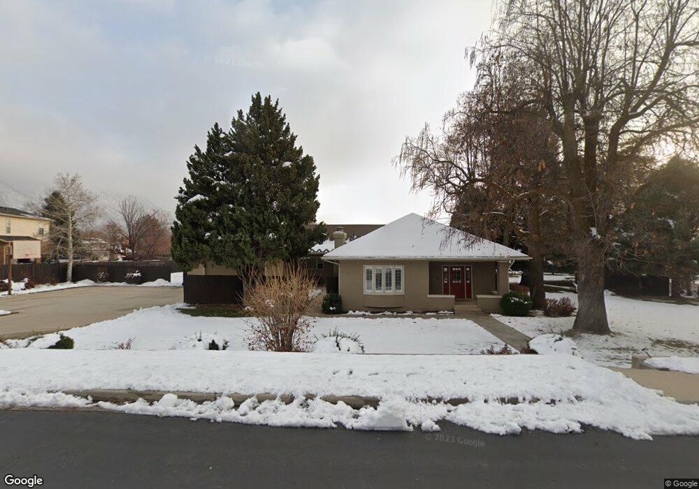
578 E 770 N Alpine, UT 84004
Estimated Value: $909,000 - $1,171,000
5
Beds
3
Baths
2,204
Sq Ft
$498/Sq Ft
Est. Value
About This Home
This home is located at 578 E 770 N, Alpine, UT 84004 and is currently estimated at $1,098,580, approximately $498 per square foot. 578 E 770 N is a home located in Utah County with nearby schools including Alpine School, Timberline Middle School, and Lone Peak High School.
Ownership History
Date
Name
Owned For
Owner Type
Purchase Details
Closed on
May 11, 2007
Sold by
Scenic Development Inc
Bought by
Rasmussen Ronald W and Rasmussen Kathleen M
Current Estimated Value
Home Financials for this Owner
Home Financials are based on the most recent Mortgage that was taken out on this home.
Original Mortgage
$2,100,000
Interest Rate
6.41%
Mortgage Type
Seller Take Back
Purchase Details
Closed on
Apr 16, 2007
Sold by
Rasmussen Ronald W and Rasmussen Kathleen M
Bought by
Utley Vernon C and Utley Christine M
Home Financials for this Owner
Home Financials are based on the most recent Mortgage that was taken out on this home.
Original Mortgage
$2,100,000
Interest Rate
6.41%
Mortgage Type
Seller Take Back
Create a Home Valuation Report for This Property
The Home Valuation Report is an in-depth analysis detailing your home's value as well as a comparison with similar homes in the area
Home Values in the Area
Average Home Value in this Area
Purchase History
| Date | Buyer | Sale Price | Title Company |
|---|---|---|---|
| Rasmussen Ronald W | -- | Integrated Title Insurance | |
| Scenic Development Inc | -- | Integrated Title Insurance | |
| Utley Vernon C | -- | Integrated Title Insurance | |
| Young George L | -- | Integrated Title Insurance |
Source: Public Records
Mortgage History
| Date | Status | Borrower | Loan Amount |
|---|---|---|---|
| Previous Owner | Scenic Development Inc | $2,100,000 |
Source: Public Records
Tax History
| Year | Tax Paid | Tax Assessment Tax Assessment Total Assessment is a certain percentage of the fair market value that is determined by local assessors to be the total taxable value of land and additions on the property. | Land | Improvement |
|---|---|---|---|---|
| 2025 | $4,252 | $543,225 | -- | -- |
| 2024 | $4,252 | $495,625 | $0 | $0 |
| 2023 | $3,827 | $478,835 | $0 | $0 |
| 2022 | $3,749 | $806,200 | $515,800 | $290,400 |
| 2021 | $2,927 | $539,500 | $303,400 | $236,100 |
| 2020 | $2,707 | $488,700 | $263,800 | $224,900 |
| 2019 | $2,534 | $477,400 | $263,800 | $213,600 |
| 2018 | $2,313 | $429,500 | $243,800 | $185,700 |
| 2017 | $2,194 | $222,425 | $0 | $0 |
| 2016 | $2,133 | $201,650 | $0 | $0 |
| 2015 | $2,032 | $181,740 | $0 | $0 |
| 2014 | $1,807 | $159,850 | $0 | $0 |
Source: Public Records
Map
Nearby Homes
- 512 Eastridge Cir
- 475 Grove Dr
- 840 N Main St
- 499 E 300 N
- 381 E Watkins Cir Unit 28
- 463 Heritage Hills Dr
- 382 E Heritage Hills Dr
- 287 Heritage Hills Dr
- 986 N Sunbrook Cir
- 781 N Country Manor Ln
- 1319 N Eastview Ln Unit 214
- 128 E Deer Crest Ln Unit 304
- 1333 N Eastview Ln
- 19 E Elk Ct
- 102 E Deer Crest Ln
- 1449 N Annie Cir
- 1540 Cherrypoint Ln Unit 7
- 1292 N Elk Ridge Ln
- 151 Glacier Lily Dr
- 887 E Village Way
- 610 E 770 N
- 500 E 770 N
- 520 E 770 N
- 537 Wilderness Dr
- 537 Wilderness Dr Unit 3
- 553 Wilderness Dr
- 553 Wilderness Dr Unit 2
- 550 E 770 N
- 575 Wilderness Dr
- 788 Grove Dr
- 788 Grove Dr
- 706 N 610 E
- 736 N 610 E
- 607 E 770 N
- 657 Wilderness Dr Unit 4
- 741 Grove Dr
- 785 Grove Dr
- 820 Grove Dr
- 634 Wilderness Dr
- 670 N 610 E
Your Personal Tour Guide
Ask me questions while you tour the home.