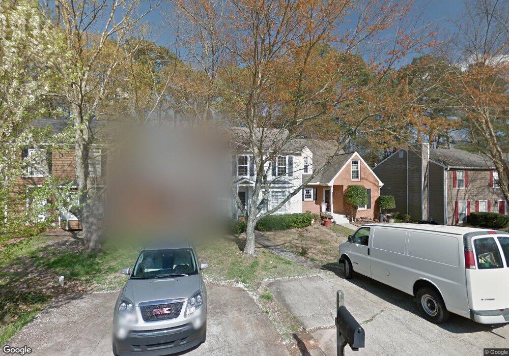
578 Manning Rd SW Marietta, GA 30064
Southwestern Marietta NeighborhoodEstimated Value: $240,000 - $299,000
3
Beds
2
Baths
1,286
Sq Ft
$213/Sq Ft
Est. Value
About This Home
This home is located at 578 Manning Rd SW, Marietta, GA 30064 and is currently estimated at $273,672, approximately $212 per square foot. 578 Manning Rd SW is a home located in Cobb County with nearby schools including A.L. Burruss Elementary School, Marietta Sixth Grade Academy, and Marietta Middle School.
Ownership History
Date
Name
Owned For
Owner Type
Purchase Details
Closed on
Jun 10, 2024
Sold by
Craig Carol M
Bought by
Cole Street Dev Corporation
Current Estimated Value
Purchase Details
Closed on
Feb 5, 2024
Sold by
Mattie Geneva Anderson Living Trust
Bought by
Craig Carol M
Purchase Details
Closed on
Mar 25, 2019
Sold by
Craig Carol M
Bought by
Anderson Mattie Geneva and Mattie Geneva Anderson Liv Tr
Purchase Details
Closed on
Jan 13, 2012
Sold by
Sloan Steven
Bought by
Craig Carol and Anderson Mattie Geneva Irrevoc
Create a Home Valuation Report for This Property
The Home Valuation Report is an in-depth analysis detailing your home's value as well as a comparison with similar homes in the area
Home Values in the Area
Average Home Value in this Area
Purchase History
| Date | Buyer | Sale Price | Title Company |
|---|---|---|---|
| Cole Street Dev Corporation | $290,000 | None Listed On Document | |
| Craig Carol M | -- | None Listed On Document | |
| Anderson Mattie Geneva | -- | -- | |
| Craig Carol | $47,500 | -- |
Source: Public Records
Tax History Compared to Growth
Tax History
| Year | Tax Paid | Tax Assessment Tax Assessment Total Assessment is a certain percentage of the fair market value that is determined by local assessors to be the total taxable value of land and additions on the property. | Land | Improvement |
|---|---|---|---|---|
| 2025 | $884 | $104,536 | $34,000 | $70,536 |
| 2024 | $884 | $104,536 | $34,000 | $70,536 |
| 2023 | $884 | $104,536 | $34,000 | $70,536 |
| 2022 | $684 | $80,844 | $18,000 | $62,844 |
| 2021 | $455 | $53,000 | $18,000 | $35,000 |
| 2020 | $455 | $53,000 | $18,000 | $35,000 |
| 2019 | $413 | $48,108 | $16,000 | $32,108 |
| 2018 | $413 | $48,108 | $16,000 | $32,108 |
| 2017 | $220 | $31,972 | $8,000 | $23,972 |
| 2016 | $178 | $25,888 | $4,000 | $21,888 |
| 2015 | $194 | $25,888 | $4,000 | $21,888 |
| 2014 | $125 | $16,092 | $0 | $0 |
Source: Public Records
Map
Nearby Homes
- 560 Manning Rd SW
- 818 Manning Way SW Unit 1
- 805 Manning Way SW
- 594 Manning Rd SW
- 332 Rockmann Ln SW
- 1161 Rockmann Terrace SW
- 106 Westland Ct SW
- 1141 Whitlock Ave NW
- 260 Manning Rd SW Unit 110
- 839 Manning Villas Ct SW
- 834 Cannon Run SW
- 1047 Chestnut Hill Cir SW
- 838 Cannon Run SW
- 1121 Cannongate Crossing SW
- 873 Cavalry Dr SW
- 798 Sentinel Ridge SW
- 1211 Cliffpine Ct SW
- 578 Manning Rd SW
- 580 Manning Rd SW
- 576 Manning Rd SW
- 576 Manning Rd SW
- 582 Manning Rd SW
- 574 Manning Rd SW
- 584 Manning Rd SW Unit 1
- 572 Manning Rd SW
- 570 Manning Rd SW
- 570 Manning Rd SW
- 586 Manning Rd SW
- 588 Manning Rd SW Unit 1
- 568 Manning Rd SW
- 590 Manning Rd SW
- 165 Kimberly Way SW Unit 167
- 566 Manning Rd SW
- 161 Kimberly Way SW
- 169 Kimberly Way SW
- 564 Manning Rd SW Unit 564
- 564 Manning Rd SW Unit 1/2