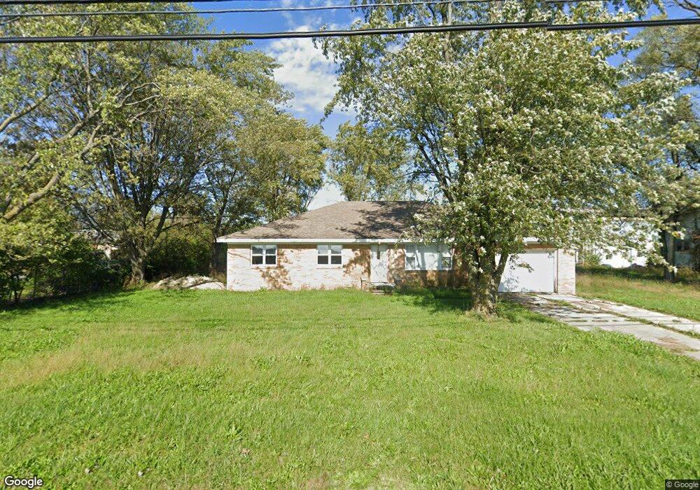
5784 Walbridge Rd Walbridge, OH 43465
Estimated Value: $293,902
3
Beds
2
Baths
2,060
Sq Ft
$143/Sq Ft
Est. Value
About This Home
This home is located at 5784 Walbridge Rd, Walbridge, OH 43465 and is currently priced at $293,902, approximately $142 per square foot. 5784 Walbridge Rd is a home located in Wood County with nearby schools including Lake Elementary School, Lake Middle School, and Lake High School.
Ownership History
Date
Name
Owned For
Owner Type
Purchase Details
Closed on
Aug 15, 2024
Sold by
Northerncarroll Llc
Bought by
Potter Michael S and Potter Mark S
Current Estimated Value
Purchase Details
Closed on
Jun 29, 2023
Sold by
Terry Carroll Revocable Inter Vivos Trus
Bought by
Northerncarroll Llc
Purchase Details
Closed on
Mar 27, 2023
Sold by
Carroll Terry L and Carroll Jocelyn
Bought by
Carroll Jocelyn
Purchase Details
Closed on
Dec 31, 2020
Sold by
Dippman Craig W
Bought by
Carroll Craig L
Purchase Details
Closed on
Oct 7, 2005
Sold by
Lusher Robert W
Bought by
Dippman Craig W
Purchase Details
Closed on
Mar 16, 2005
Sold by
Lusher Robert W
Bought by
Lusher Robert W and The Robert W Lusher Trust
Purchase Details
Closed on
Sep 5, 1980
Bought by
Lusher Robert W
Create a Home Valuation Report for This Property
The Home Valuation Report is an in-depth analysis detailing your home's value as well as a comparison with similar homes in the area
Home Values in the Area
Average Home Value in this Area
Purchase History
| Date | Buyer | Sale Price | Title Company |
|---|---|---|---|
| Potter Michael S | $120,000 | None Listed On Document | |
| Northerncarroll Llc | -- | None Listed On Document | |
| Carroll Jocelyn | -- | -- | |
| Carroll Craig L | -- | None Available | |
| Dippman Craig W | $120,000 | None Available | |
| Lusher Robert W | -- | -- | |
| Lusher Robert W | -- | -- |
Source: Public Records
Tax History
| Year | Tax Paid | Tax Assessment Tax Assessment Total Assessment is a certain percentage of the fair market value that is determined by local assessors to be the total taxable value of land and additions on the property. | Land | Improvement |
|---|---|---|---|---|
| 2025 | $2,641 | $33,880 | $12,845 | $21,035 |
| 2024 | $2,642 | $33,880 | $12,845 | $21,035 |
| 2023 | $2,642 | $33,890 | $12,850 | $21,040 |
| 2022 | $3,389 | $40,150 | $14,040 | $26,110 |
| 2021 | $3,299 | $40,150 | $14,040 | $26,110 |
| 2020 | $3,213 | $40,150 | $14,040 | $26,110 |
| 2019 | $3,149 | $40,150 | $14,040 | $26,110 |
| 2018 | $3,199 | $40,150 | $14,040 | $26,110 |
| 2017 | $3,160 | $40,150 | $14,040 | $26,110 |
| 2016 | $3,245 | $41,970 | $14,040 | $27,930 |
| 2015 | $3,245 | $41,970 | $14,040 | $27,930 |
| 2014 | $3,355 | $41,970 | $14,040 | $27,930 |
| 2013 | $1,670 | $41,970 | $14,040 | $27,930 |
Source: Public Records
Map
Nearby Homes
- 100 W Union St
- 114 E Perry St
- 225 E Union St
- 5668 Ayers Rd
- 5501 Ayers Rd
- 29751 Brookview Ct
- 7210 W Lake Rd
- 236 S Bridge Rd
- 238 S Bridge Rd
- 232 S Bridge Rd
- 241 S Bridge Rd
- 237 S Bridge Rd
- 30236 Lemoyne Rd
- 30348 Lemoyne Rd
- 125 Chesapeake Ln
- 259 E Andrus Rd
- 2448 Norma Place
- 2432 Rochester Place
- 7426 Starcrest Rd
- 5874 Taylor Ave
- 5818 Walbridge Rd
- 5747 Walbridge Rd
- 5941 Walbridge Rd
- 5949 Walbridge Rd
- 30001 E Broadway St
- 29911 E Broadway St
- 29887 E Broadway St
- 29813 E Broadway St
- 29783 E Broadway St
- 5487 Walbridge Rd
- 29747 E Broadway St
- 5445 Walbridge Rd
- 29723 E Broadway St
- 3365 Walbridge Rd
- 29693 E Broadway St
- 29666 E Broadway St
- 5387 Walbridge Rd
- 5401 Walbridge Rd
- 29685 E Broadway St
- 29659 E Broadway St
Your Personal Tour Guide
Ask me questions while you tour the home.