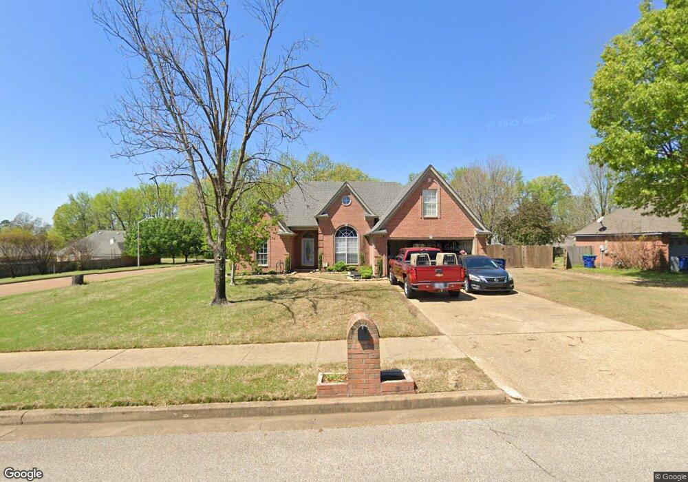
5785 Eagleston Dr Olive Branch, MS 38654
Estimated Value: $259,000 - $302,782
3
Beds
2
Baths
1,900
Sq Ft
$150/Sq Ft
Est. Value
About This Home
This home is located at 5785 Eagleston Dr, Olive Branch, MS 38654 and is currently estimated at $285,196, approximately $150 per square foot. 5785 Eagleston Dr is a home located in DeSoto County with nearby schools including Olive Branch Elementary School, Chickasaw Elementary School, and Olive Branch Middle School.
Ownership History
Date
Name
Owned For
Owner Type
Purchase Details
Closed on
Dec 6, 2021
Sold by
Capps Tina
Bought by
Ryan Allison and Ryan Patrick
Current Estimated Value
Home Financials for this Owner
Home Financials are based on the most recent Mortgage that was taken out on this home.
Original Mortgage
$250,000
Outstanding Balance
$227,968
Interest Rate
3.09%
Mortgage Type
New Conventional
Estimated Equity
$57,228
Purchase Details
Closed on
Nov 21, 2013
Sold by
Capps Thomas A
Bought by
Capps Tina
Create a Home Valuation Report for This Property
The Home Valuation Report is an in-depth analysis detailing your home's value as well as a comparison with similar homes in the area
Home Values in the Area
Average Home Value in this Area
Purchase History
| Date | Buyer | Sale Price | Title Company |
|---|---|---|---|
| Ryan Allison | -- | None Available | |
| Capps Tina | -- | None Available |
Source: Public Records
Mortgage History
| Date | Status | Borrower | Loan Amount |
|---|---|---|---|
| Open | Ryan Allison | $250,000 |
Source: Public Records
Tax History
| Year | Tax Paid | Tax Assessment Tax Assessment Total Assessment is a certain percentage of the fair market value that is determined by local assessors to be the total taxable value of land and additions on the property. | Land | Improvement |
|---|---|---|---|---|
| 2025 | $2,383 | $23,173 | $2,500 | $20,673 |
| 2024 | $1,873 | $15,924 | $2,500 | $13,424 |
| 2023 | $1,873 | $15,924 | $0 | $0 |
| 2022 | $2,173 | $15,924 | $2,500 | $13,424 |
| 2021 | $1,873 | $15,924 | $2,500 | $13,424 |
| 2020 | $1,726 | $14,846 | $2,500 | $12,346 |
| 2019 | $1,726 | $14,846 | $2,500 | $12,346 |
| 2017 | $1,695 | $26,578 | $14,539 | $12,039 |
| 2016 | $1,768 | $15,075 | $2,500 | $12,575 |
| 2015 | $2,068 | $27,650 | $15,075 | $12,575 |
| 2014 | $1,768 | $15,075 | $0 | $0 |
| 2013 | $1,708 | $15,075 | $0 | $0 |
Source: Public Records
Map
Nearby Homes
- 5956 Eagleston Dr
- 5825 Southridge Dr
- 5930 Lee's Crossing St
- 2914 Cypress Lake Dr S
- 6073 Allen Pkwy E
- 10009 Lacey Dr
- 5295 Blocker St
- 9598 Nielsen Dr
- 9893 Cherokee Dr
- 7550 Old Highway 78
- 9784 Mosby Dr
- 0 Hacks Rd Unit 4132565
- 6180 Rd
- 9113 Rue Orleans Ln
- 9077 Rue Orleans Ln
- 5427 Highway 305 N
- 5608 Marlin Place
- 9919 Adina Cove
- 9678 Stuart Cove
- 6748 Cockrum Rd
- 5799 Eagleston Dr
- 5784 Sparrow Run
- 5757 Eagleston Dr
- 5798 Sparrow Run
- 5813 Eagleston Dr
- 5788 Eagleston Dr
- 5802 Eagleston Dr
- 5812 Sparrow Run
- 5756 Sparrow Run
- 5751 Eagleston Dr
- 5827 Eagleston Dr
- 5760 Eagleston Dr
- 5816 Eagleston Dr
- 5826 Sparrow Run
- 5750 Sparrow Run
- 5739 Eagleston Dr
- 5830 Eagleston Dr
- 5787 Michaelson Dr
- 5841 Eagleston Dr
- 5840 Sparrow Run
Your Personal Tour Guide
Ask me questions while you tour the home.