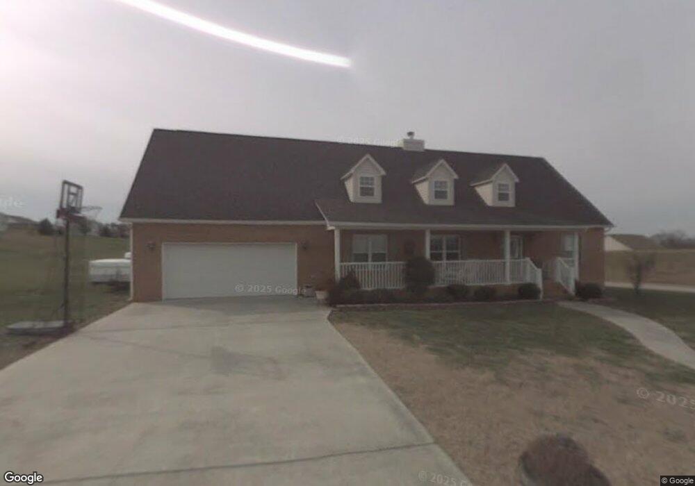
5785 Kay Dr Russellville, TN 37860
Estimated Value: $309,000 - $400,000
--
Bed
2
Baths
2,344
Sq Ft
$148/Sq Ft
Est. Value
About This Home
This home is located at 5785 Kay Dr, Russellville, TN 37860 and is currently estimated at $345,918, approximately $147 per square foot. 5785 Kay Dr is a home located in Hamblen County with nearby schools including Russellville Elementary School, East Ridge Middle School, and Morristown East High School.
Ownership History
Date
Name
Owned For
Owner Type
Purchase Details
Closed on
Jan 23, 2014
Sold by
Smith Doris B
Bought by
Davis Leia S and Davis James Carl
Current Estimated Value
Purchase Details
Closed on
Aug 13, 2002
Sold by
Elio Chaviano
Bought by
Smith Doris B
Home Financials for this Owner
Home Financials are based on the most recent Mortgage that was taken out on this home.
Original Mortgage
$132,905
Interest Rate
6.53%
Purchase Details
Closed on
Sep 19, 2001
Sold by
Mgc Dev
Bought by
Chaviano Elio
Purchase Details
Closed on
Sep 30, 1988
Bought by
Horner Charles Keith and Horner Geralene
Purchase Details
Closed on
Mar 24, 1987
Bought by
Horner Charles Keith and Horner Geralene
Purchase Details
Closed on
Mar 1, 1962
Create a Home Valuation Report for This Property
The Home Valuation Report is an in-depth analysis detailing your home's value as well as a comparison with similar homes in the area
Home Values in the Area
Average Home Value in this Area
Purchase History
| Date | Buyer | Sale Price | Title Company |
|---|---|---|---|
| Davis Leia S | -- | -- | |
| Davis Leia S | -- | -- | |
| Smith Doris B | $139,900 | -- | |
| Chaviano Elio | $16,500 | -- | |
| Horner Charles Keith | -- | -- | |
| Horner Charles Keith | -- | -- | |
| -- | -- | -- |
Source: Public Records
Mortgage History
| Date | Status | Borrower | Loan Amount |
|---|---|---|---|
| Previous Owner | Not Available | $132,905 |
Source: Public Records
Tax History Compared to Growth
Tax History
| Year | Tax Paid | Tax Assessment Tax Assessment Total Assessment is a certain percentage of the fair market value that is determined by local assessors to be the total taxable value of land and additions on the property. | Land | Improvement |
|---|---|---|---|---|
| 2024 | $1,034 | $52,475 | $6,450 | $46,025 |
| 2023 | $1,034 | $52,475 | $0 | $0 |
| 2022 | $853 | $43,275 | $6,450 | $36,825 |
| 2021 | $853 | $43,275 | $6,450 | $36,825 |
| 2020 | $853 | $43,275 | $6,450 | $36,825 |
| 2019 | $846 | $39,700 | $7,175 | $32,525 |
| 2018 | $846 | $39,700 | $7,175 | $32,525 |
| 2017 | $846 | $39,700 | $7,175 | $32,525 |
| 2016 | $790 | $39,700 | $7,175 | $32,525 |
| 2015 | $734 | $39,700 | $7,175 | $32,525 |
| 2014 | -- | $39,700 | $7,175 | $32,525 |
| 2013 | -- | $49,175 | $0 | $0 |
Source: Public Records
Map
Nearby Homes
- 5751 Charlene Dr
- 1290 Little Mountain Rd
- 1341 Little Mountain Rd
- 814 Pullen Rd
- 00 Shinbone E Sugar Hollow Rd
- Tract 3 Shinbone Rd
- Tract 4 Shinbone Rd
- 1976/1986 Shinbone Rd
- Tract 2 Shinbone Rd
- 1475 Shinbone Rd
- 5740 Dodson Ferry Rd
- 6284 Old Russellville Pike
- 5790 N 2nd St
- 6330 Old Russellville Pike
- 6563 E Andrew Johnson Hwy
- 6650 E Andrew Johnson Hwy
- 1041 Wilburn Rd
- 233 Harvey Dr
- 6421 Old Russellville Pike
- 1342 Slop Creek Rd
- 5779 Kay Dr
- 5791 Kay Dr
- 5760 Christine Ln Unit S/D LITTLE MOUNTAIN
- 5760 Christine Ln
- 5760 Christine Dr
- 5788 Kay Dr
- 5773 Kay Dr
- 5745 Christine Dr
- . Sarah Way
- 5746 Christine Ln
- 5746 Christine Ln
- 5746 Christine Ln
- 5706 Christine Ln
- 5780 Kay Dr
- 5792 Kay Dr
- 5769 Kay Dr
- 1050 Sarah Way
- 5795 Kay Dr
- 5739 Christine Dr
- lot 83 Sarah Way