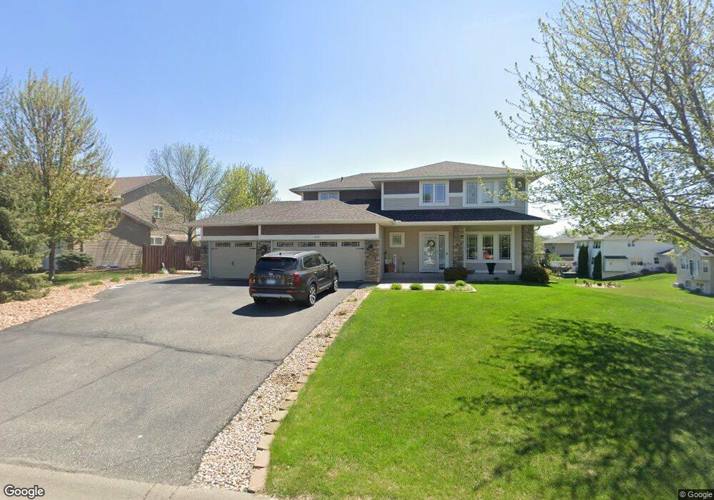
579 Franklin Ave W Delano, MN 55328
Estimated Value: $577,000 - $624,617
5
Beds
4
Baths
3,526
Sq Ft
$170/Sq Ft
Est. Value
About This Home
This home is located at 579 Franklin Ave W, Delano, MN 55328 and is currently estimated at $599,904, approximately $170 per square foot. 579 Franklin Ave W is a home located in Wright County with nearby schools including Delano Elementary School, Delano Middle School, and Delano Senior High School.
Ownership History
Date
Name
Owned For
Owner Type
Purchase Details
Closed on
May 17, 2022
Sold by
Merritt Adam and Merritt Laura
Bought by
Klaphake Michael and Klaphake Kristy
Current Estimated Value
Home Financials for this Owner
Home Financials are based on the most recent Mortgage that was taken out on this home.
Original Mortgage
$618,925
Outstanding Balance
$584,797
Interest Rate
4.67%
Mortgage Type
New Conventional
Estimated Equity
$15,107
Purchase Details
Closed on
Oct 26, 2007
Sold by
Us Home Corp
Bought by
Not Provided
Create a Home Valuation Report for This Property
The Home Valuation Report is an in-depth analysis detailing your home's value as well as a comparison with similar homes in the area
Home Values in the Area
Average Home Value in this Area
Purchase History
| Date | Buyer | Sale Price | Title Company |
|---|---|---|---|
| Klaphake Michael | $651,500 | -- | |
| Not Provided | $298,875 | -- |
Source: Public Records
Mortgage History
| Date | Status | Borrower | Loan Amount |
|---|---|---|---|
| Open | Klaphake Michael | $618,925 |
Source: Public Records
Tax History Compared to Growth
Tax History
| Year | Tax Paid | Tax Assessment Tax Assessment Total Assessment is a certain percentage of the fair market value that is determined by local assessors to be the total taxable value of land and additions on the property. | Land | Improvement |
|---|---|---|---|---|
| 2025 | $7,162 | $581,800 | $73,000 | $508,800 |
| 2024 | $6,668 | $575,400 | $75,000 | $500,400 |
| 2023 | $5,430 | $561,800 | $75,000 | $486,800 |
| 2022 | $5,266 | $428,600 | $74,000 | $354,600 |
| 2021 | $5,160 | $366,800 | $56,500 | $310,300 |
| 2020 | $5,212 | $356,800 | $56,000 | $300,800 |
| 2019 | $5,362 | $345,400 | $0 | $0 |
| 2018 | $5,002 | $337,900 | $0 | $0 |
| 2017 | $4,584 | $312,600 | $0 | $0 |
| 2016 | $4,490 | $0 | $0 | $0 |
| 2015 | $3,338 | $0 | $0 | $0 |
| 2014 | -- | $0 | $0 | $0 |
Source: Public Records
Map
Nearby Homes
- Springfield Plan at Highland Ridge
- Lewis Plan at Highland Ridge
- Vanderbilt Plan at Highland Ridge
- Bristol Plan at Highland Ridge
- Clearwater Plan at Highland Ridge
- Sinclair Plan at Highland Ridge
- 266 6th St NW
- 274 6th St NW
- 269 6th St NW
- 568 Rolling Hills Ln
- 396 Franklin Ave W
- 242 Lori Ln
- 253 Overlook Ct
- 872 Watertown Ave
- 263 6th St NW
- 250 Rolling Hills Ln
- 104 Hummingbird Way
- 270 Rolling Hills Ln
- 450 Whitewater Ct
- 812 Watertown Ave
- 565 Franklin Ave W
- 100 6th St SW
- 106 6th St SW
- 106 106 6th-Street-sw
- 553 Franklin Ave W
- 112 6th St SW
- 572 Franklin Ave W
- 151 6th St SW
- 156 6th St SW
- 584 Franklin Ave W
- 564 Franklin Ave W
- 118 6th St SW
- 118 118 6th-Street-sw
- 598 Franklin Ave W
- 541 Franklin Ave W
- 558 Franklin Ave W
- 124 6th St SW
- 546 Franklin Ave W
- 105 6th St SW
- 527 Franklin Ave W